A Driving Tour
Enchanted Circle

n Locator Map (for more detail see Area Map)
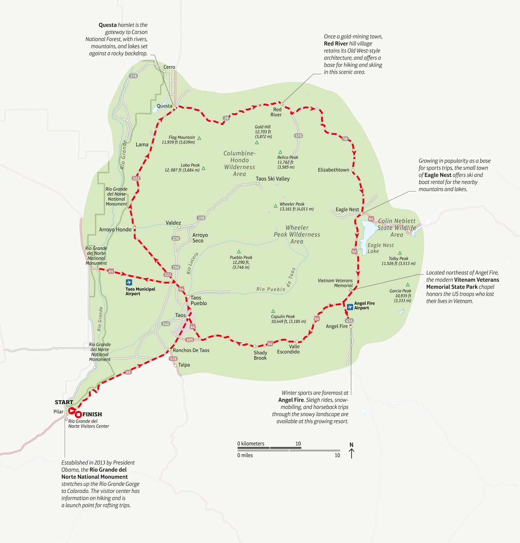
The scenery around Taos rises from high desert plateau with its sagebrush and yucca plants to the forested Sangre de Cristo Mountains. The Enchanted Circle tour follows a National Forest Scenic Byway through some of the area’s most breathtaking landscapes. Circumnavigating the highest point in New Mexico, Wheeler Peak (13,161 ft/ 4,011 m), it continues through the ruggedly beautiful Carson National Forest. Lakes and hiking trails lie off the tour, which passes through a number of small towns.
EXPERIENCE Santa Fe and Northern New Mexico
n Double-tap image to read the labels
Distance 111 miles (179 km)
Starting point North of Taos on Hwy 522, continuing east and south on Hwys 38 & 64
Stopping-off point Eagle Nest
Terrain While the main roads offer smooth driving, bear in mind that many sights are located on dirt tracks and minor roads