experience more
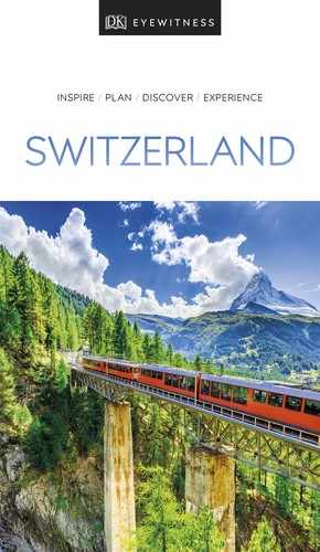
The small town of Olten is set in a picturesque location on the banks of the River Aare. Pedestrian access to the old part of the town is provided by the Alte Brücke, a covered bridge dating from 1802.
The Old Town is dominated by the tall Gothic belfry of a church that was demolished in the 19th century. There are many fine historic houses, particularly on Hauptgasse and along the Old Town’s riverbank. Also of interest are the 17th-century monastery church and the Neo-Classical Stadtkirche, which dates from 1806–12 and is decorated with detailed paintings by draughtsman and caricaturist Martin Disteli. Many works by this local artist, along with 19th- and 20th-century paintings, installations and sculpture, are exhibited in the Kunstmuseum.
Kunstmuseum
" ⌂ Kirchgasse 8 # Tue–Fri 2–5pm, Sat & Sun 10am–5pm ∑ kunstmuseumolten.ch
t The beautiful Baroque city of Solothurn located on the banks of the River Aare
Acclaimed as Switzerland’s most beautiful Baroque city, Solothurn was founded by Celts but later became the second-largest Roman town north of the Alps. From here, boats depart for Biel/Bienne, and explore a particularly scenic stretch of the Aare.
Solothurn’s monumental Neo-Classical St Ursen Kathedrale, was built from 1763 to 1773, and is flanked by friezes depicting the city’s patron saints, Ursus and Victor, martyred by the Romans. The treasury in the crypt is open for guided tours only. The climb up to the bell tower is worth it for the sweeping views over the rooftops to the surrounding countryside.
Nearby is the former arsenal, the Altes Zeughaus, now a museum of militaria, including arms and uniforms used by Swiss mercenaries who served as bodyguards to popes and French kings. The town’s small art gallery, the Kunstmuseum, contains some fine Old Masters, including the Madonna of Solothurn (1522) by Hans Holbein the Younger. Ferdinand Hodler’s dramatic depiction of William Tell emerging from the clouds, painted in 1897, is iconic.
St Ursen Kathedrale
' ⌂ Hauptgasse § 032 626 46 46 # Church: 8am–6:30pm daily; tower: Apr– Oct: 9:30–5:30 Mon–Sat, noon–5:30pm Sun
Altes Zeughaus
" ⌂ Zeughausplatz 1 # 1–5pm Tue–Sat, 10am– 5pm Sun ∑ museum-alteszeughaus.so.ch
Kunstmuseum
" ⌂ Werkhofstrasse 30 # 11am–5pm Tue–Sun, 10am–5pm Sat & Sun ∑ kunstmuseum-so.ch
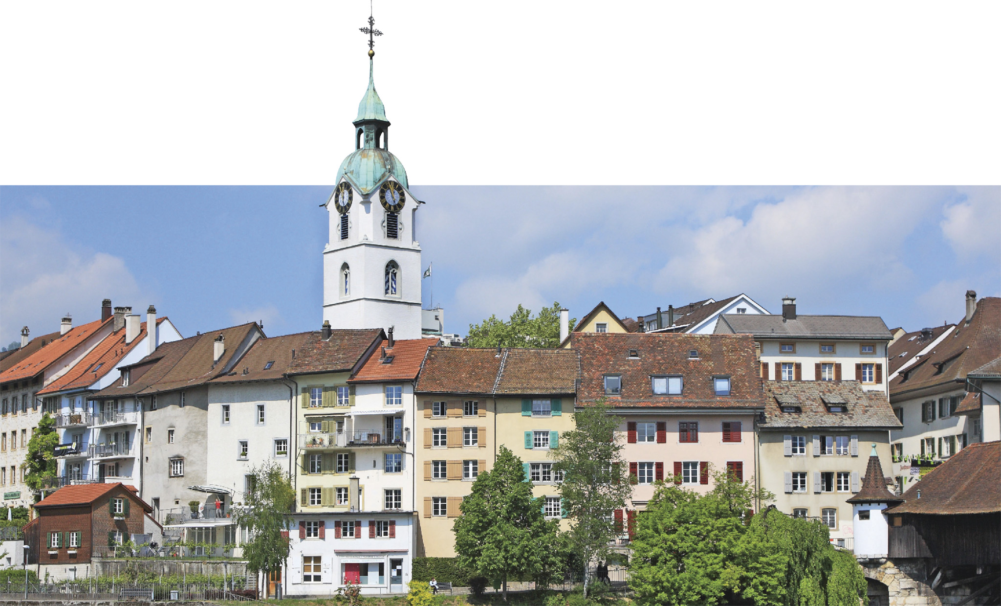
t The stunning Jura mountains dotted with high alpine meadows
Some of the most spectacular views of the Mittelland can be enjoyed from the summit of the Weissenstein, a ridge of the Jura that rises like a rampart 1,284 m (4,213 ft) high. It is situated 10 km (6 miles) north of Solothurn. It is accessible by road or rail to Oberdorf, from where you can either hike to the summit or take a telecabine (closed on Monday and Tuesday).
On the ridge is the newly renovated hotel Kurhaus Weissenstein, with a restaurant. This is a good base for hiking, rock climbing and paragliding in summer, and for sledging in winter. Among the area’s other attractions are a botanical garden and the Nidleloch, a limestone cave.
Biel, known as Bienne in French, is the second-largest town in the canton of Bern. Founded in the 13th century, it was ruled by the prince-bishops of Basel until the 19th century. Biel/Bienne’s principal industry is watchmaking and its factories produce some of the world’s leading brands, such as Omega and Rolex. It is Switzerland’s largest bilingual town: three-fifths of its inhabitants speak French, and the rest German.
The town is set on the shores of the Bielersee (or Lac de Bienne) at the point where the River Schüss (or Suze) flows into it. Set on a hill, the Old Town has narrow cobbled streets and decorative fountains. Its nucleus is a square known as the Ring, which is surrounded by fine arcaded houses. One of them is the house of the guild of foresters. This beautiful building has a 16th-century circular turret topped by an onion dome. Also on the square is the 15th-century church of St Benedict, with impressive late-Gothic stained-glass windows.
At the intersection of Burggasse and Rathausgasse, west of the Ring, stands the Rathaus, the Gothic town hall, which dates from the 1530s. It is fronted by a Fountain of Justice. The late 16th-century Zeughaus, or arsenal, nearby is now used as a theatre.
In two adjacent buildings, Schwab and Neuhaus, the Neues Museum Biel imagines 19th-century bourgeois life with displays of domestic interiors. Other sections are devoted to industry, archaeology, and 19th- and early 20th-century paintings by local artists. Further down Seervorstadt the dynamic Centre Pasquart stages a programme of changing exhibitions of contemporary art and photography.
There are boat trips on the lake, including services to Solothurn, medieval Twann and pretty La Neuveville.
Neues Museum Biel
" ⌂ Seevorstadt 52 # 11am–5pm Tue–Sun ∑ nmbiel.ch
Centre Pasquart
" ⌂ Seevorstadt/Faubourg du Lac 71–73 # Noon–6pm Wed & Fri, noon–8pm Thu, 11am–6pm Sat & Sun ∑ pasquart.ch
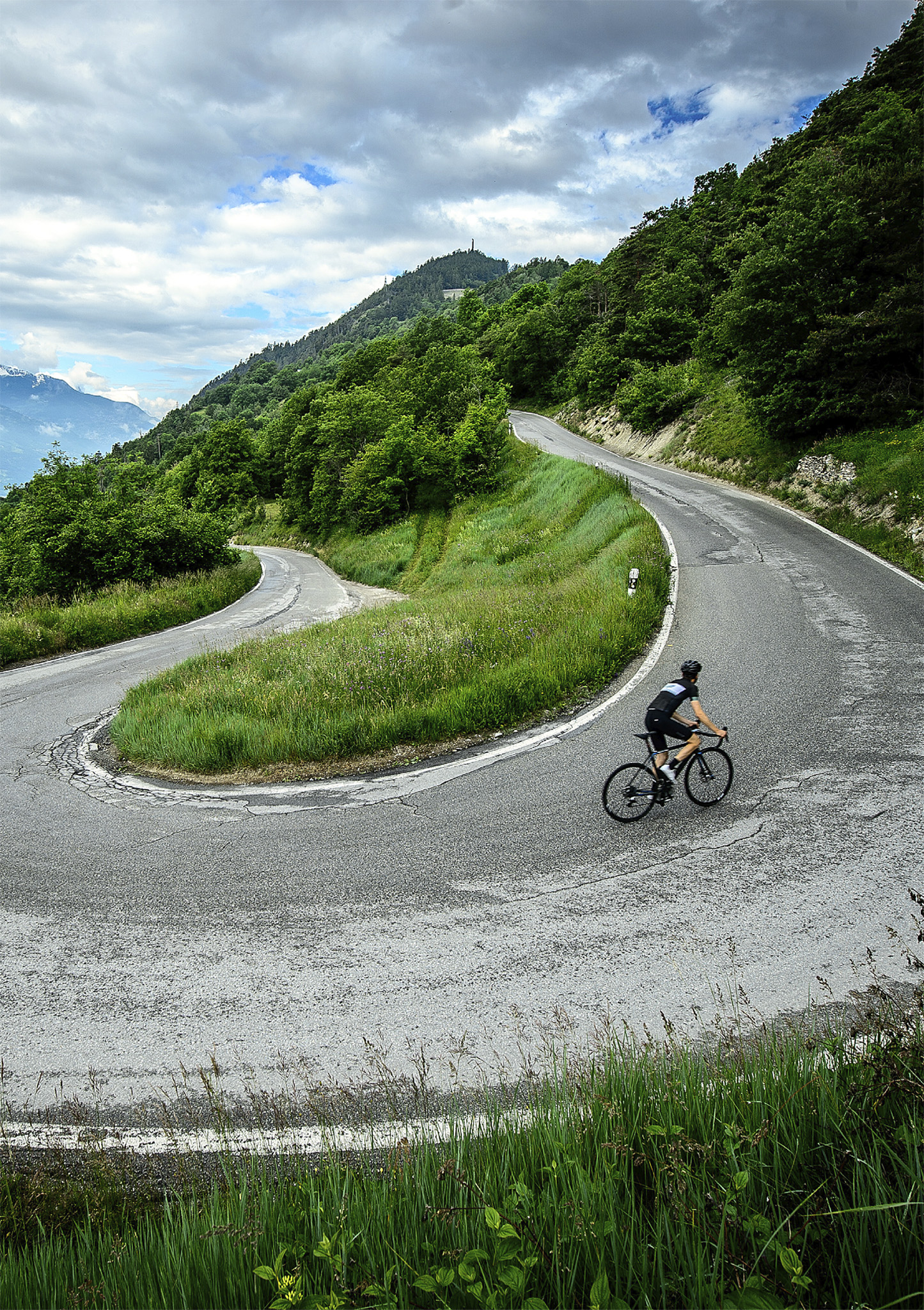
The Emmental, the long, wide valley of the River Emme, has a beautiful landscape of green meadowland, grazed by cows. The valley, crisscrossed with excellent cycling and hiking routes, is dotted with traditional wooden chalets with high roofseaves that brush the ground.
Farming and traditional customs are central to the local culture. This is also where the famous Emmental cheese is made, most of it by hand. At the Schaukäserei (show dairy) in Affoltern, visitors can see every stage in the process of producing this holey, nutty-tasting cheese. It is on sale in the dairy’s shop and on the menu in its restaurant, and in inns up and down the valley.
Burgdorf is a small town in the north of the Emmental. The old part of the town stands on top of a hill. It has arcaded houses, a Gothic church, and a 7th-century castle founded by the Zähringers. Further up the valley, the quiet village of Trubschachen has pottery workshops where colourful local wares are made and offered for sale.
The Emmental also has the longest arched wooden bridge in Europe. Built in 1839, the Holzbrücke spans the Emme just downstream of the village of Hasle-Rüegsau.
Schaukäserei
" ⌂ Schaukäsereistrasse 6, Affoltern # Apr–Oct: 9am–6pm daily; Nov–Mar: 9am–5pm daily ∑ emmentaler-schaukaserei.ch
Did You Know?
Switzerland produces more than 450 varieties of cheese, with Emmental the most exported.
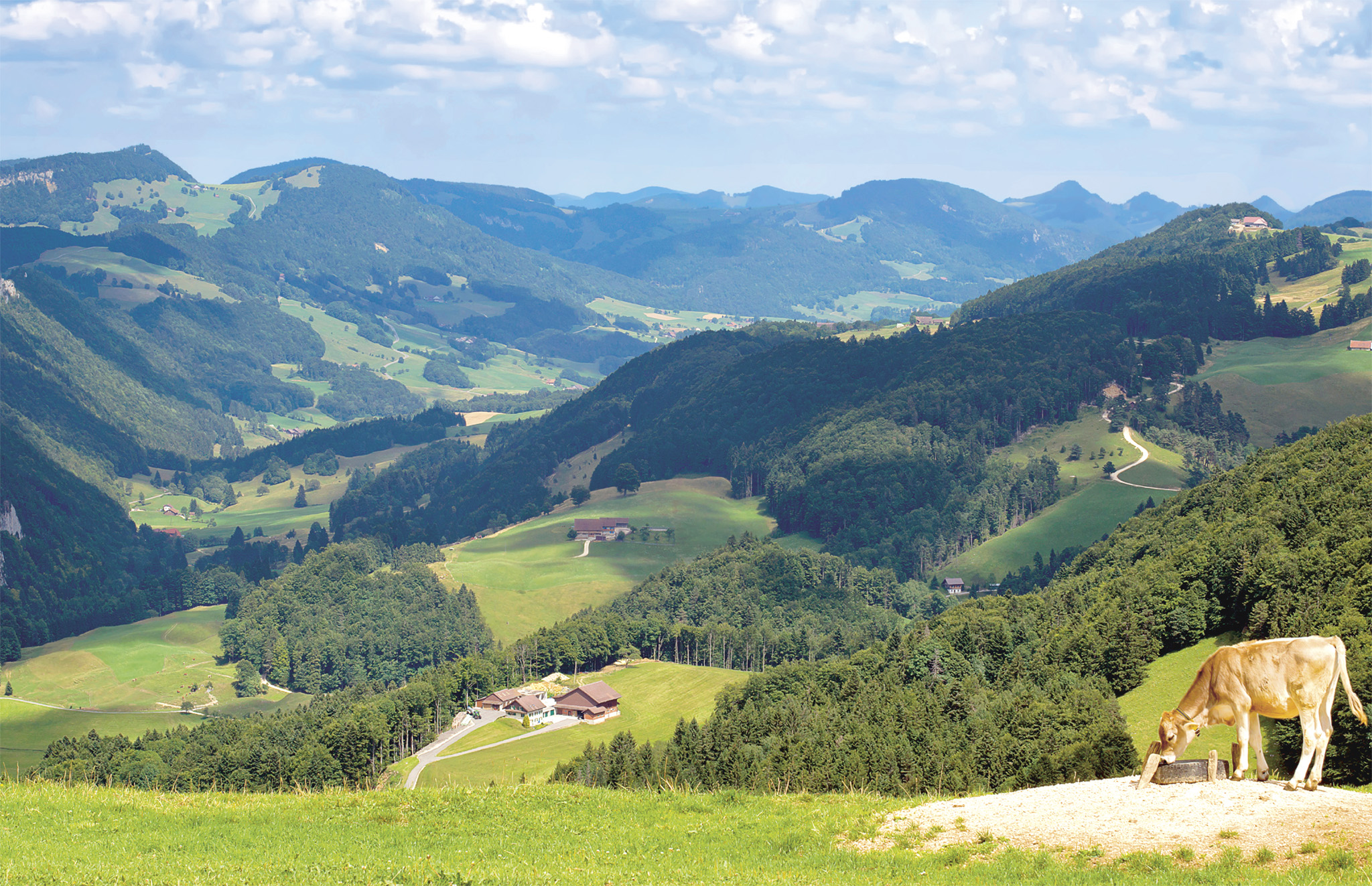
t The old market town of Thun, with its glorious lake and mountain backdrop
The historic market town of Thun stands at the northern end of the Thunersee, on the River Aare. Thun’s origins go back to 1191, when Berthold V, Duke of Zähringen, built a hilltop castle above the river here.
Thun’s Old Town spreads out beneath the castle, along the right riverbank. The main street, Hauptgasse, runs parallel to the river, and is split into two levels. The walkway is built on the roofs of the arcaded buildings lining the street, so that pedestrians step down to enter the shops below. Alleys off Obere (Upper) Hauptgasse lead up to the castle, Schloss Thun, from which there are impressive views of the town and the Bernese Oberland. Inside the castle’s massive turreted keep, which looms over Thun, is a museum that traces the town’s history. Other rooms in the castle contain collections of household objects, weapons and uniforms. Also on the hill is the Stadtkirche, the town’s church. A short walk east of the castle and down to the river leads to the Kunstmuseum, which contains a large collection of Swiss art.
On the left bank of the river in Schadau Park stand a Neo-Gothic folly and a pavilion. Inside the pavilion the Wocher Panorama, painted by Marquard Wocher in 1814, records daily life in 19th-century Thun; it’s the oldest such panorama in the world.
Schloss Thun
" ⌂ Schlossberg 1 # Feb & Mar: 1–4pm daily; Apr–Oct: 10am–5pm daily; Nov–Jan: 1–4pm Sun ∑ schlossthun.ch
Kunstmuseum
" ⌂ Hofstettenstrasse 14 # 10am–5pm Tue–Sun; 10am–7pm Wed ∑ kunstmuseumthun.ch
Wocher Panorama
" ⌂ Seestrasse 45, Schadaupark # Mar–Oct: 11am–5pm Tue–Sun; Jul & Aug: 10am–6pm daily ∑ thun-panorama.ch
From simple alpine chalets to entire farmsteads, about 100 historic rural buildings and 250 farmyard animals fill this 66-hectare (160-acre) open-air museum. The buildings, some of wood, others of stone or brick, come from several regions of Switzerland. Some of the houses at the museum have workshops where craftsmen using authentic tools and original machinery demonstrate various crafts and trades, including weaving, spinning and cheese-making.

t Traditional wooden chalets with flower baskets in Brienz
Located at the eastern end of the Brienzersee, Brienz is the main town on the lakeshore and is a good base for hiking, fishing and water sports.
Being the centre of Swiss woodcarving, Brienz is full of shops selling all kinds of wooden objects. The work- shops of the renowned Schule für Holzbildhauerei are open to visitors during term-time. Students can be seen at work, and there is also an exhibition of their finished pieces.
Another speciality of Brienz is violin-making. Future violin-makers learn their craft at the Geigenbauschule, which also welcomes visitors, and there is an exhibition of instruments.
The summit of the Brienzer Rothorn, which rises to 2,350 m (7,710 ft) about 5 km (3 miles) north of Brienz, can almost be reached by steam-driven rack railway. The short walk from the summit station is rewarded by breathtaking views.
Schule für Holzbildhauerei
⌂ Schleegasse 1 # Exhibition: 10:30am–5pm Wed–Sun ∑ museum-holzbildhauerei-ch
Geigenbauschule
⌂ Oberdorfstrasse 94 § 033 951 18 61 # By arrangement
Experience Mittelland, Bernese Oberland and Valais
|
Stay Hotel Bären An 18th-century village coaching inn, near the station. Ask for a room overlooking the Eiger. ! C4 ⌂ Oberdorfstrasse 1, Wilderswil ∑ baeren.ch Alpenruh Cosy accommodation with stunning views and larger than usual family rooms, near the cable terminus. ! D5 ⌂ Eggli 954B, Mürren ∑ alpenruh-muerren.ch |
This small town lies in the heart of the Hasli valley, the Upper Aare valley east of the Brienzersee. It is a snow sports resort in winter, and a base for hiking and mountain biking in summer.
Meiringen lies near the Reichenbachfälle, the waters chosen by the writer Arthur Conan Doyle as the scene of Sherlock Holmes’s “death” after a struggle with Professor Moriarty. The Sherlock Holmes Museum features a representation of the famous detective’s drawing room at 221B Baker Street, London. From Meiringen a funicular takes visitors to the top of the Reichenbachfälle. From here there is a stupendous view of the cascading waters.
Also of interest in Meiringen is the small church at the top of the town, built in 1684 over a Romanesque crypt.
Between Meiringen and Innertkirchen is the impressive Aareschlucht, a deep gorge cut by the River Aare.
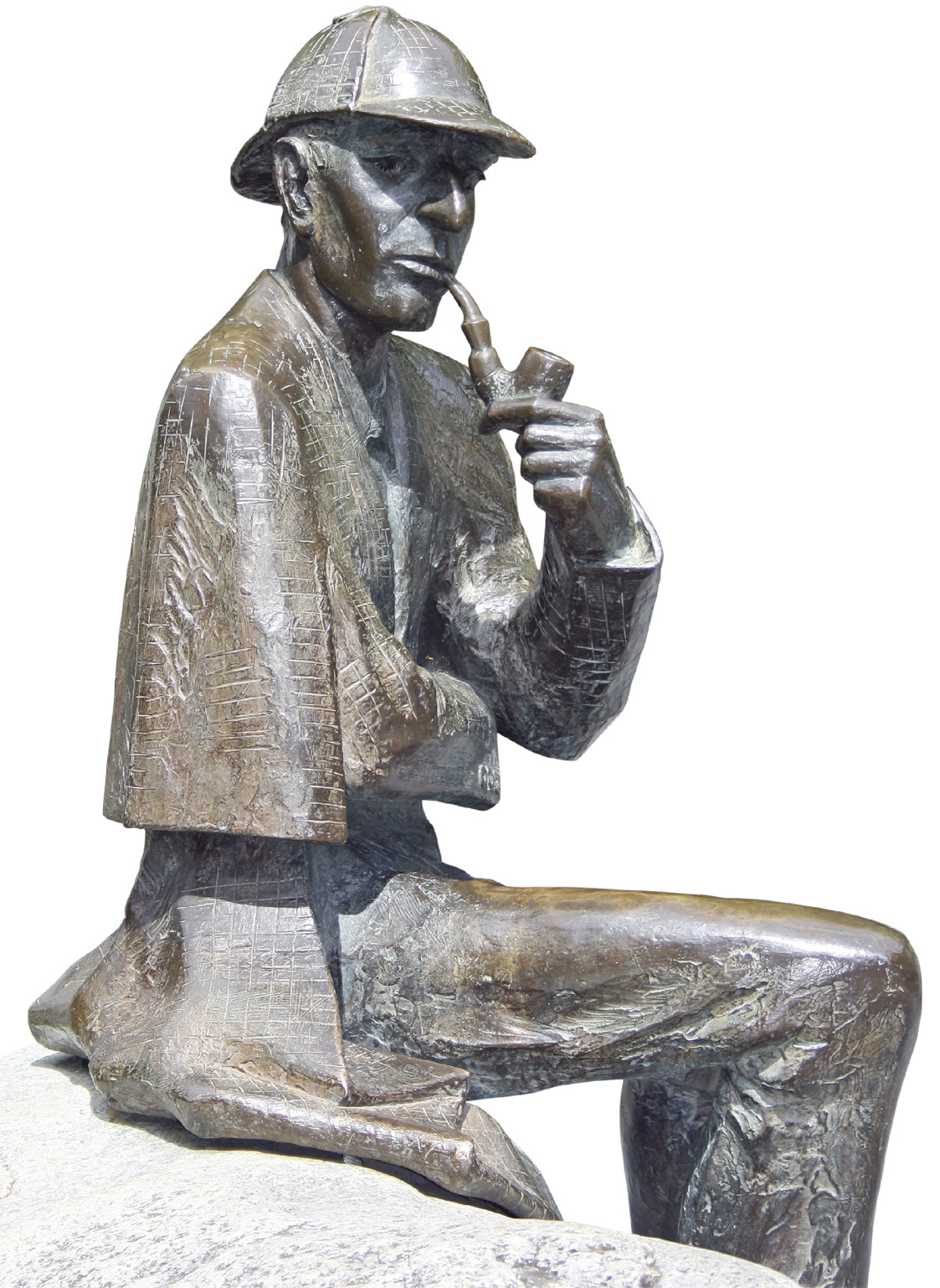
t A statue of Sherlock Holmes in Conan Doyle Place, Meiringen
Reichenbachfälle
§ 033 972 9010 (funicular) # Funicular: early May–Jun, Sep & Oct: 9–11:45am & 1:15–5:45pm; Jul & Aug: 9am–6pm
Sherlock Holmes Museum
" ⌂ Bahnhofstrasse 26 # May–Sep: 1:30–6pm daily; Dec–Apr: 1:30–6pm Wed & Sun ∑ sherlockholmes.ch
Aareschlucht
# May–Oct: sunrise–sunset ∑ aareschlucht.ch

t Grindelwald, one of the most popular destinations in the Swiss Alps
The road and railway lines into the mountains diverge just south of Interlaken. One branch carries into the Lauterbrunnen valley towards Mürren; the other heads east along the Lütschen valley to Grindelwald.
Nestled beneath the Eiger, Wetterhorn and Mettenberg this lively resort village has long been one of the most popular destinations in the Alps. In winter it offers good skiing, and in summer great hiking. A one-hour walk east of the village leads to a wooded trail up to the Oberer Gletscher, a glacier inching its way down the Wetterhorn.
Experience Mittelland, Bernese Oberland and Valais
|
EAT Bergrestaurant Bussalp Climb through cow-dotted fields for hearty mountain fare. ! D4 ⌂ Bussalp ∑ bussalp.ch Piz Gloria A revolving restaurant offering good food and down-to-earth prices. ! C5 ⌂ Schilthorn ∑ schilthorn.ch C UND M Great pastries in a former ski school chalet with views to the Eiger. ! D4 ⌂ Almisgaessli 1, Grindelwald ∑ cundm-grindelwald.ch |
South of Interlaken lies the Bernese Oberland’s most impressive mountain scenery, centred on a mammoth triple-peaked ridge: the Eiger (3,970 m/13,025 ft), the Mönch (4,099 m/13,448 ft) and the Jungfrau (4,158 m/ 13,642 ft). An efficient network of rail and cable car routes from Interlaken makes it easy to travel around.
One of the best-known rail excursions travels up to the Jungfraujoch. This icy saddle, lying just below the summit of the Jungfrau, has been dubbed the “Top of Europe”, and at 3,454 m (11,332 ft) above sea level, the train station here is the highest on the continent.
As there are two different routes up to the Jungfraujoch, this excursion can easily be done as a circular journey. Trains head from Interlaken to Lauterbrunnen, where you change to the rack railway that climbs up through the village of Wengen and on further up to the dramatic station at Kleine-Scheidegg, directly beneath the famous north face of the Eiger.
Different trains head from Interlaken up to Grindelwald, where you again change, this time to the rack railway, which climbs up to Kleine-Scheidegg from the other direction. From Kleine-Scheidegg, a separate line heads up through tunnels and along the mountain face to the Jungfraujoch itself. From April to September seat reservations are recommended. The cogwheel railway stops twice, at the Eismeer and at the Eiger Wall, from where visitors can enjoy magnificent views.
Grindelwald’s Velogemel, or bike-sledge
Have a go on the unique Swiss bike-sledge for the ride of a lifetime. A local woodworker invented the wooden contraption, called a “velogemel”, to get around in deep snow back in 1911. And it is still used today by the local postman in Grindelwald. It looks like a bike, with skis in place of wheels. You can rent one at the train station at Grindelwald and velogemel down from Bussalp above Grindelwald. Every year the Velogemel World Championships are held here, around Bussalp.
Unspoilt Lauterbrunnen is the world’s deepest U-shaped valley, a rough-hewn glacial gorge hemmed in by steep walls cut by 72 waterfalls. Staubbach Falls, on the edge of Lauterbrunnen village, inspired the German poet Goethe to break into verse. Lauterbrunnen is on the main Swiss railway line and serves as a gateway to Grindelwald, Wengen and Mürren.
t Lauterbrunnen village, set in a magnificent wild valley gorge

t Mannlichen station, dwarfed by the peaks of the Bernese Oberland
At an altitude of 1,274 m (4,180 ft), the car-free resort of Wengen overlooks the stunning Lauterbrunnen valley. This is classic Swiss alpine scenery, with snowy peaks, sheer cliffs, cascading waterfalls and verdant, rolling meadows where the cows graze.
Mountain trains heading from Lauterbrunnen climb towards the Jungfraujoch, stopping midway at Wengen. A village of chalets and large hotels tucked on a shelf of southwest-facing pasture, Wengen is blessed with long hours of sunshine even in winter and has a long history of being a popular mountain holiday destination, just like its neighbours Mürren and Grindelwald.
Skiing terrain is extensive and especially suited to families, and in summer the countryside around Wengen offers superb hiking. Trails lead down to the flower-filled meadows around Wengwald, and up to Männlichen (which can also be reached by cable car). From here visitors can enjoy spectacular views down over Grindelwald on one side and the Lauterbrunnen valley on the other.
Did You Know?
There are over 500 kilometres of signposted hiking trails around Wengen.
t The charming mountain village of Mürren set amid spectacular alpine scenery
From Lauterbrunnen there are two ways of reaching the small car-free village of Mürren, on the opposite side of the valley from Wengen. Both routes are spectacular. A cable car rises to Grütschalp, from where a tram takes a scenic route along the cliff edge to reach Mürren. Alternatively, buses travel along the valley-floor road (past a magnificent series of waterfalls at Trümmelbach) to Stechelberg, from where a cable car climbs to Mürren, perched 800 m (2,625 ft) above the valley floor. The views, down the valley and up to a dazzling panorama of snowy crags, are astounding. Another cable car heads further up, to the ice-bound summit of the Schilthorn (2,970 m/9,744 ft), where there is a revolving panoramic restaurant, Piz Gloria, famously featured as the villain’s lair in the James Bond film, On Her Majesty’s Secret Service (1969).
Located at the head of the Engstligental, a wide valley, Adelboden is an attractive village with chalets, pleasant streets and well-kept gardens. The small 15th-century parish church here is of interest for its frescoes and stained-glass windows created by Augusto Giacometti. The village also has an interesting museum documenting local history and daily life in the Engstligental.
Adelboden is primarily a resort, with 72 ski lifts and some 210 km (130 miles) of pistes in the Adelboden-Lenk region ski pass. The town also offers facilities for extreme sports, as well as ice rinks for skating and curling. In summer it is a base for mountain biking and hiking.
The Engstligenfälle, spectacular waterfalls tumbling from Engstligenalp, 4 km (2.5 miles) above Adelboden, are accessible by cable car. There are several hiking trails, which lead up to higher altitudes, including Ammertenspitz (2,613 m/8,573 ft), and also down past the falls.

t The mountain village of Kandersteg, an ideal base for skiing or hiking
The village of Kandersteg stretches out along the valley of the River Kander, west of the Jungfrau massif. The village is located near the north entrance to the old Lötschberg Tunnel, through which trains run for 15 km (9 miles) under the Lötschberg to emerge at Goppenstein, in eastern Valais. In 2008, a 35-km- (22-mile-) tunnel opened beneath the old line, massively cutting travel times.
Apart from its attractive 16th-century parish church, Kandersteg’s main interest to visitors is as a resort. In winter, the gentle slopes around the village make ideal skiing pistes for beginners. In summer the village turns into a popular base for hiking, biking and paragliding or simply for exploring the stunning lakes and soaring mountains.
Oeschinensee, a small lake surrounded by towering cliffs, can be reached by a chair-lift from the eastern edge of the village. Fit hikers can take the trail back down to Kandersteg. Blausee, an enchanting small boating lake surrounded by a pine forest, is a ten-minute drive north of Kandersteg.
Nearby, the lofty peak of the Blüemlisalphorn (3,671 m/ 12,044 ft) and its impressive neighbour the Hockenhorn (3,297 m/10,820 ft) offer mountaineers a somewhat more demanding challenge. The Lötschenpass hut is a handy spot to overnight during multi-day treks.
Experience Mittelland, Bernese Oberland and Valais
|
Stay Berghaus Bort A small chalet hotel with simple, sparsely furnished rooms drenched with sunshine. ! D4 ⌂ Bortweg 44 ∑ bort.swiss Ruedihaus Kandersteg A large rustic house just outside Grindelwald, dedicated to tradition: no metal, no plastic and no WiFi. The Swiss love it. ! D4 ⌂ Hinder de Büele ∑ doldenhorn-ruedihus.ch Monte Rosa Hotel Warmth, comfort and friendly service at high altitude. ! B5 ⌂ Bahnhofstrasse 80 ∑ monterosazermatt.ch Grand Hotel Regina Palatial luxury with a pool and spas, just steps from the train station. D4 ⌂ Dorfstrasse 80, Grindelwald ∑ grandregina.ch Bellevue des Alpes Unrivalled views and true comfort provided for seasoned climbers and casual walkers. D4 ⌂ Kleine Scheidegg ∑ scheidegg-hotels.ch |
t The village of Gstaad, with its traditional Swiss architecture
Given it is one of Switzerland’s most famous resorts, Gstaad is a surprisingly small village, its size out of proportion to its international prestige. At the junction of four valleys, it connects into a larger regional ski pass network, including the Diablerets Glacier.
In summer Gstaad attracts numerous visitors who come to enjoy rock climbing, hiking, cycling and rafting on the turbulent waters of the Saane. By remaining faithful to traditional architecture, the town has maintained its romantic character. Its main street, the Promenade, is lined with shops, cafés and galleries.
Located where the Dranse and Rhône rivers meet, at the point where the latter curves to the north, Martigny was established by the Romans as Octodorus in about 15 BC. Excavations have unearthed a complex of Roman buildings, among them baths, an amphitheatre and a temple dedicated to Minerva.
The town is dominated by the Tour de la Bâtiaz, a 13th-century fortress set on a promontory. In Martigny’s old district are the 15th-century Maison Supersaxo and the Chapelle Notre-Dame-de- Compassion, built in the 1620s, both worth a visit.
Martigny’s main attraction is the Fondation Pierre Gianadda, a museum built on the ruins of a Gallo-Roman temple. Among its several collections, the Musée Archéologique Gallo-Romain contains statues and artifacts uncovered during excavations. The Musée de l’Auto, in the basement, showcases vintage cars, including Swiss-made models. A small number of paintings, by Cézanne, Van Gogh and Toulouse-Lautrec and other artists, are shown in the Salle Franck, while important temporary exhibitions are staged in the main gallery.
Nearby is the popular Barryland, a “living museum” dedicated to the famous St Bernard dogs that were once kept at the Grand St Bernard Pass monastery and who were trained by monks to sniff out travellers lost in snow or avalanches. The museum also keeps a number of dogs on site, which you are allowed to pet at certain times of day.
Fondation Pierre Gianadda
" ⌂ 59 Rue du Forum # Jun–Nov: 9am–7pm daily; Dec–May: 10am–6pm daily ∑ gianadda.ch
Barryland
" ⌂ Route du Levant 34 # 10am–6pm daily ∑ barryland.ch
Verbier is Switzerland’s most extensive ski area, with terrain to suit every skier, from gentle slopes to some of the most challenging pistes. That, plus its beautiful location, climate, cosmopolitan atmosphere and vibrant nightlife, have made it a celebrity favourite. At an altitude of 1,500 m (4,921 ft), the resort lies on a wide plateau with fine views of peaks in Switzerland, Italy and France. Just below Verbier lies the Val de Bagnes, a picturesque valley and one of the country’s best kept secrets.
Verbier’s ski pass area covers more than 400 km (248 miles) of on- and off-piste runs. The highest point is Mont Fort, at 3,330 m (10,925 ft). From there are far-reaching views as far as Mont Blanc. In summer, there are two golf courses and good hiking trails.
Xtreme Verbier is a winter event in which skiers and snowboarders swoop down steep mountain faces studded with cliffs. In summer the town hosts the Verbier Festival, an international festival of classical music with free workshops. August sees the world’s best horse riders compete in a prestigious dressage event.
Did You Know?
The International Alphorn Festival is held in July in Nendaz, near Verbier.
Situated on the border with Italy at an altitude of 2,469 m (8,100 ft), the St Bernard Pass is the oldest of all Alpine pass routes, in use since 800 BC.
The pass is named after Bernard of Menthon, Bishop of Aosta, who built a hospice for travellers here in 1049. It has been inhabited by monks ever since. It welcomes travellers all year round – access in winter is by skis or snowshoes. There is also an interesting museum that documents the history of the pass.
The St Bernard Pass is closed to vehicles all winter, with snow common in June. However, the St Bernard Tunnel provides a year-round route between Switzerland and Italy.
t The 17th-century church within the Grand St Bernard Pass hospice
The Simmental, the beautiful long valley of the River Simme, is divided into two sections. Nieder Simmental, the lower section, runs from the town of Spiez – where the River Simme enters the Thunersee (Lake Thun) – westwards to Boltigen. Here the valley veers to the south, becoming Obere Simmental, the upper section. This part stretches up a little above the valley to the holiday resort and spa town of Lenk, near the source of the Simme.
Several charming villages lie along the Simmental, among them Erlenbach, the starting point for whitewater rafting down the Simme.

Insider Tip
The Simmental Cycle Route
Head out on this enjoyable flat-terrain bike route, which winds its way over tarmacked and natural paths from Lenk to Erlenback (lenk-simmental.ch).
The tiny medieval village of St-Pierre-de-Clages is set on the southern, vineyard-covered slopes of the Rhône valley. Apart from an annual book festival and some well-stocked antiquarian bookshops in the village, its main attraction is a beautiful Romanesque church with an octagonal bell tower. Dating from the late 11th to the early 12th century, it was originally part of a Benedictine priory. The rib-vaulted interior is almost entirely devoid of decoration, and this pleasing austerity is accentuated by the unadorned stonework of the walls and columns. The stained-glass dates from 1948.
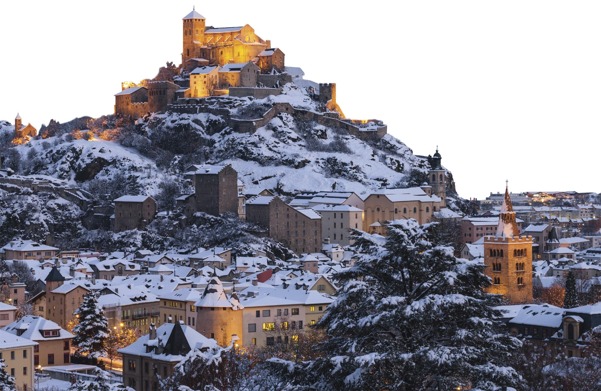
t Sion, capital of the French-speaking Valais, dramatically set amid rocky outcrops
The capital of the canton of Valais sits along the Rhône, at the foot of two hills. Four castles stand guard over the town of Sion: Valère, Tourbillon, Majorie and Montorge, each dating back to the 13th century or earlier. The surrounding Rhône valley is renowned for its apricots and indiginous Fendant vineyards.
The Château de Tourbillon itself is now in ruins, but many of the ramparts remain. The chapel, with ribbed vaulting and carved capitals, contains medieval wall paintings. The nearby Château de Valère is a 12th-century fortified church with 15th-century murals and the world’s oldest working organ, dating from 1430.
Château de Tourbillon
§ 027 606 47 45 # Mid-Mar–Apr & Oct–mid-Nov: 11am–5pm daily; May–Sep: 10am–6pm daily
Château de Valère
§ 027 606 47 15 # Jun–Sep: 10am–6pm daily; Oct–May: 10am–5pm Tue–Sun
Located in the Rhône valley, Sierre (Siders in German) lies on an invisible linguistic border separating French speakers from their German compatriots. The town enjoys a wonderfully sunny climate and is surrounded by vineyards. It contains several historic buildings, including a 16th-century castle, the Château des Vidomnes. The Baroque town hall contains a small museum of pewter objects.
The local winemaking tradition is documented by the Wine Museum Sierre, which has fascinating collections displayed in two places. One part occupies a wing of the 16th-century Château de Villa in Sierre, the other the 16th-century Zumofenhaus in Salgesch (Salquenen in French), a village east of Sierre. The scenic 6-km (4-mile) Sentier Viticole, or wine route, wends through villages and vineyards, with a number of wine-tasting stops along the way. The route connects the museum’s two parts.
Wine Museum Sierre
" ⌂ Château de Villa, 6 Rue Ste-Catherine # Mar–Nov: 2–6pm Wed–Fri, 11am–6pm Sat & Sun ∑ museeduvin-valais.ch

Hidden Gem
Lac St Léonard
Between Sion and Sierre lies Europe’s largest underground lake, the Lac St Léonard (www.lac-souterrain.com). You can visit it mid-March to November – in summer, concerts are staged on the water.
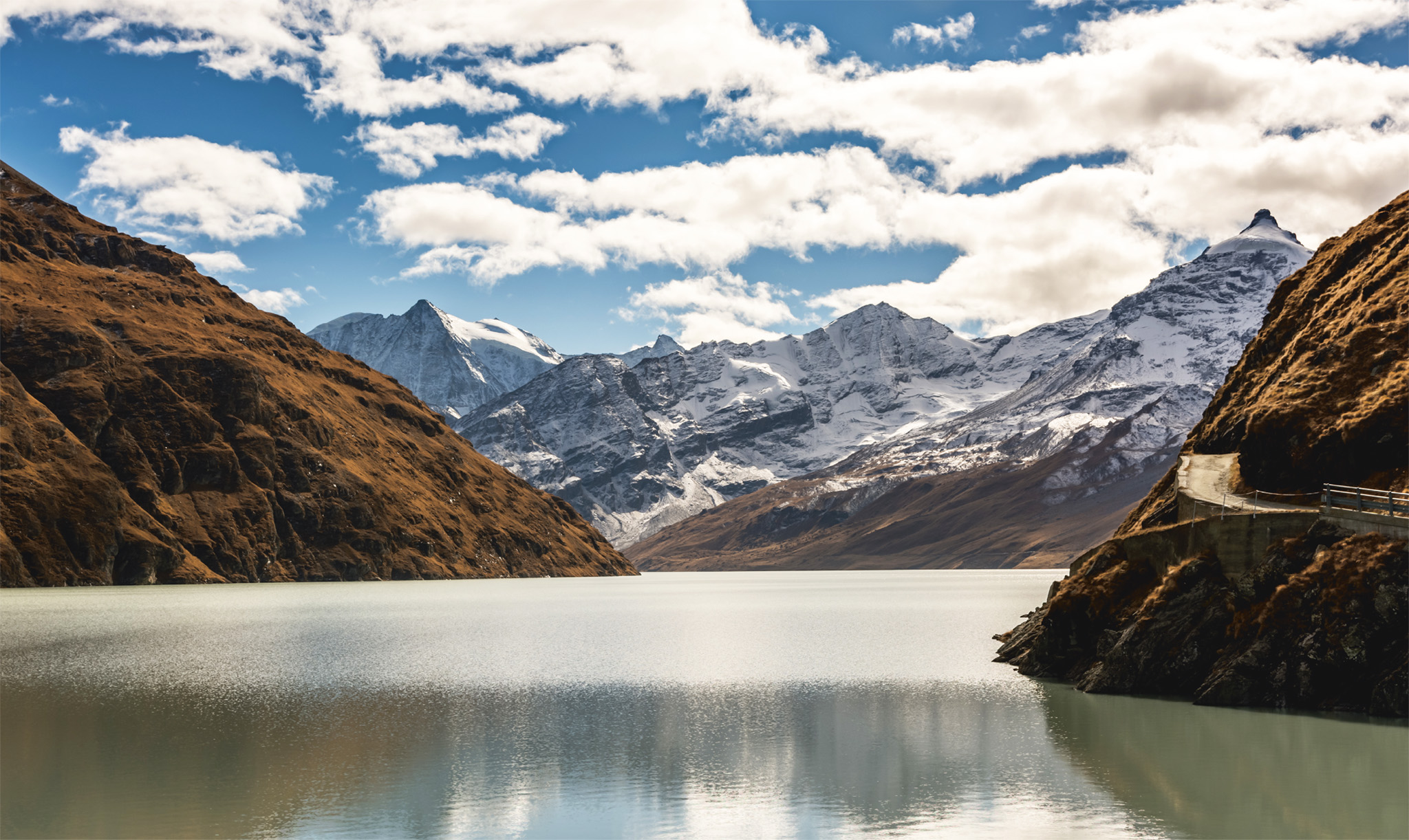
t The Lac des Dix framed by alpine peaks and the Grande Dixence dam
The world’s highest gravity dam and the greatest feat of modern engineering in Switzerland, this extraordinary hydroelectric dam towers 285 m (935 ft) high, across the River Dixence, at the head of the Val d’Hérémence.
The Lac des Dix, the stretch of water that fills the valley above the dam, is surrounded by mountains. Rising to the west is Rosablanche (3,336 m/ 10,945 ft); to the east soars Les Aiguilles Rouges (3,646 m/ 11,962 ft); and to the south climbs Mont Blanc de Cheilon (3,870m/12,697 ft) and Pigne d’Arolla (3,796m/12,454 ft). A cable car runs from the foot of the dam, where there is a restaurant, up to the lake. From here you can hike to the Cabane des Dix, a mountain refuge, walk around the lake or take the six-hour hike to the small resort of Arolla.
Val d’Hérémence joins the Val d’Hérens at the small town of Hérémence. The town is a good base for skiing on the eastern slopes of Mont Rouge, and also for hiking in the mountains.
Linking Martigny to Chamonix in France over the narrow Forclaz Pass, Trient is an almost forgotten valley of tranquillity and pastoral life. A rack-railway train, the “Mont Blanc Express”, carries passengers along the edge of the valley, offering views car drivers will never see on the road. Most spectacular is the journey up to the lake and dam at VerticAlp Emosson on the Swiss border, involving three types of funicular.
Hikers can walk all the way up to the permanent ice of Trient Glacier and spend the night in one of the Swiss Alpine Club’s mountain huts dotted across the terrain.
Visitors can learn about the animals that live – or used to live – in the Alps at the Zoo des Marécottes. Wolves, ibex and black bears are all here, and there’s also the added attraction of a natural alpine swimming pool.
VerticAlp Emosson
⌂ Route du Châtelard 6, Le Châtelard # Mid-May–Nov: 9am–5pm daily ∑ verticalp-emosson.ch
Zoo des Marécottes
" ⌂ Les Marécottes Mon & Tue 10am–5pm, Wed–Sun 10am–7pm ∑ zoo-alpin.ch
Did You Know?
One of the funiculars up the Trient Valley to Emosson climbs at an incline of 87 per cent.
Stretching southeast from Sion, the tranquil Val d’Hérens (Eringertal in German) reaches into the Pennine Alps. This pretty valley has enchanting scenery and is home to pretty villages with wooden chalets.Traditions are kept alive here, making it seem a world away from modern life.
A striking geological feature of the Val d’Hérens is a cluster of rock formations known as the Pyramides d’Euseigne. Visible from the valley road, these sawtoothed outcrops of rock jut out of the hillside like fangs. They were sanded into shape during the Ice Age by the erosive action of wind, rain and ice. Each point is capped by a rock, which protected the softer rock beneath from erosion, so producing these jagged formations.
The village of Evolène, 15 km (9 miles) south of the village of Euseigne, is a good base for hiking. At the head of the valley, amid lush Arolla pine forests and colourful flowery meadows, is the hamlet of Les Haudères, where there is a Geology and Glacier Centre with an interesting museum. Beyond this small outpost, the Val d’Hérens extends into tree-lined Val d’Arolla. At the end of the road sits the small resort of Arolla.

t The dramatic jagged rocks that form the Pyramides d’Euseigne
t The unspoilt Val d’Anniviers, a side valley in the Valais, popular with hikers
A popular destination in the summer for hikers, the rugged Val d’Anniviers begins across from Sierre and runs up to the glaciers of Zinal to the south. Surrounded by the high peaks of the Pennine Alps and cut by the River La Navisence, the valley is dotted with villages which offer visitors skiing in the winter, and hiking and cycling in the summer.
Near the entrance to the valley perches the unspoilt mountain village of Vercorin. From Soussillon you can journey to medieval Chandolin, a village of quaint wooden chalets and fantastic views. From Vissoie it is worth going to sun-drenched Saint-Luc at 1,650 m (5,413 ft) for a breathtaking view of the Val d’Anniviers. From there you can proceed up to the top of Bella Tola (3,025 m/9,925 ft).
Grimentz is a fascinating village, full of traditional tall wooden chalets built on the underlying bedrock. From here, hiking trails lead up to the Moiry dam and the Glacier de Moiry . The highest village in the valley is Zinal at 1,670 m (5,479 ft). This resort is a ski centre in winter and a good base for summer hiking. From Zinal guides can be hired for the climb to the summit of the Zinal-Rothorn (4,221 m/13,848 ft), the Pyramide des Besso, Oberes Gabelhorn and Pointe de Zinal. There are also many easier peaks and highly scenic rambling routes.
Insider Tip
Hike the Valais Bisses
The bisses are irrigation channels that run throughout the Valais. Some of them have been there for centuries, and many are now restored and make excellent hiking paths. Some are vertigo-inducing, set along a cliff edge; others are more gentle.
The Monte Rosa massif spans Swiss and Italian territory, and possesses the highest peak in Switzerland and the second highest in the Alps after Mont Blanc: the Dufourspitze, which peaks at 4,634 m (15,203 ft). Because of its shape, Monte Rosa is easier to climb than the Matterhorn.
Situated on its Italian side, near the summit at 4,556 m (14,947 ft), is the Capanna Regina Margherita, the highest mountain shelter in Europe, built in 1893. The Monte Rosa massif is encircled by the Gornergletscher, a vast glacier and the second-largest glacial system in the Alps; stretching lower down are the usually deserted slopes of Stockhorn and Gornergrat.
t The winding road up to the popular ski resort of Crans-Montana
The fashionable ski and golf resort of Crans-Montana lies on a plateau north of the Rhône valley, with a clear view of the Valais Alps to the south. In the late 19th century, as the fashion for mountain holidays grew, Crans and Montana expanded and merged into one legal entity.
Crans-Montana can be reached by road from Sion, and from Sierre either by a road that winds up through vineyards and pasture, or by funicular. This very sunny resort has a network of cable cars and ski lifts, accessing over 140 km (87 miles) of pistes and the glacier of Plaine Morte, a popular destination for cross-country skiing. The resort is best known, however, for high-altitude golf. Two nine-hole courses, plus the legendary Swiss Masters links, with views over the Rhône Valley, make Crans-Montana Switzerland’s premier golf centre. And at this altitude, balls fly an incredible 20 per cent further than at sea level.
Experience Mittelland, Bernese Oberland and Valais
|
EAT La Brentaz A family-friendly spot in the centre of town serving hearty comfort food, with plenty of fresh fish on the menus. ! C5 ⌂ Place Centrale 2, Vercorin § 027 455 17 01 ¢ Mon, Tue L’Étable du Marais Traditional Swiss food and an excellent wine list, served in a lovingly restored barn. The rösti Marais is a specialty. ! C5 ⌂ 3961 Grimentz, Valais § 027 476 20 18 |

t A roadside rest stop amid the hills around Saas-Fee in springtime
A village dating back to the 13th century, Saas-Fee, in the Pennine Alps, has been a resort since the early 19th century. It is the main town in the Saas Valley, through which flows the River Saaser Vispa. It has a magnificent setting at the foot of the Dom (4,545 m/ 14,911 ft) and is surrounded by other tall peaks.
The car-free resort has many traditional wooden chalets, which are built on high walls. Saas-Fee, more than many resorts in the area, cherishes its traditional rural culture, and several local traditions are enacted for visitors. These include processions marking Corpus Christi, cow fights and yodelling contests, folk festivals celebrating Swiss National Day, and the late-spring festival Alpaufzug, which marks the time when cows are taken up to their summer pastures. The Saaser Museum, with a reconstruction of a typical local house, and a large collection of beautifully preserved crafts and costumes, is devoted to regional folk traditions and culture.
All around the village, in winter or in summer, are vistas of mammoth glaciers and steep crevasses. Year-round skiing is possible on the Feegletscher (Fairy Glacier) in the Mischabel massif; it is the highest massif to lie entirely in Switzerland.
In summer, there is a range of hiking trails, from easy strolls to demanding treks, that lead into the surrounding peaks or to other sites, such as Mattmarksee, an artificial lake. A cable car also runs up to the rocky outcrop of Felskinn (3,000 m/9,800 ft). From here, the Alpine Metro makes the journey up to Mittelallalin, where you can savour the panorama from Allalin (041 27 957 17 71), the highest revolving restaurant in the world at a height of 3,500 m (11,480 ft).
The Simplon Pass, at 2,005 m (6,580 ft), is one of the most important routes between western and southern Europe. Connecting Switzerland and Italy, it also marks the border between the Pennine and Lepontine Alps. The route has been in use since the Stone Age, and so has played an essential role in trade since the Middle Ages.
The strategic importance of the pass was recognized by Napoleon, on whose orders a new road was built here in 1800–06. This road is about 64 km (40 miles) long and runs from Brig, over the pass and through the village of Simplon, down to the Italian town of Domodossola. Napoleon’s road is passable virtually all year round. A railway tunnel under the pass was built in 1906, as an alternative crossing.

t The imposing Stockalper Palace in Brig
Built over a Roman settlement, Brig is the major town in the Upper Valais. It lies at the crossroads of the main alpine routes leading over the Simplon, Furka, Grimsel and Nufenen passes and through the Lötschberg Tunnel. Located on the Rhône, the bridges that span the river at this spot give the town its name. During the 17th century, the trade route to Italy, leading over the Simplon Pass, was controlled by the Stockalper family of merchants. Kaspar Jodok Stockalper von Thurm gave Brig its finest monument, a Renaissance-Baroque palace built between 1658 and 1678. The building is set with three tall square towers crowned by cupolas Caspar, Melchior and Balthazar. The palace has an arcaded courtyard and a chapel dedicated to the Three Kings, with an ornate silver altarpiece made by Samuel Hornung of Augsburg.

t Attractive arcaded courtyard
Experience Mittelland, Bernese Oberland and Valais
Customs of the Lötschental

The Lötschental is a remote valley just east of Leukerbad. For centuries the valley’s inhabitants were isolated from the outside world during winter, and they have retained many ancient rituals, customs and traditions. One such custom is Tschäggättä, a festival that lasts from Candlemas until Shrovetide. Young bachelors don sheepskin coats, with the fleece on the outside and cowbells strapped to their waists, and wear grotesque masks (left). Masked processions are held during the last week of the carnival.
Lying at the head of the Dala valley, at an altitude of 1,400 m (4,595 ft), Leukerbad (Loèche-les-Bains in French) is one of the highest spa resorts in Europe. The therapeutic properties of its hot springs, which are rich in calcium, sulphur and gypsum, have been appreciated since Roman times.
Leukerbad has several public spa complexes, with pools and many other facilities, including treatments and rehabilitation programmes.
Above the resort, and accessible by cable car, lies the breathtaking Gemmi Pass, found on the hiking trail to Kandersteg and the Bernese Oberland.