COLONIAL TOWNS
1. Valladolid
The city is a combination of distinguished colonial architecture and the easygoing atmosphere of a Yucatán market town. Whitewashed arcades and 17th-century houses surround the main plaza, and among the town’s many old Spanish houses and churches is a fine Franciscan monastery. Just off the plaza, Casa de los Venados houses one of Mexico’s finest collections of modern folk art. Four blocks away is the dramatic pit of Cenote Zací, once Valladolid’s main source of water.

Valladolid cathedral and main square
2. Tizimín
The city’s name comes from the Mayan tsimin, a kind of demon, also used to describe the Spaniards when they first appeared on horseback. Today the town is the capital of Yucatán’s “cattle country,” between Valladolid and Río Lagartos. Its pleasant twin central plazas are divided by two huge monasteries, giving it a distinctly Mediterranean appearance.
3. Teabo
With an air of tranquility, this remote town clusters around its grand and lofty Franciscan church, built in 1650–95. In the sacristy are rare murals of saints, discovered by accident in the 1980s. Teabo is also known for its fine embroidery.
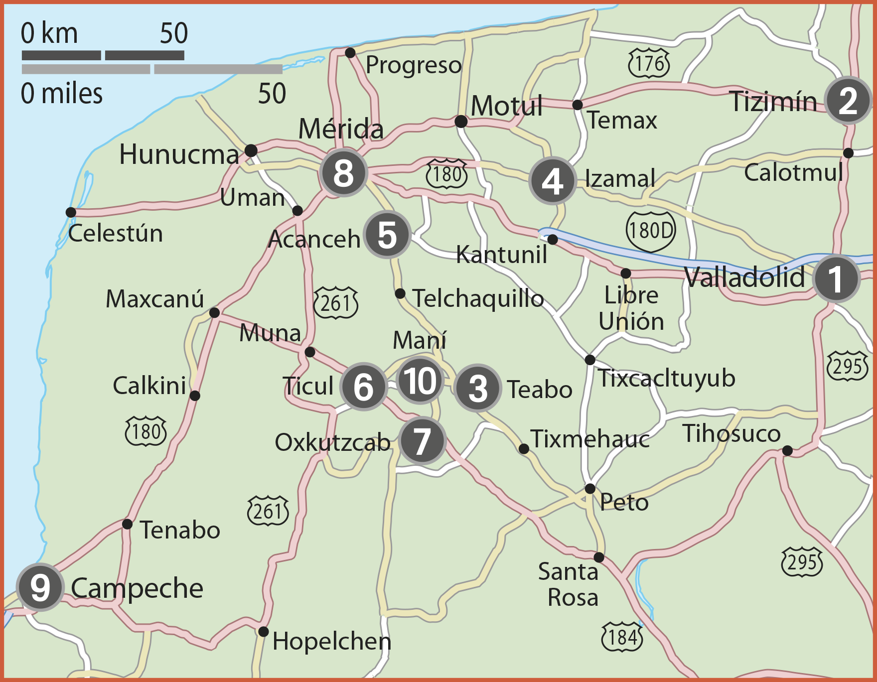
4. Izamal
Known as La Ciudad Dorada, the Golden City, because of the ocher wash of its buildings, this is the most complete and unchanged of Yucatán colonial towns. At its heart is the largest of the Yucatán’s Franciscan monasteries, and a short distance from this are the pyramids of a much older Mayan city. Victorias, or horse-drawn carriages, are a favorite way of getting around.
The yellow colonial city of Izamal
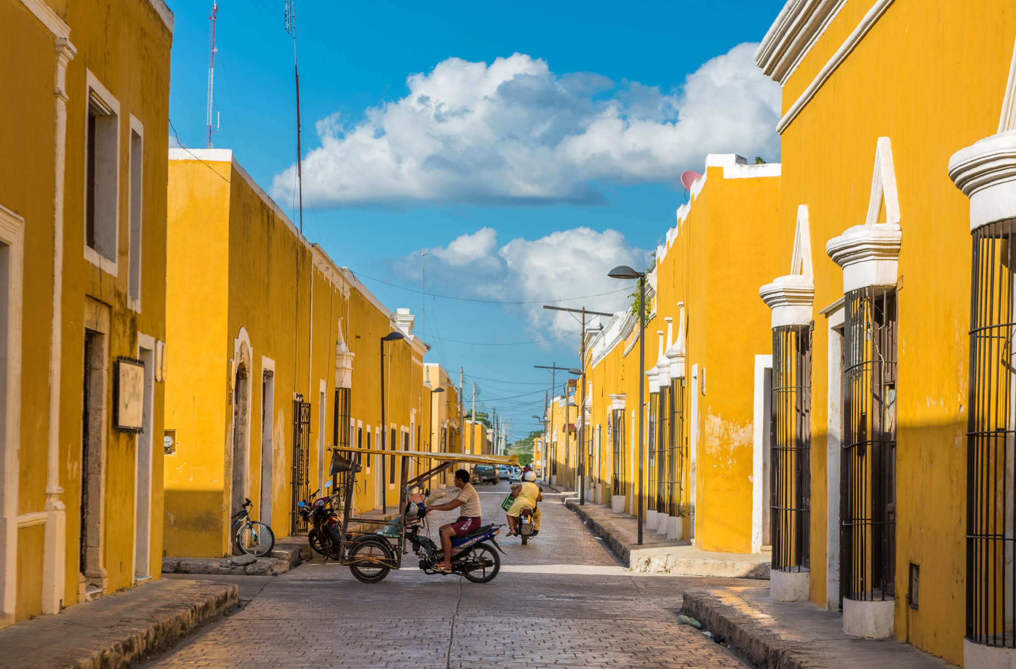
5. Acanceh
An extraordinary little town in which over 2,000 years of time are on show, from its ancient Mayan edifices to a fine 18th-century Spanish church.
Ancient Mayan pyramid, Acanceh
6. Ticul
With a slow-moving, unfussy, friendly atmosphere, Ticul is the epitome of a small Yucatán country town and makes an excellent base for visiting Puuc. Shoes are the town’s traditional product, and it also has a museum dedicated to chocolate, featuring live demonstrations and cultural re-enactments.
7. Oxkutzcab
The south of Yucatán near the Puuc hills is a fertile, fruit-producing region. Oxkutzcab has a huge market, where Mayan women in huípiles (white blouses with bright embroidery) preside over stalls stacked with succulent mangoes, papaya, oranges, watermelons, and more. Above them stands the lofty tower of the town church, finished in 1645.
8. Mérida
The capital of the Yucatán, which was founded by the Spaniards in 1542 on the site of the ancient Mayan city of Ti’ho, has a seductive appeal. Whitewashed Spanish houses with shaded patios provide delightful places to stay. Despite the bustle of its market (and traffic), amid the city’s old squares daily life still proceeds at a leisurely, friendly pace.
9. Campeche
The most complete Spanish walled city in Mexico, Campeche is full of reminders of the era when it was a trading hub of Spain’s empire and looked upon with greed by Caribbean pirates. The old city – complete with its churches, patios, Andalusian-style grill windows, and facades in delicate pastel colors – has been restored to refresh its distinctive Hispanic character and charm.
10. Maní
Now wonderfully sleepy, this town was important at the time of the Spanish Conquest, and contains the oldest Franciscan missionary monastery in the Yucatán, the scene of dramatic events in 1562. The town was the seat of Tutul Xiu, the first of the Mayan lords to accept Spanish authority in 1542. The monastery and town square are situated on the top of an old Mayan temple-platform.