
GRAND CANAL
Venice’s majestic “highway,” the Canal Grande, is only one of the 177 canals flowing through the city, but at some 2.5 miles (4 km) in length, 98–230 ft (30–70 m) in width, and averaging 15 ft (4.5 m) in depth, it certainly earns its name. Snaking its way through the city with a double curve, its banks are lined with exquisite palaces, while on its waters colorful flotillas of gondolas, ferries, taxi launches, high-speed police boats, and barges groaning under loads of fresh produce provide endless fascination. In 1818, when the water was cleaner, Lord Byron swam all the way down the Grand Canal from the Lido.
NEED TO KNOW
![]() The Grand Canal runs from Piazzale Roma, the bus terminal and parking area, to Piazza San Marco. It is easily navigable courtesy of ferries Nos. 1 (all stops) and 2 (main stops only).
The Grand Canal runs from Piazzale Roma, the bus terminal and parking area, to Piazza San Marco. It is easily navigable courtesy of ferries Nos. 1 (all stops) and 2 (main stops only).
- Take the vaporetto line No. 1 to enjoy the best views of the sights along the canal.
- To beat the crowds, start out from Piazzale Roma heading toward San Marco in the late afternoon or evening, or take the reverse direction in the morning.
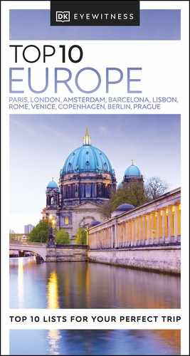
1. Fondaco dei Turchi
With an exotic air and its round arches, this Veneto-Byzantine building (1225) was the Turkish trade center for 200 years. It is now the Natural History Museum (Santa Croce 1730).
Fondaco dei Turchi
2. Ca’ Pesaro
This colossal Baroque palace (Santa Croce 2076), decorated with diamond-point ashlar work, was the final creation of architect Longhena. Home to the city’s modern art collections, it is beautifully floodlit at night.
3. Rialto Bridge
One of the city’s most familiar sights, the striking 92-ft- (28-m-) wide, 26-ft- (8-m-) high Istrian stone Ponte di Rialto dates from 1588.

Rialto Bridge
4. Riva del Vin
A sunny quayside with a string of open-air restaurants, this is one of the few accessible banks of the Grand Canal. Barrels of wine (vino) used to be offloaded here, hence the name.
5. Ca’ Rezzonico
The finest feature of this imposing palace is its grandiose staircase. Today it is a museum of 18th-century Venice.

Ca’ Rezzonico
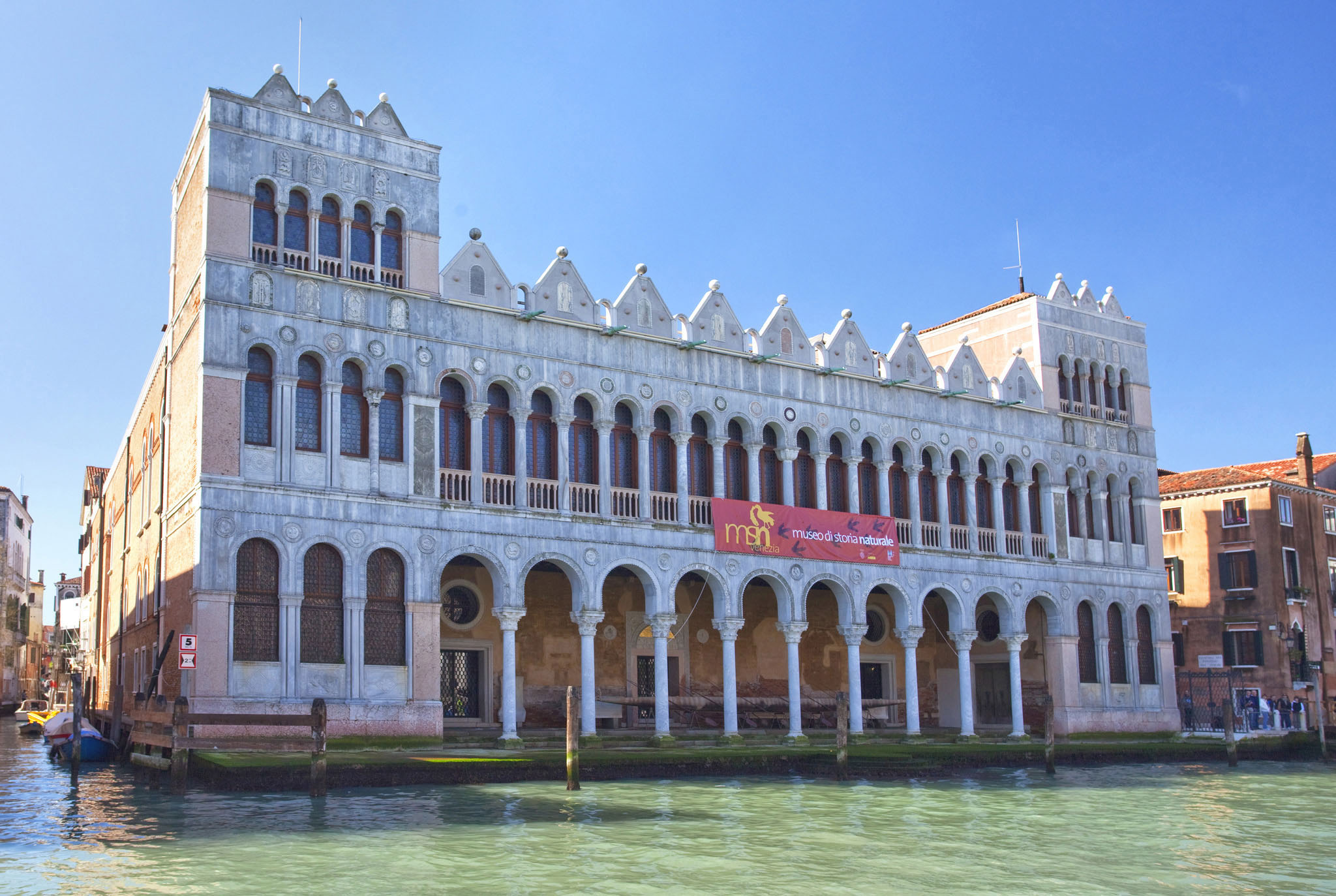
6. Accademia Bridge
The lovely wooden Ponte dell’Accademia, built in 1932 by the engineer Miozzi, was intended as a temporary measure until a more substantial structure was designed, but it is now a permanent fixture. It affords stunning views of the Grand Canal.
Accademia Bridge
7. Ca’ Dario
With an ornamental Renaissance façade studded with multicolored stone medallions, this lopsided palace is supposedly cursed due to a number of misfortunes that have overtaken its various owners.
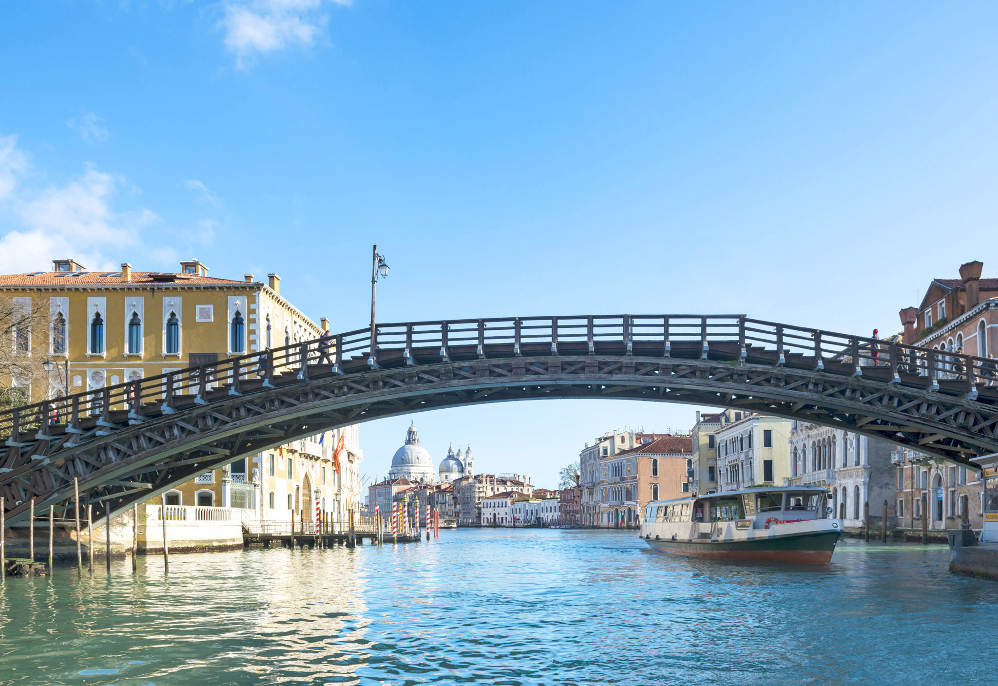
8. Santa Maria della Salute
Longhena’s 17th-century masterpiece of sculpted whorls beneath a towering dome, this church commemorates the end of a devastating plague in the city.

The view toward Santa Maria della Salute
Santa Maria della Salute
9. Punta della Dogana
The figure of Fortune stands atop the erstwhile customs house, now an arts center (Campo della Salute), and doubles as a weather vane. The Grand Canal joins St. Mark’s Basin here.
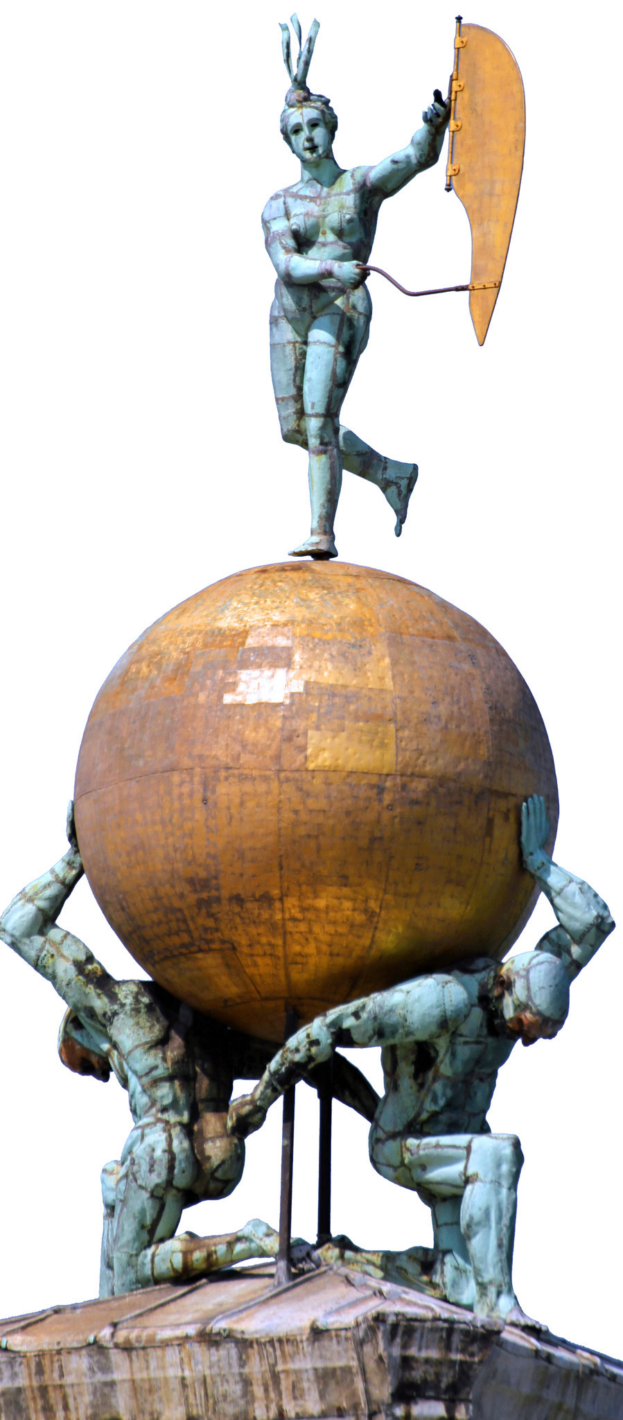
Punta della Dogana
10. Harry’s Bar
The legendary watering hole (Calle Vallaresso 1323) of Ernest Hemingway is where the Bellini aperitivo was invented. Opened in 1931, it was named after the American who funded it.
WAVE DAMAGE
Damage to buildings caused by wash has worsened of late with the rise in motor-propelled craft. Waves provoked by all boats eat into foundations of buildings on the water’s edge, as well as making life harder for the gondoliers. Speed limits aim to curb this: 4.5 mph (7 kmph) for private craft and 7 mph (11 kmph) for waterbuses on the Grand Canal. Narrower canals mean 3 mph (5 kmph), while 12.5 mph (20 kmph) is the lagoon maximum.