Millions of years ago, the Colorado and Green Rivers cut winding paths deep into rock, creating a labyrinth of rocky canyons, mesas, buttes, and spires that form the heart of this stunning wilderness. With fantastic hiking trails and plenty of breathtaking photo opportunities, this park promises an unforgettable experience.

t Mesa Arch in the Island of the Sky district at sunrise, with a keyhole view of the landscape
Experience Southern Utah
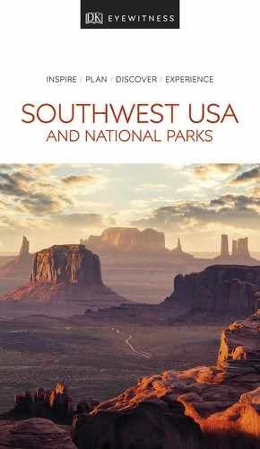
t Winter sunrise above Grand View Point in the Island of the Sky district
The confluence of the rivers as the center of the park divides its 527 sq miles (1,365 sq km) into three districts: the Needles, the Maze, and the grassy plateau of the Island in the Sky. The rivers themselves constitute a fourth district. Because of its remote nature, Canyonlands is generally less crowded than southern Utah’s other national parks. The districts have their own distinct character and are two to six hours’ drive apart. No roads link them, so most visitors only visit one section at a time.
Island in the Sky is the most popular due to its easy access by car. A 12-mile (19-km) scenic road runs from the visitor center to Grand View Point, with its panoramic view over the rivers and canyons. The Needles, named for its colorful sandstone spires, is primarily a backcountry district with over 60 miles (97 km) of interconnecting hiking trails. The Maze is rugged and remote, best suited to experienced hikers. Horseshoe Canyon is a big draw here.
Did You Know?
Spring through fall, park rangers present geology talks at the Grand View Point.
Horseshoe Canyon
It’s a long drive on dirt roads to reach the Horseshoe Canyon trailhead, then a minimum five-hour round-trip hike into the canyon, at the northern end of the Maze district. It’s definitely worth the effort to see some of the most significant rock art in North America. The panel in the Great Gallery depicts well-preserved intricate, life-size human figures and hunting scenes, painted in the Barrier Canyon style by hunter-gatherers during the Late Archaic period (2000–1000 BC).
Exploring Canyonlands National Park
The park has many good hiking trails. At Island in the Sky, Mesa Arch is reached by a short, easy trail that starts halfway along the main road. The views through the arch make it a great spot for photos, especially at sunrise. At Grand View Point, you can walk a mile along the edge of the canyon to a second awesome overlook at the end of the mesa. In the Needles, easy to moderate hikes include the Cave Springs trail, which leads to a historic cowboy camp and prehistoric petroglyphs, and the Pothole Point trail. Both districts contain more strenuous and overnight hikes. The Maze area is best tackled by hardy backcountry veterans. You’ll need a permit to visit the more remote areas; check the website for permit info.
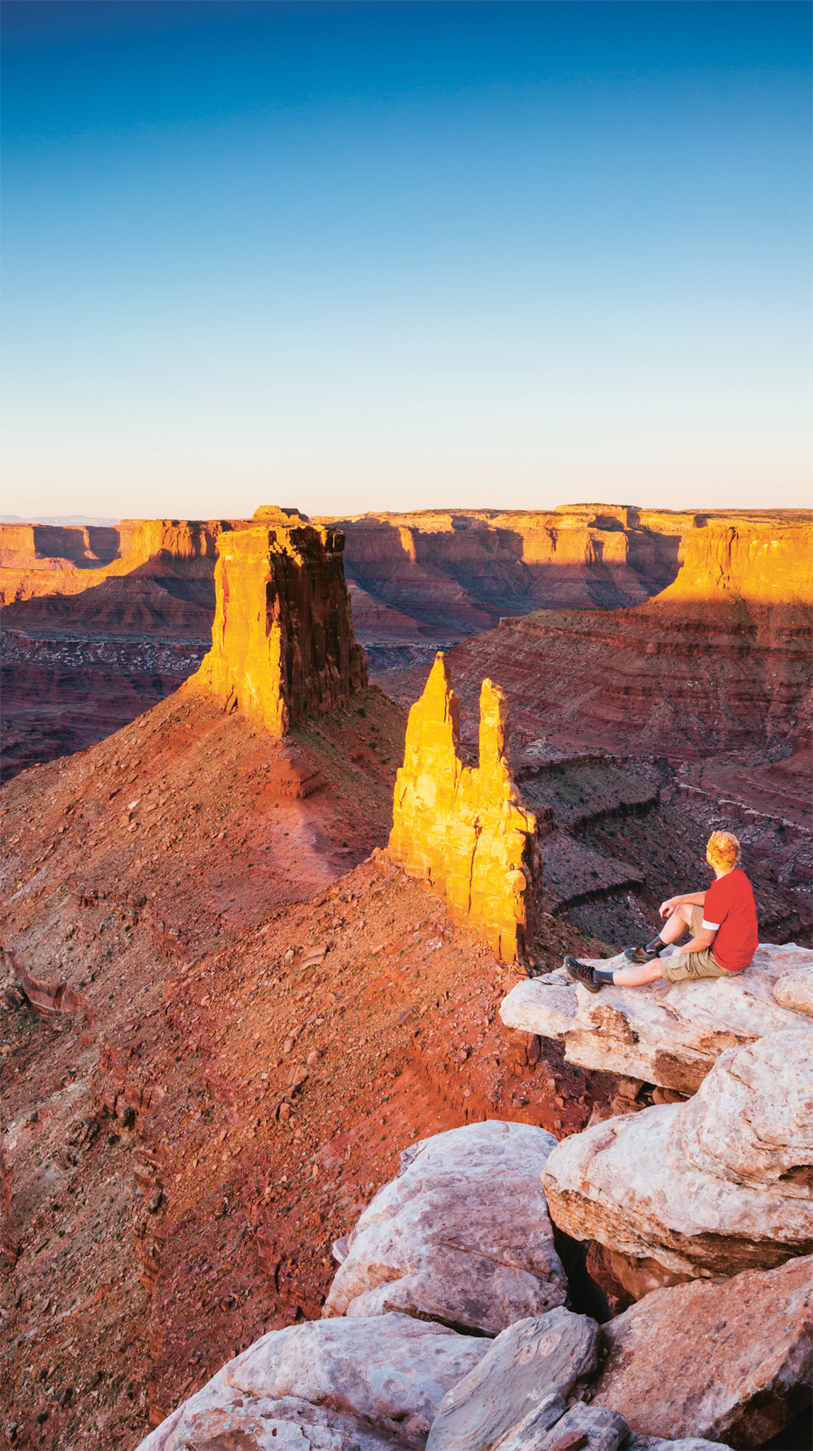
t Admiring the view from one of the park’s many overlooks
EXPERIENCE Southern Utah

n Double-tap image to read the labels
Did You Know?
The Maze area of the canyons was a hideout for Butch Cassidy and other outlaws in the late 1800s.
On the River
A beautiful way to see Canyonlands is from the water. Above the confluence, both the Colorado and Green rivers have miles of calm water that make for relaxing trips by kayak, canoe, or other shallow-water craft. Below the confluence, the rivers surge through Cataract Canyon on a thrilling, 14-mile (23-km) stretch of white water. The park website lists local companies that run river trips.