Few places in North American have a longer or more eventful history of human habitation than Canyon de Chelly. Four periods of Native culture have been unearthed here. The sandstone cliffs of the canyon reach as high as 1,000 ft (300 m), towering above the neighboring meadows and desert landscape in the distance. The canyon floor is fringed with cottonwood bushes, watered by the Chinle Wash.
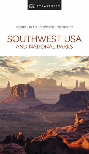
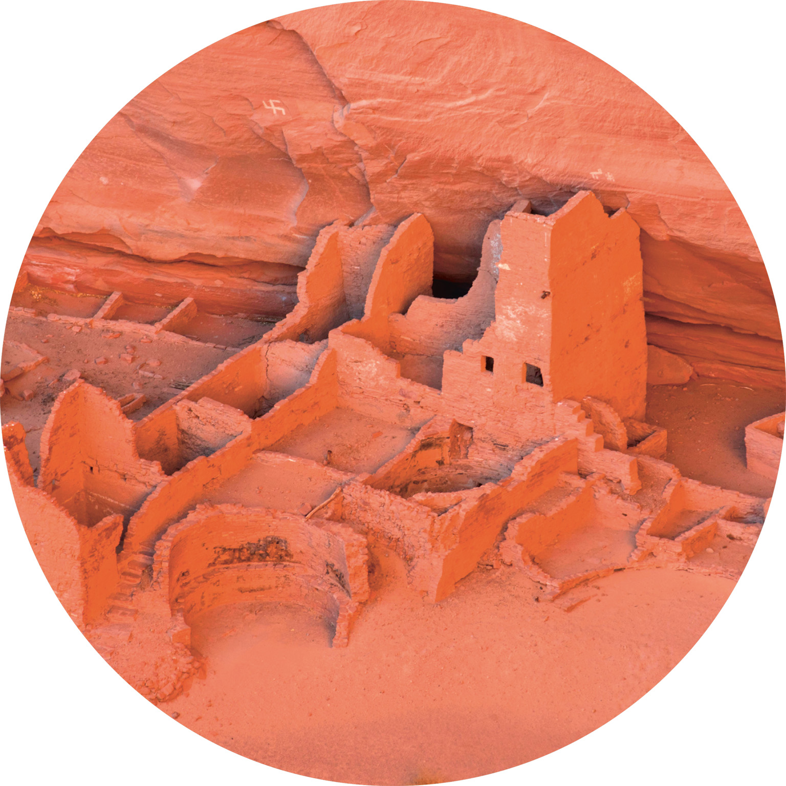
t Cliff dwellings of the White House Ruins, tucked into a tiny hollow in the cliff
Experience The Four Corners

t Spider Rock, rising high from the canyon floor – one of the park’s most distinctive geologic features
The earliest remains found in the canyon are of the Basketmaker people dating to around AD 300, followed by the Ancestral Puebloans, who created the cliff dwellings in the 12th century. They were succeeded by the Hopi, who lived here seasonally for around 300 years, taking advantage of the canyon’s fertile soil. In the 1700s, the Hopi left the area and moved to the mesas, returning to the canyon to farm during the summer months. Today, the canyon is the cultural and geographic heart of the Navajo Nation. Pronounced “de Shay,” de Chelly is a Spanish corruption of the Navajo word Tsegi, meaning Rock Canyon.
Canyon de Chelly is very different from the sparse desert landscape that spreads from its rim. Weathered red rock walls, just 30-ft- (9-m-) high at the canyon mouth, rise to more than 1,000-ft- (300-m-) high within the canyon, creating a sheltered world. About 40 Navajo families live in the park. Navajo hogans dot the canyon floor; Navajo women tend herds of sheep and weave rugs at outdoor looms. Everywhere Ancestral Puebloan ruins dot the canyon. The White House Ruins, a group of rooms occupied by Ancestral Puebloans between 1060 and 1275, seem barely touched by time and are among the most striking ruins in the park. The trail leading up to them offers superb views. Navajo-led 4WD tours along the scenic North and South rims are a popular way to view the sites in the park.
Exploring Canyon de Chelly
The White House Ruins Trail is the only site within the valley of the canyon that can be explored without a Navajo guide. Aside from this, you can take scenic drives along the rims without joining a guided tour. The South Rim Drive is a 37-mile (60-km) round-trip offering stops at the White House, Sliding House, and Junction ruins, taking in Spider Rock, and views of the de Chelly and Monument canyons, Defiance Plateau and the Chuska Mountains. The North Rim Drive is a 34-mile (55-km) round-trip with stops at cliff dwellings, including Antelope House, Mummy Cave, and Yucca and views of de Chelly and del Muerte canyons.

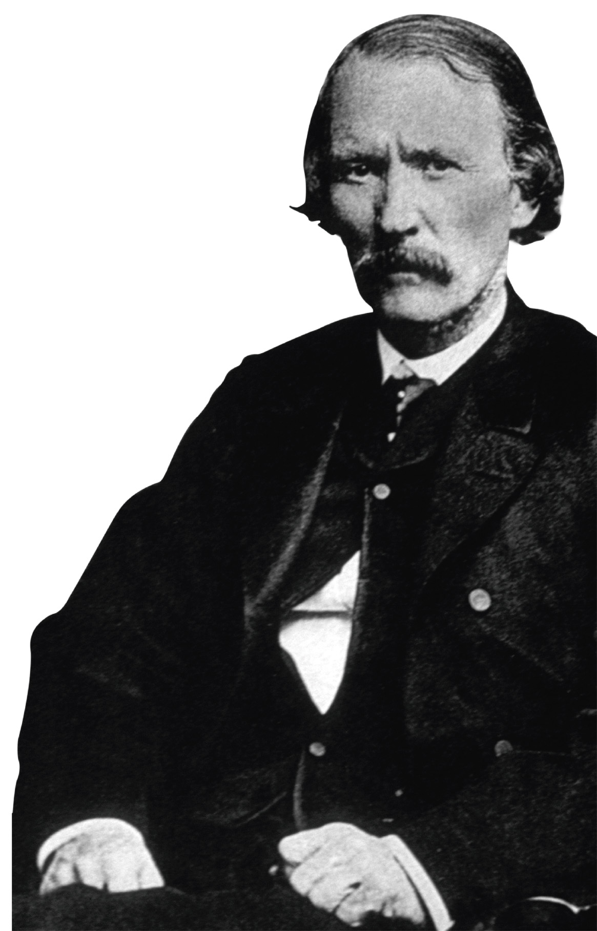
t A Navajo riding on horseback on the sandy floor of Canyon de Chelly National Monument
Did You Know?
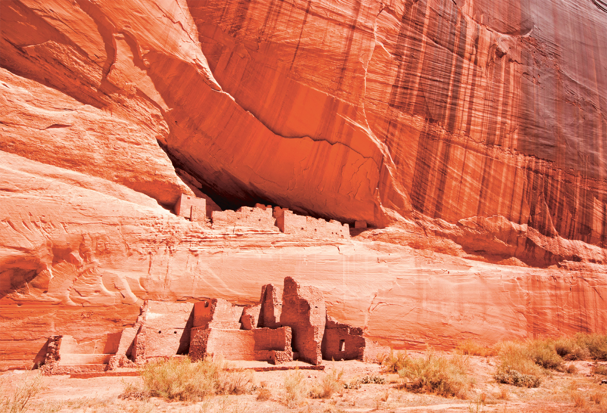
Spider Woman is one of the most important deities of traditional Navajo religion.

Insider Tip
Canyon Guided Tours
A list of authorized companies offering hiking, horseback, and vehicle guided tours is on the park’s website. Reservations are recommended from March to October. Ranger-led hikes can be booked at the visitor center.
Experience The Four Corners
Massacre Cave
The canyon’s darkest hour was in 1805, when a Spanish force under Antonio Narbona entered the area to subdue the Navajo, claiming they were raiding their settlements. While some Navajo fled, others took refuge in a cave high in the cliffs. The Spanish fired into the cave, and Narbona boasted that he had killed 115 Navajo, including 90 warriors. Navajo accounts are different, claiming that most of the warriors were absent (probably hunting), and those killed were mostly women, children, and the elderly.
Experience The Four Corners
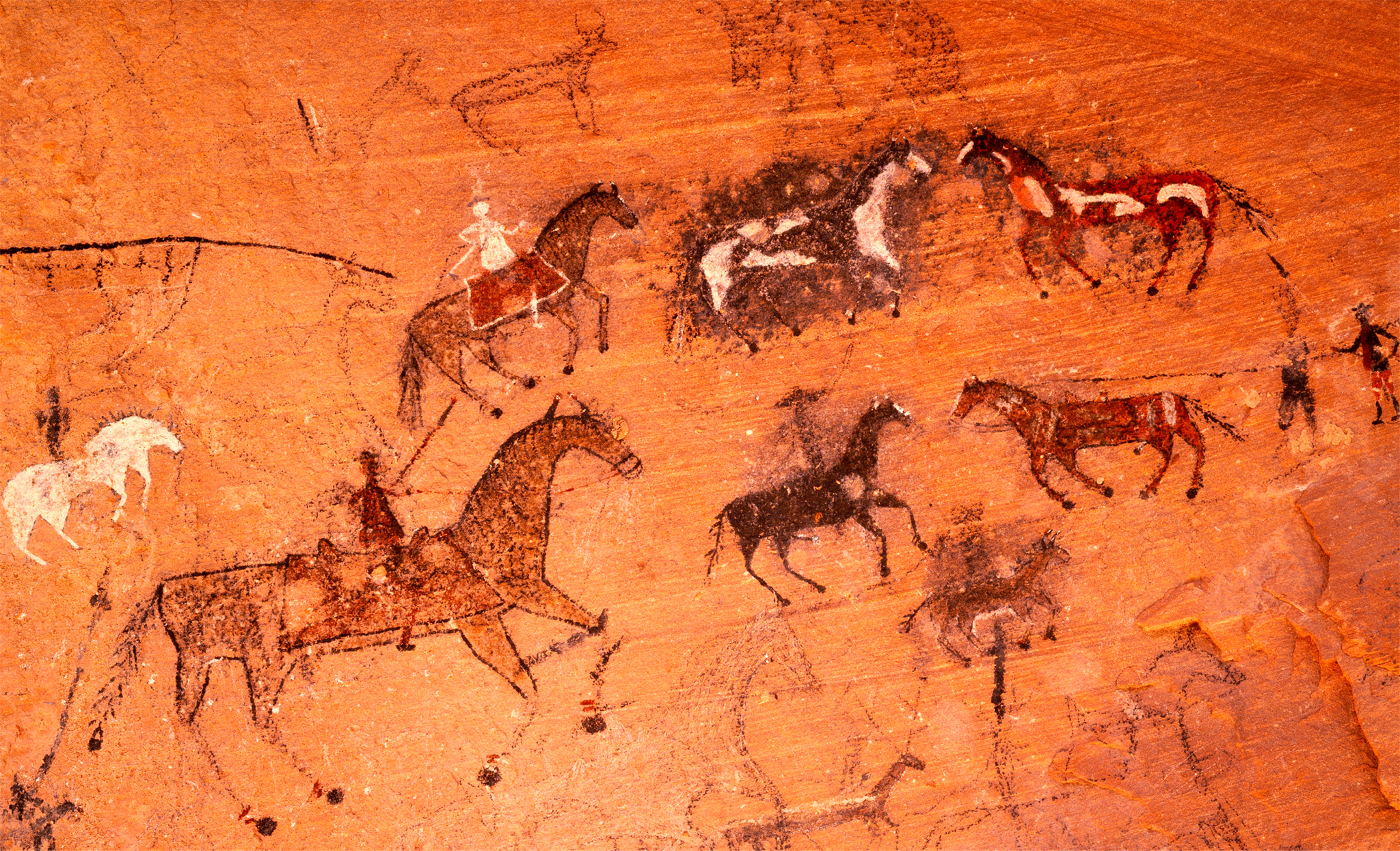
Kit Carson and the “Long Walk”
In 1863, the US government sent Kit Carson under the command of General James A. Carlton to the Four Corners to settle the problem of Navajo raids. In January 1864 Carson entered Canyon de Chelly, capturing the Navajo hiding there. In 1864, they were among 9,000 Navajo who were driven on the “Long Walk,” a forced march of 370 miles (595 km) from Fort Defiance to Bosque Redondo in New Mexico. There, in a pitiful reservation, more than 3,000 Navajo died before the US government accepted the resettlement as a failure and allowed them to return to the Four Corners.
EXPERIENCE The Four Corners
Highlights |
Antelope House RuinNamed for a pictograph of an antelope painted by Navajo artists in the 1830s, Antelope House has ruins dating from AD 700. They can be seen from the Antelope House Overlook along the North Rim Drive. |

Tsegi OverlookThis high curve along the South Rim Drive offers general panoramic views of the farm-studded canyon floor with green vegetation and the surrounding landscape. The distinctive feature that can be seen is Blade Rock – a long curving fin that projects from the North Rim cliffs right to the edge of the Chinle wash. There are several stalls here where Navajo vendors sell jewelry, pottery, and various other crafts. |

Spider RockRising more than 800 ft (245 m) from the canyon floor, Spider Rock was, according to Navajo legends, where Spider Woman lived in the crack between the two rocks and taught her people the art of weaving. |
Hogan InteriorMade of horizontal logs, the hogan is the traditional dwelling of the Navajo and the center of Navajo family life. A smoke hole in the center provides a link with the sky, while the dirt floor gives contact with the earth. A door faces east to greet the rising sun. |

Canyon VegetationWithin the canyon, cottonwood, oak, and olive trees line the river washes; the land itself is a fertile oasis of lush meadows, alfalfa and corn fields, and fruit orchards. |