
North Carolina • Tennessee
GREAT SMOKY MOUNTAINS
ESTABLISHED 1934
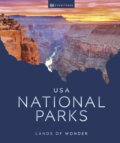
Spend a few hours in this magical place, with its mysteriously misty mountains, verdant forests, and incomparable hiking, and you’ll understand why it’s the most visited national park in the country.
More than 12.5 million people come to Great Smoky Mountains National Park each year, and there are just as many reasons for why they are drawn here. Not least of which are those hazy and hauntingly beautiful mountains and the hiking trails that crisscross them—in particular, that giant among hikes, the Appalachian Trail. The thick forests, the scenic drives, the historic sites, and, of course, the mind-boggling variety of gorgeous plant and animal life all exert a magnetic pull. Although no one can give with certainty an exact number of all the plant and animal species in the region, it’s estimated that as many as 100,000 different varieties live in these foggy wilds.
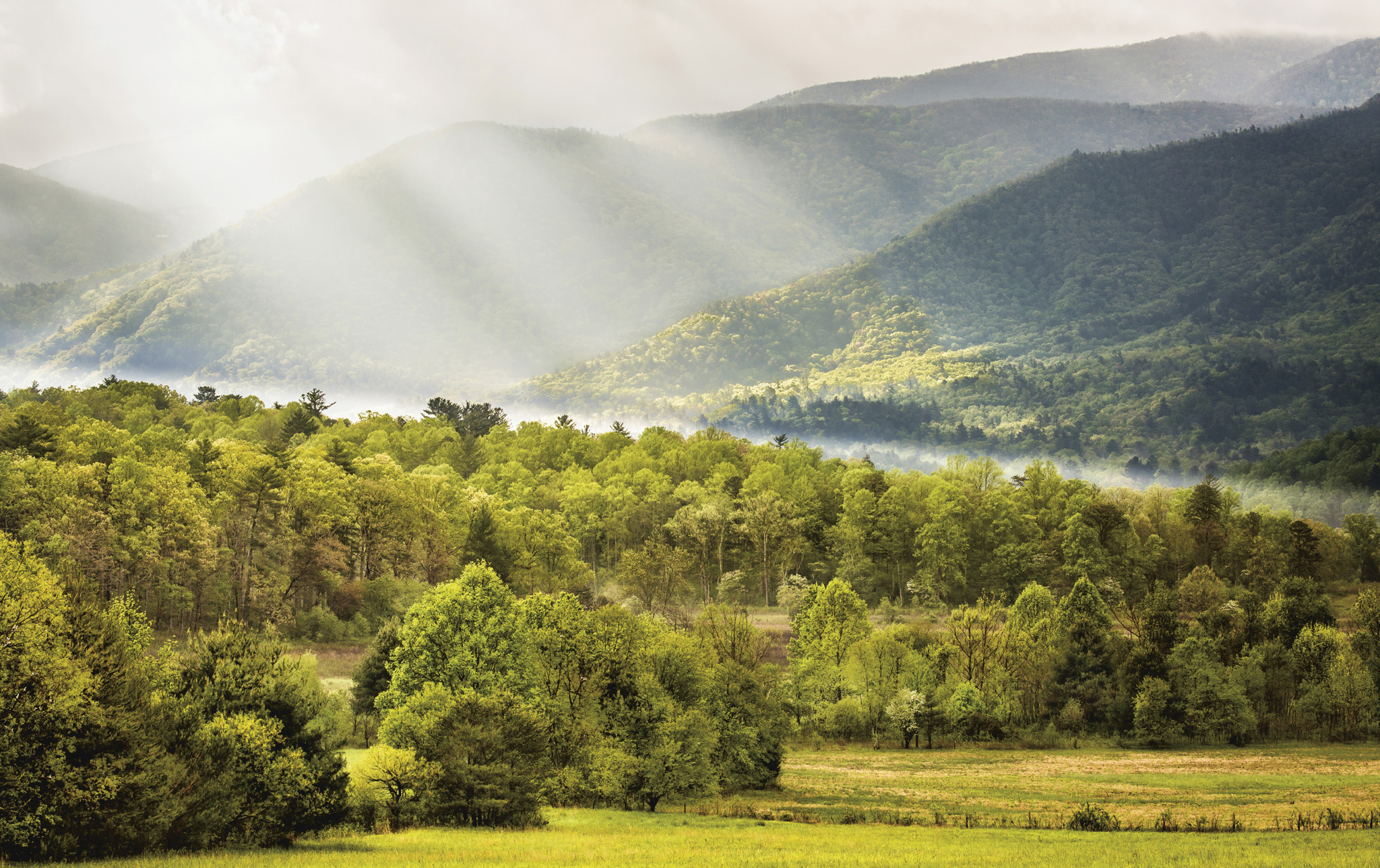
The park sprawls across two states; each side has its own unique attractions; both share those misty mountains. All peoples who have inhabited this region have been struck by its distinctive hue. The Cherokee called the mountains the “land of the blue smoke,” and the first Europeans agreed, naming these the Great Smoky Mountains, along with the Blue Ridge Mountains, both part of the vast Appalachian mountain range.
A solitary hiker views the distant scenery through mountaintop cloud cover
2,200
At nearly 2,200 miles (3,540 km) long, the Appalachian Trail is the longest continuously marked footpath in the world.
FLORA AND FAUNA
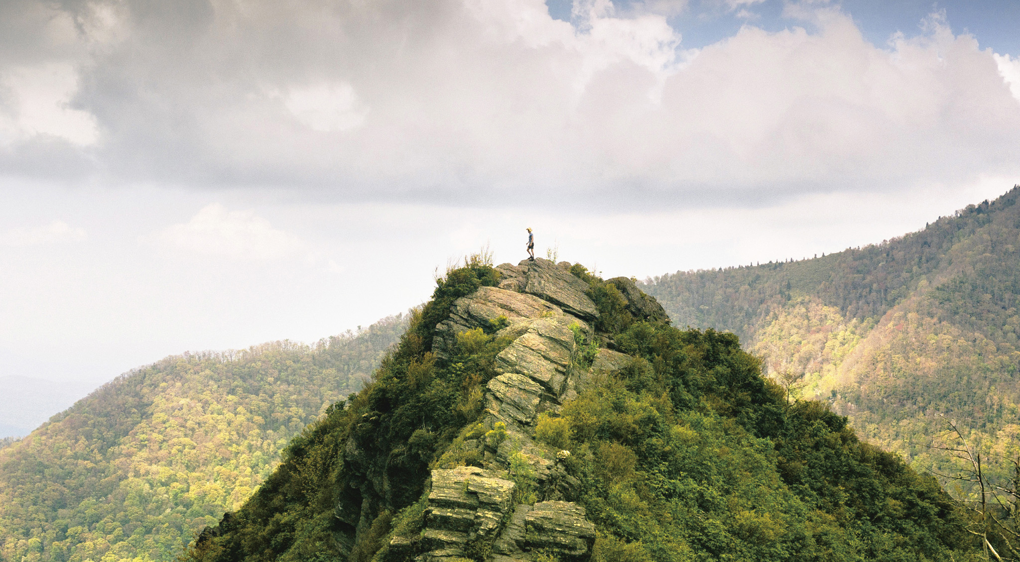
Fireflies
From late May to mid-June, huge numbers of synchronous fireflies gather in the park, mostly around Elkmont in Tennessee, and they put on a spectacular display. As the sun starts to set, people line the roads and gaze into the woods. There in the trees, a few lights start to glow and flash, then more and more join in, until entire forest glades are illuminated by thousands of flashing green bulbs.
5 to 7
The amount of time in months it takes the average person to hike the length of the Appalachian Trail.
41
The fastest time for walking the whole trail was 41 days, 7 hours, 39 minutes.
The beaten path
The Appalachian Trail stretches from Maine to Georgia, passing through 14 states. Just 71 miles (114 km) is in the park, although the trail’s highest point, Clingmans Dome (6,643 ft/2,025 m), is here, as well as its only dam crossing, Fontana Dam, which is where the trail exits the park.
Climb to the top
On the North Carolina side of the park, there are hundreds of miles of hiking trails, with almost boundless vistas of forests, streams, and waterfalls. Some trails straddle both states—one of the most popular being the Clingmans Dome, which starts in North Carolina and ends at the park’s highest point, just inside Tennessee.
To embark on the trek, you need to drive to the Clingmans Dome trailhead, where you leave the car behind. The trail to the top is only 1.2 miles (2 km) and it’s paved, but don’t be fooled. It’s steep, especially the last section. At the outset, views are partly obscured by trees, with occasional tantalizing glimpses of what lies ahead. Gradually, the trees thin and the mountains start to emerge, more and more of them, appearing on the horizon.
Pause and drink in this magnificent view before pressing on. As you cross the state line, a curved walkway takes you above the trees—if the walk didn’t make you breathless, the panoramic, 360-degree views will. On a clear day, you can see 100 miles (160 km) over the peaks below.

Clouds roll over the Deep Creek area, which is renowned for its thick forests and streams

The Clingmans Dome Observation Tower is easily the best spot in the park for photos, but you’ll also get impressive shots at the Deep Creek Valley Overlook and the Newfound Gap Overlook.
Lakes and trails
Fontana Lake—at 440 ft (130 m)—is the deepest lake in North Carolina and is easily viewed from Clingmans Dome. It also marks the spot where the park ends and the Nantahala National Forest begins. When it’s at its highest levels in summer, the lake provides easy access by boat to more remote trailheads in the park. And if you walk across the gates of Fontana Dam, you’ll have had a chance to walk part of the renowned Appalachian Trail. But don’t stop there—keep walking into the lush woods until you get far enough away to look back and survey the lake surrounded by forests and mountains, its surface dotted with wooded islets. To call the scene picturesque doesn’t begin to do it justice.
For some local sporting adventure, get out onto the park’s waters at Deep Creek near Bryson City, where the tubing is superb. Choose from two areas—one for the adventurous, the other for the more laid-back. Rent your tube near the Deep Creek trailhead, a 20-minute walk from the put-in spot and right near a picture-perfect rushing waterfall. Then take the plunge and enjoy the thrill.
FAMILY FUN
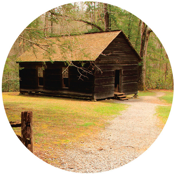
Mountain Farm Museum
For a taste of what log-cabin life was like in isolated settlements, head 2 miles (3.2 km) north of Cherokee to the Mountain Farm Museum and Oconaluftee Visitor Center. They host activities for kids of all ages that illustrate the hardships faced by early settlers, despite the bounty of the mountains.
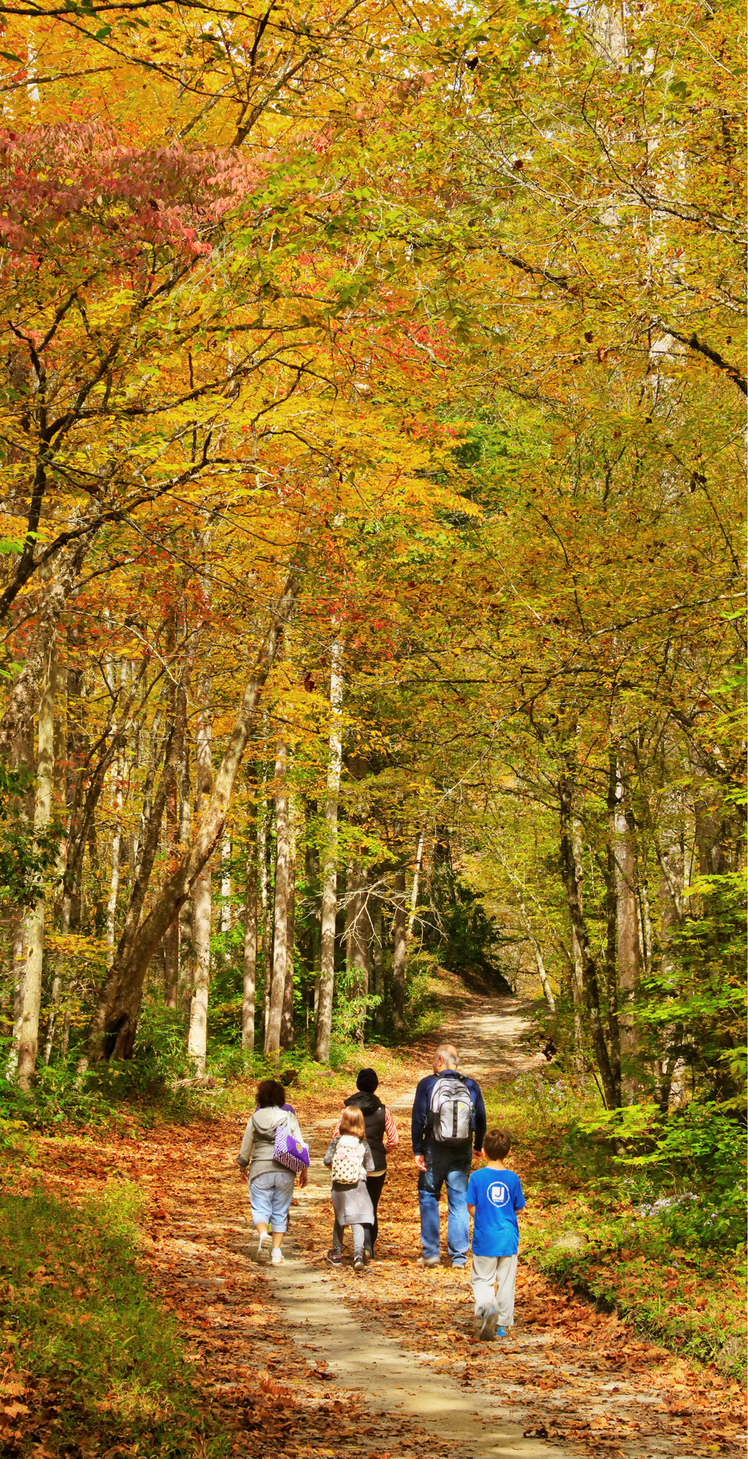
The Bradley Fork Trail shows itself at its finest when at the peak of its splashing fall glory
A watery wonderland
Tennessee more than holds its own when it comes to the wet and wonderful aspects of the park’s natural splendor. To get up close—and wet—take the Trillium Gap Trail near Gatlinburg. This 2.6-mile (4-km) out-and-back trail leads you past bubbling streams, through a hemlock forest, past sweeping mountain views, and even behind the 25-ft (8-m) Grotto Falls. This is also one of the best places to spot the park’s famous salamanders. You may be lucky enough to see one of the park’s 1,500 black bears ambling through the neighborhood.
Much higher, at 80 ft (24 m), are Laurel Falls, and a 2.6-mile (4-km) trail gets you there and back. With rocks on one side and steep drops on the other, the paved trail is a sight in its own right, sporting dramatic views of the surrounding mountains. After walking about an hour, the sounds of Laurel Falls greet you, and a walkway takes you between the upper and lower sections of the falls and their thundering waters.
Green, green valley
If you prefer to experience the park by car, then the Smokies offer numerous spectacular drives. One of the best is undoubtedly Cades Cove—cove being the local word for a valley. The loop road is just 11 miles (18 km) long, but, even so, allow at least half a day to accommodate the many stops along the way. Most of the park is thickly wooded but Cades Cove is open, so ideal for wildlife spotting. You might see deer grazing in the fields, hear the gobble of wild turkeys, or spy white-tailed deer. Bring binoculars to observe them from a distance. Cades Cove is also perfect for birdwatching. Flashes of color in the trees and bushes could be the the blue grosbeak, the pileated woodpecker, or the yellow-throated warbler.
Get a feel for the life of a pioneer at two historic buildings in the area. The John Oliver Cabin, one of the oldest structures in the park, was built without nails in the 1820s by the first European settlers. It was one of the last properties to be vacated as the owner resisted multiple eviction orders. The photogenic John Cable Grist Mill dates from the 1870s. April through October, volunteers from the Great Smoky Mountain Association work the mill and you can purchase their fresh ground corn.
The Roaring Fork Motor Nature Trail is another notable drive. At just 5.5 miles (9 km) long, what it lacks in length it makes up for in beauty. The road winds through thick forests, alongside mountain streams that become noisy torrents after heavy rains, and past log cabins from days gone by.
The morning light shines through gauzelike clouds at Cades Cove, home to bears, elk, and deer
FLORA AND FAUNA
Salamanders
The Great Smoky Mountains are known as the Salamander Capital of the World, and have 24 species of lungless salamanders, and four other families of salamanders. The lungless salamanders “breathe” through blood vessels that cover their skin, mouth and throat. Watch out for the vivid black-chinned red salamander, which definitely stands out.

History Timeline |
|
|
The Great Smoky Mountains exude a timelessness, as if they have always been here and always will be. The oldest rocks in the park formed more than a billion years ago, and the constant change of nature ensures that the park will continue to evolve through the centuries. |
|
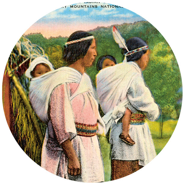
2000 BCThe Cherokee live for 4,000 years in the area that today makes up the national park, until they are forcibly relocated. |

|
1830After president Jackson signs the Indian Removal Act, all tribes east of the Mississippi are made to walk to Oklahoma in the Trail of Tears. |

|
1901Little River Railroad opens to export lumber from the Smokies (until 1939). Many oppose the park because of business interests. |
|
1925The idea to make the area a national park is studied, including the ramifications for local people. It gets the go-ahead the next year. |
|
1976The park is made an International Biosphere Reserve. The ecosystem is now studied in detail to ensure its sustainable development. |

|