
We can add a point layer using analytical dataset from our database, say top 10 sellers of tires. You can do that by simply matching the analytical dataset with the spatial data (map).
Adding a point layer has the same steps as adding a polygon layer.
But what if you want to identify a point that is not based on a dataset?
Let's say we want to add a new layer on our previous world map. Let's identify the countries the company have on their expansion list; namely, Russia, China, and Brazil.
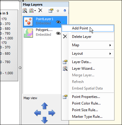
- In the Map Layer properties pane, click on the add layer button and select Point Layer from the menu as shown in the following screenshot:

- Click on the arrow of PointLayer1 (if you didn't rename it) to access its context menu, and select Add Point, as shown in the following screenshot:
- That displays a crosshair, which you use that to pinpoint the area in the map that you want to identify, in this case Russia:
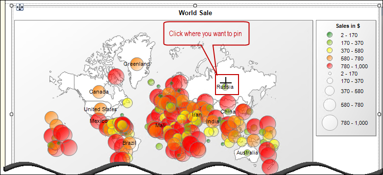
- Repeat the same steps for China and Brazil.
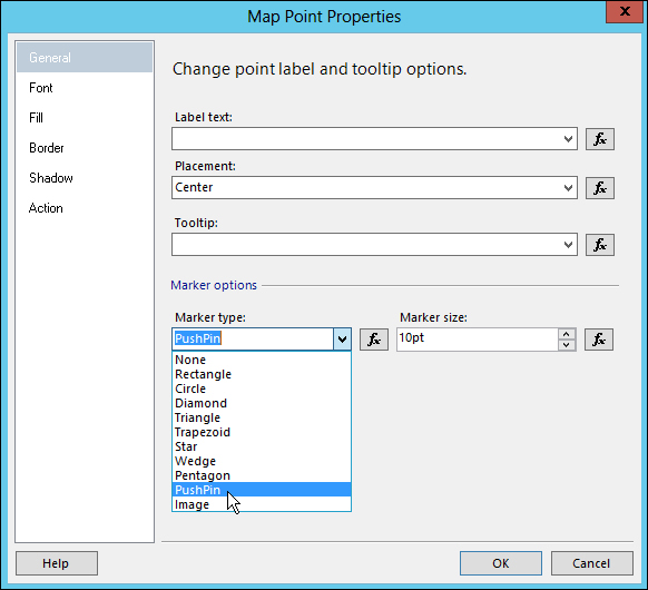
- Let's change Marker type of our point.
Click the arrow next to PointLayer1, and select Point Properties. On the General tab, select the PushPin marker. Place the marker in the Center.
- Also, change the color of the pushpins to Red in the Fill tab:
- Click on OK when done.
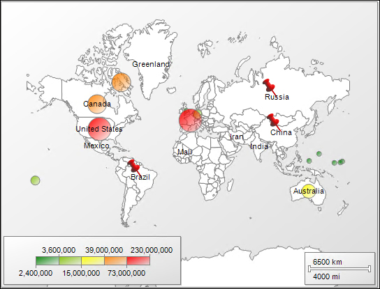
Let's preview our map with the added pushpins:
..................Content has been hidden....................
You can't read the all page of ebook, please click here login for view all page.