Utah
CAPITOL REEF
ESTABLISHED 1971
Giant domes, rainbow-colored cliffs and buttes, remarkable geologic features, and spectacular desert solitude await on the scenic drives and hiking trails of this remote national park.
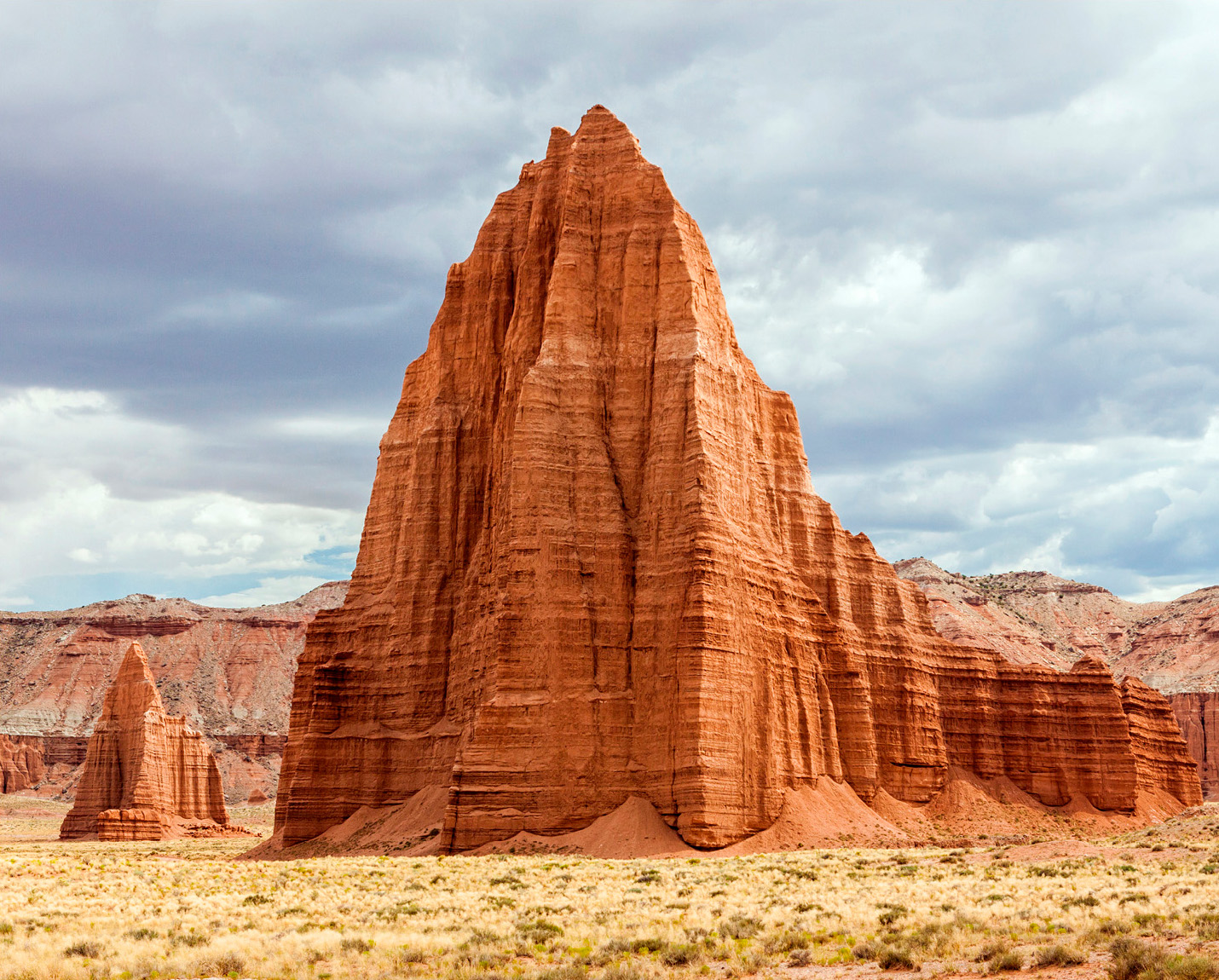
Imagine a colossal geologic wrinkle rising thousands of feet out of the desert and running a hundred miles through the middle of Utah’s red rock country. It’s known as the Waterpocket Fold, and it lies at the heart of this stunning national park. Over the eons, erosion chiseled away at the rock layers of this remarkable region, creating a wonderland of sculpted spires, imposing monoliths, awe-inspiring arches, winding canyons, and colorful sandstone cliffs that turn fiery red and gold in the setting sun. It also dented the sandstone with potholes, or “pockets,” which capture seasonal rains and help the desert creatures survive in the arid climate.
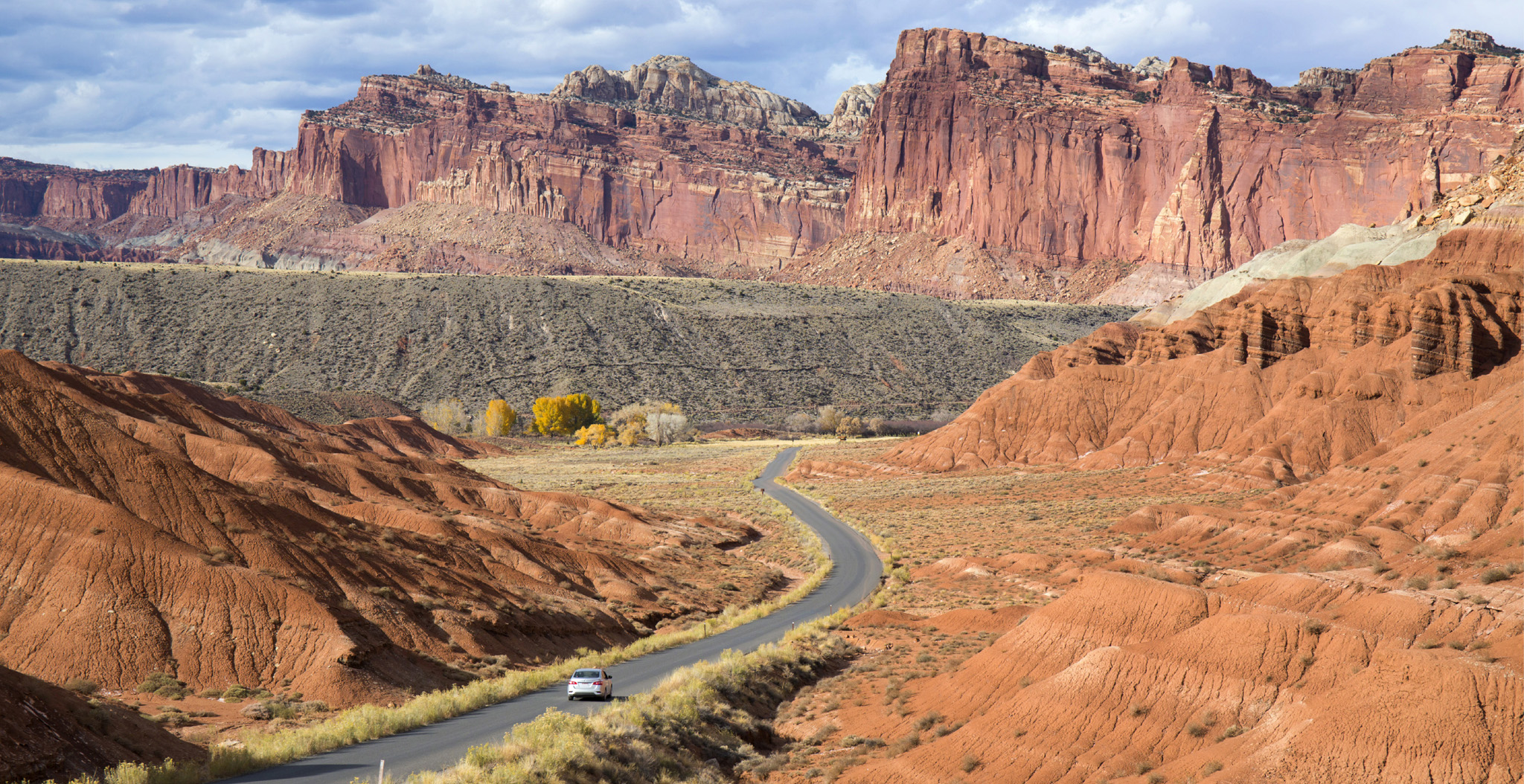
A lone car winds its way north along Scenic Drive toward Waterpocket Fold and the Mormon settlement of Fruita
Did You Know?
Twenty-two orchards planted in pioneer days are still thriving. During harvest time, you can pick and eat the fruit.
The road less traveled
The park takes its name from a string of huge white domes that reminded early settlers of the United States Capitol. They used the nautical term “reefs” to describe the layered ridges that formed land barriers. Capitol Reef is more isolated than Utah’s other parks, and the journey through this unpopulated, otherworldly landscape to get to the park is rewarding in itself. When at last you do arrive, you’ll be greeted by miles of open gravel roads and unspoiled trails to explore.
Highway 24, a designated scenic byway, runs through the park, and from here you can see landmarks such as the sculpted red tower of Chimney Rock and the massive white bulk of Capitol Dome. The Capitol Reef Scenic Drive takes you deeper into the park, revealing the towering cliffs of Capitol Gorge. Some of the most spectacular areas, such as the Waterpocket District, can only be reached by unpaved roads and hiking trails. Cathedral Valley, the rugged northern section, is marked by impressive desert landscapes and rock formations.
The park may seem untouched, but it has a long human footprint. Petroglyphs by the Fremont Culture Indians have adorned the cliffsides for a thousand years. Showing animals and people, the art serves as a record of their hunter-gatherer way of life.
Cathedral Valley is so named because its rock formations resemble Gothic cathedrals
If you have…

An hour ▷ Drive through the park on Highway 24, stopping at the overlooks to see natural landmarks and petroglyphs.
A day Follow the Capitol Reef Scenic Drive and the dirt roads leading to Grand Wash and Capitol Gorge. Take a short hike, and visit the pioneer village at Fruita.

2–3 days ▷ Explore deep in the park on a backcountry hike, such as Cathedral Valley or the Waterpocket District, with stunning views of the Fold.