

Introduction
This chapter focuses on twenty international case studies chosen to illustrate a broad spectrum of places and communities around the world where a charrette process has been used.
All the processes are related to change. They offer communities a way to express concerns and ideas, which are then considered by the charrette team and reinterpreted as valued and effective inputs: people’s views are heard and honoured.
The case studies demonstrate that charrettes can give people more control over changes to their community and environment. Feelings can often change too – from negative and passive to positive and proactive.
In many instances, the processes have resulted in huge learning curves for the professionals and politicians involved, and in some cases they have changed lives and careers. There are examples of communities getting involved in the pre-charrette organisational phase and the post-charrette delivery phase, whose members then go on to manage and deliver buildings and services. This is in addition to involvement in the charrette itself.
I have worked on many of the charrettes featured in the case studies, collaborating with colleagues from JTP and other practices. For case studies I have not been involved in personally, I am indebted to colleagues for directing me towards selected processes in their parts of the world, and for providing images and text.
While writing this book, I have returned to some places, and visited others for the first time, to assess outcomes from the charrettes and talk to participants. Most quotations come from personal conversations or from telephone conversations with people who participated in the original events.
What has become evident is the clarity of thinking and purpose that was developed through the charrette processes. This was affirmed by the communities and professionals involved. Apart from the tangible delivery of some truly inspiring projects, perhaps the most valuable result has been the relationships that developed within the communities themselves, which has led to further successes that would never otherwise have happened.
The case studies show that communities should not be feared, but welcomed as key participants in planning at any scale, as their input will help deliver what is right and best for the community concerned.
The case studies are presented in three sections: Foresight, Vision and Hindsight. Foresight explains the background to the place and why a charrette was decided on. Vision explains the process and the resulting vision, or masterplan. Hindsight looks back at the charrette from today’s perspective and assesses what has happened since. The final chapter of the book considers the case studies together and draws out the lessons learned.
To give an overview of the case studies and to enable the reader to select charrettes that are of most interest to them, a matrix is included. The charrettes are categorised by location and date, with category headings as follows.
Client Sector
Depending on the body that initiated the charrette process, they are differentiated as ‘Public’, ‘Private’ or ‘Community’/Third. Public sector includes local authorities, non-governmental agencies and national governments. Private includes private landowners, land promoters or masterplan developers, or developers who will go on to build out the resulting scheme. Community/Third includes civic or charitable bodies or community groups. In the latter case, raising funds to involve professional facilitators can be a key challenge.
Scale
The ‘Regional’ category includes charrettes that cover more than one distinct settlement and deal with connections and infrastructure. ‘City/Town’ charrettes may involve a whole settlement, or part of a settlement such as a town centre that is significant enough to warrant engaging the whole settlement community. ‘Neighbourhood’ is more localised and typically covers a site or area that can be treated as a distinct development or regeneration opportunity, and which impacts on people within walking distance from the site.
Site
Most of the charrettes are held in the context of an existing Urban, settlement, be it a city, town or village. The ‘Rural’ category describes a site set in the countryside or bush, distinct from the nearest settlement.
Vision Focus
This category describes the primary professional or subject discipline that is the focus of the charrette – some charrettes fall into more than one category.
The ‘Planning’ category has a strategic focus, which will impact on future planning policy of the particular local community or local government.
‘Urban design’ involves a finer-grained focus that considers land use, layout and the relationship between streets and spaces. ‘Green design’ includes charrettes that have a landscape and/or environmental focus.
The ‘Architecture’ category includes the design of buildings and their relationships with place. And finally, ‘Governance’ refers to community involvement being designed in to decision making in relation to delivery and future management of the place.
Case Studies
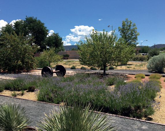
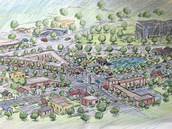
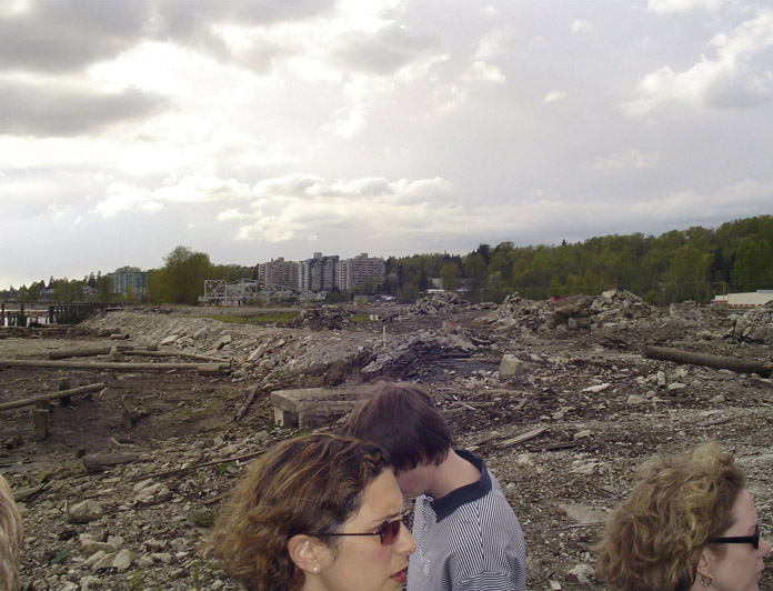
5.1 Santa Fe Railyard Regeneration
SANTA FE, NEW MEXICO, US
DATE FEBRUARY 1997 CLIENT SECTOR PUBLIC/THIRD SITE URBAN SCALE NEIGHBOURHOOD VISION URBAN DESIGN GREEN DESIGN GOVERNANCE
What to do with a large, valuable railyard that becomes available in the heart of the historic, thriving state capital of New Mexico – who decides?
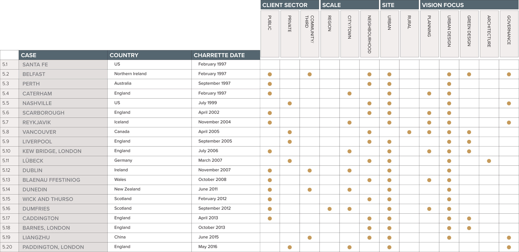
Figure 5.1.1:
Santa Fe Railyard in 1913
Santa Fe, founded by the colonial Spanish in 1610, is the oldest state capital in the US. The indigenous Pueblo people had previously inhabited the land, living in small village settlements over thousands of years. The ‘modern’ city, set at the foot of the Sangre de Cristo Mountains on the edge of the Rockies, has an altitude of more than 2,100 m (7,000 ft) and a cooler climate than the surrounding lower-lying desert. It is a fashionable and highly liveable city,
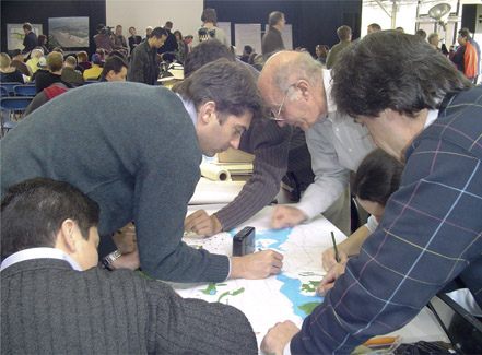
characterised by attractive adobe buildings in the historic downtown. It has a burgeoning arts and culture scene, which makes it a popular place for both visitors and residents. In the late nineteenth century, the Santa Fe Railyard was built on agricultural land irrigated by the Acequia Madre (‘mother ditch’). In 1880 the first train arrived at Santa Fe station, and for over 100 years the yard was a vibrant commercial and tourist hub, a focal point for the town. Almost overnight, however, the opening of the interstate highway made the railyard practically obsolete. Depending on the time of year it was either a mud pit or a dustbowl. The 1980s was a time of significant growth for Santa Fe, and the railway land, being close to the city centre, became very valuable. Inevitably the Atchison, Topeka and Santa Fe Rail Company decided to develop the site. Discussions between the city government and the rail company led to the creation of a masterplan, drawn up in Boston, which proposed tearing up the rail tracks, demolishing the buildings and constructing one and a half million square feet of real estate. Local architect Suby Bowden recalls that the plan was first seen at a council design review. The railway put up a for sale sign, and there was ‘uproar in the community, who saw it as their land’. Steve Robinson, President of the Santa Fe Railyard Community Corporation, agrees: ‘There was a strong sense of sadness – is this is what our heritage has come to – another faux-adobe shopping mall and a hotel?’ Eventually there was so much opposition that the masterplan was abandoned. This gave Suby the opportunity to go to the city council and suggest an alternative, more culturally sensitive approach. At that time the town plaza was being taken over by tourists, and the community needed their own space. A concept emerged in which the plaza would be the ‘living room’ for guests, and the railyard would become a focus for families and local people, with a park and weekly community activities. The next bold step was for the Trust for Public Land to acquire the land and hold on to it until they were sure that a park could actually be built. The city eventually bought the property from the Trust in 1995 and then began the process of its conversion into a public, mixed-use development. Having discarded the masterplan proposal, discussions took place locally about how to set up a community-based planning process, and Gayla Bechtol, from the local AIA chapter, suggested an R/UDAT. The concept that citizens would be consulted was unprecedented in Santa Fe, which had a ‘patron’ system going back 400 years. Expertise and free advice is a positive element of R/UDATs, but some local people were concerned that if experts came in to design the railyard, it would discourage participation by the community. It was therefore decided to run ten or twelve months of community-based planning, followed by the R/UDAT. Weekly public meetings took place over six months in 1996, to which anyone could bring their ideas. It was a process of simply listening to the community and discussing what land uses people wanted in the railyard, and what the priorities were. During this time, an R/UDAT steering group was set up to organise the charrette, with a wide range of members including the local AIA chapter, the City Planning Department, the Santa Fe Land Use Resource Center, the Trust for Public Land and the Metropolitan Redevelopment Commission. Suby recollects that ‘there were lots of women in top positions – it was a female-led process which believed you could collaborate’. The charrette was held over three weekends in February 1997. The first weekend focused on a design workshop facilitated by local
designers. One hundred and twenty citizens signed up for the whole weekend. This was followed by a citizen vote to determine land uses, which fed into the R/UDAT on the second weekend.
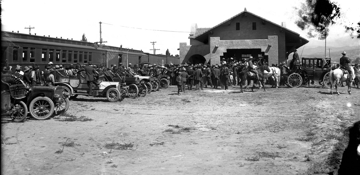
Figure 5.1.2:
R/UDAT Community Report
The R/UDAT was an intense and creative ‘window’ within a long, drawn-out planning process. The team, led by Charles M Davis, FAIA, included ten volunteer advisors from outside Santa Fe. Members of the team went on town and site tours and did many interviews. They then focused on creating a community plan, which had sections on governance, implementation, planning and transportation, as well as finance. The plan enabled people to visualise what the area might be like in the future, and it also gave the city council information about financial commitments. On the fourth night of the R/UDAT the local newspaper published the results in a special edition, which was distributed to the whole town. During the third weekend, the town’s citizens came together to discuss principles from the R/UDAT proposals and to ratify the plan. By that time many of the same people were attending all the meetings – so, with the benefit of the widespread distribution of the newspaper, a telephone survey was conducted. This revealed 75 per cent support for the proposals among the wider community. Subsequently, the councillors unanimously adopted the plan. Seven thousand people (over 10 per cent of the population) actively participated in a year of public participation through surveys, questionnaires and meetings.
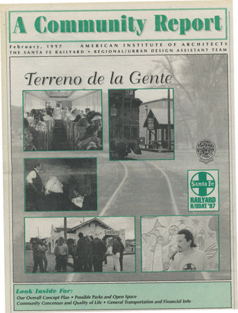
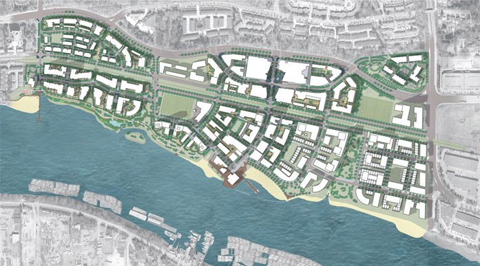
Figure 5.1.3:
Charrette masterplan
The masterplan and design code for the railyard were completed in 2001. ‘Meanwhile uses’ included outdoor activities, such as movies in the park and a farmers’ market. The city council originally offered to manage the park, but the community eventually took it over on a ninety-year lease. An international competition was held for the park and piazza, which was won by a landscape and urban design team headed by Ken Smith, Frederic Schwartz and Mary Miss. The design concepts focused on the
railway aesthetic, indigenous planting and respect for the Acequia Madre, which runs through the site.
Figure 5.1.4:
Santa Fe Railyard Park
The pace of building and refurbishment was slow, but finally in 2008 came the grand opening of the 4-hectare (10-acre) park and piazza. Industrial buildings had been restored for local business use, and new buildings were in operation. A commuter train service was established, and 10,000 people turned out to celebrate the arrival of the first train from Albuquerque. The public involvement process still continues through the management of the award-winning park, which is run according to four values: time, culture, land and oral history. In 2017 an impressive ninety-six public events were held in the park. The Santa Fe Railyard Community Corporation, created out of the R/UDAT process, now offers low rates and rents for businesses, and is developing low-cost housing to the west end of the site.
Figure 5.1.5:
Santa Fe farmers’ market
The regular Saturday farmers’ market is thronged with locals and visitors, and traders are delighted with the facilities laid on for them. For one shopper, the Santa Fe Railyard is now ‘the new downtown – it’s where you come to socialise … you can purchase something from a vendor … next thing you know you’ve been talking for twenty minutes’. Those fighting for their land came from a largely Hispanic background. The farmers were the connection between the land and its agricultural past, and the city’s roots lie in an oral rather than a written tradition. As Suby Bowden says, ‘Santa Fe has a long memory. Perhaps, as a consequence, it moves slowly and is OK with that’. Gayla Bechtol concludes: ‘I am most proud of the democracy that happened – helping people have a voice that otherwise wouldn’t have a voice in the process; that was for me the most gratifying – it was just cool.’Foresight
Vision
Hindsight

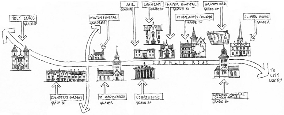
5.2 A First Step for the Crumlin Road
BELFAST, NORTHERN IRELAND
DATE FEBRUARY 1997 CLIENT SECTOR PUBLIC SITE URBAN SCALE NEIGHBOURHOOD VISION FOCUS URBAN DESIGN
A community planning process was used to take a tentative first step to create common ground between two communities in conflict, by agreeing acceptable uses along the high road they share.
Figure 5.2.1:
British Army mobile patrol along the Crumlin Road during the Troubles, 1971
Crumlin Road is an interface between the Protestant and Catholic communities of North Belfast. For thirty years it was synonymous with the Troubles, featuring regularly on news bulletins around the world reporting a seemingly endless series of attacks and murders. Even after the Good Friday Agreement of 1998, the Crumlin Road was in the headlines again in August 2000 when two loyalists associated with Ulster Defence Association brigadier Johnny Adair were shot and killed while sitting in their jeep. Crumlin Road is one of Belfast’s key arterial routes, linking the city to the Antrim Hills and beyond. Historically, the route connected some of the city’s principal linen mills to the city centre and the docks, and thousands of jobs in manufacturing and shipbuilding sustained the area’s economy. The road is also known for being the location of many significant buildings, such as the Mater Hospital, Crumlin Road Gaol and Crumlin Road Courthouse. As well as churches and community buildings, there are mills, shops and homes along the road. By 1996 the Crumlin Road had seen thirty years of decline and neglect due to the Troubles, the waning of Belfast’s economy, especially in shipbuilding, and the blight of a planned but unrealised road widening scheme. As well as being the site of some of the city’s worst dereliction, the Crumlin Road area was also one of the most deprived in the city. Housing and territory have long been key issues in North Belfast. The Protestant areas have been depopulating while the Catholic
population is growing and requires more space for housing, but the former community would not concede to the latter.
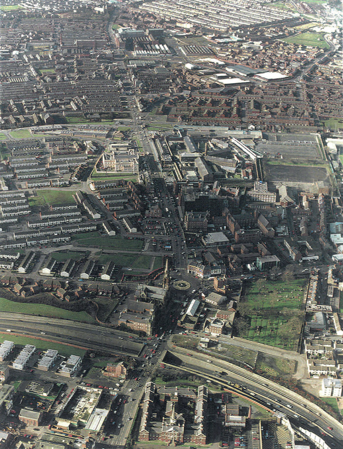
Figure 5.2.2:
Aerial photo along the Crumlin Road looking west to the Antrim Hills
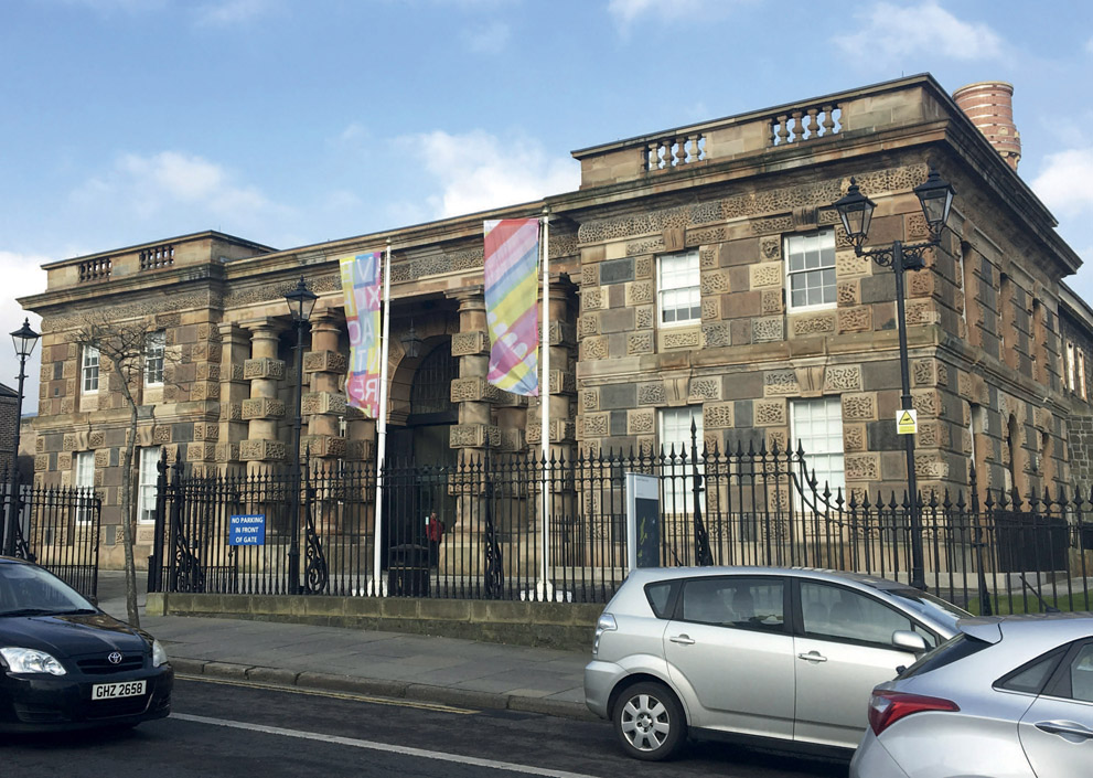
Making Belfast Work (MBW) was launched in 1988 by the Northern Ireland Department of the Environment, to strengthen and target more effectively the efforts being made by the community, the private sector and the government to address the economic, educational, social, health and environmental problems facing local people. In the mid-1990s MBW decided to focus on the regeneration of Belfast’s arterial routes. The intention was to bring marginalised communities into engagement with public authorities by building on a sense of optimism, encouraged by a new era of ceasefire. In September 1996 John Thompson & Partners (JTP) was appointed to undertake a community planning process to develop a consensus vision for the future of the Crumlin Road. At the time it was seen as a dangerous road, with highly demarcated territory and with no sense of free movement. By bringing the two communities together and focusing on a road they both used, MBW hoped that some compromise and agreement might emerge. A key objective was to find future uses for the gaol and courthouse, both designed by architect Sir Charles Lanyon, and built in the mid-nineteenth century. Since the declaration of a ceasefire in 1995, these listed buildings stood vandalised and unused, facing each other across the Crumlin Road. MBW was seeking new uses for them both but needed the permission of the community. The initial aim was to hold a publicly advertised ‘community conference’, with the potential to produce a ‘community plan’. However, following preparatory work in Stage One, community leaders believed this proposal to be too prescriptive and potentially divisive.
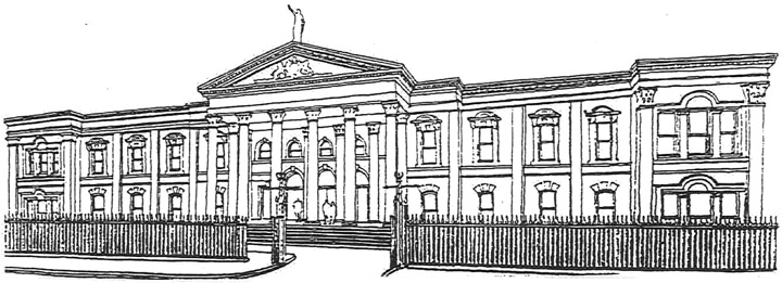
Figure 5.2.3:
Crumlin Road Courthouse
Figure 5.2.3A:
Listed buildings along the Crumlin Road
A steering committee was formed to oversee the preparation of the event, under the chairmanship of Jonathan Davis, then a director at JTP. The practice was viewed as a trusted and neutral party, and it was important not to force the timetable. A critical role of the steering committee was for the representatives of both the nationalist and loyalist communities to meet and broker a mutually acceptable venue, agenda and format for the event. Intense discussions ensued during which the process was debated and sometimes put in doubt. An agreed position was eventually worked out, which provided clear definitions of what the process sought to achieve, and what it did not. To do so, two lists were created as follows. What the process IS:
What the process ISN’T:
The event was redefined as an invitation-only ‘Ideas Weekend’ with the output to be a ‘flexible framework’ rather than a masterplan, which would form the basis for further discussions. As the agreed title of JTP’s subsequent report stated, this was to be ‘A First Step for the Crumlin Road’. The Ideas Weekend took place over five days between 20 and 24 February 1997 at the Spires Conference Centre in central Belfast. On Day one, following a project briefing, the facilitation team walked the full length of the Crumlin Road from west to east – a walkabout that was pre-notified to the communities to ensure safe passage. Over 100 people attended the event, and participants took part in ‘future workshops’, which discussed the multifaceted problems of the Crumlin Road and gave participants the opportunity to consider ideas for the area, how change might be brought about, and by whom. During design table sessions the future of the Crumlin Road’s public buildings, the relationship between the various residential communities and improvements for the overall quality of the environment were explored. A ‘way forward’ workshop focused attention on viable next steps. Following the two public days, the JTP team drew together conclusions and recommendations to provide a flexible framework for a possible way forward. The results were presented back to the weekend participants in a slideshow. Four potential project clusters were identified, which separately or together could have the potential to contribute to the regeneration of the area. In line with the steering committee’s objectives, it was stressed that these were examples of how regeneration might be achieved, and were a first step, not a final outcome. Considering the Ideas Weekend process took place over a year before the Good Friday Agreement of 10 April 1998, it was a significant achievement that the event took place at all. It reflected the efforts being made by many local people as part of the peace process of the mid-1990s. The event seemed to create a shift of imagination among participants, enabling a fragmented and depressing landscape to be seen as a cluster of opportunities that had the potential to be exploited for the benefit of all.
Figure 5.2.4:
Team walkabout on day one of the ideas weekend
Looking back at the process, Roisin McDonough, formerly of MBW, recalls: ‘I was very enthused about the process; it gave people a very keen sense of what things could look and feel like. Building relationships was a good thing, and the process encouraged a participative and deliberative form of democracy – it was intelligent.’ The use of co-design sketching techniques gave visual expression to participants’ ideas, and illustrated practical means by which these could be achieved. What the actual event did not do, as some had feared it might, was to derail the hard work and carefully developed relationships that had been established over the preceding months by the steering committee. During the twenty years since the event, resources have been directed into the area, which has resulted in new development and regeneration, better environment management and a brighter feel. But Crumlin Road still suffers from underinvestment, and the core issues have not gone away: there are very high levels of deprivation, and housing is still off the agenda. The 1997 collaborative event, with its strict ground rules, supported a growing awareness that interfaces could be created; an acceptance of the permanent physical divide between two communities. Communities would be separated in a way that would maintain the peace, as long as the interfaces were based on common interest and also respected the symbols and expression of community traditions. For example, both communities agreed that retail and community uses were acceptable for interface land, but not housing, as this would be construed as a territorial move. Consequently, in January 2016, after a decade of controversy about what should be done with the former Girdwood Barracks in North Belfast, a £11.7m community and leisure hub has opened, offering first-class leisure, community and education facilities. The Ideas Weekend also identified the potential for investment in the Crumlin Road Gaol as a way to develop leisure, cultural and heritage opportunities, which could have significant tourist appeal. In May 2002, the report of the North Belfast Community Action Project team discussed the need for a large-scale physical regeneration project in North Belfast, and highlighted the potential of the former Crumlin Road Gaol. By the end of 2012 the prison had reopened its doors as a tourist attraction, business space and conference centre. While much of the building is still to be fully let to businesses, the museum has been successful in attracting visitors, among them many former inmates from both sides of the political divide.
Figure 5.2.5:
Crumlin Road project clusters
Figure 5.2.6:
Crumlin Road Gaol today
Opposite the gaol, the courthouse, having suffered a number of fires in recent years and having failed to attract investment for adaptation and reuse has lain in a terrible state, a shadow of its former magnificence. But in March 2017 a Liverpool-based developer, Signature Living, bought the building with the intention of spending £25m to convert it into a 160-bedroom hotel, an initiative that has been supported by both sides of the community divide. The Ideas Weekend was held at a critical time in Belfast’s history, and it succeeded in bringing people together, building relationships and establishing agreed positions on many issues. A number of the identified physical projects have subsequently been delivered in a way that was jointly envisaged and agreed at the 1997 collaborative event. Memories are still raw for many who live in this divided community, but the potential exists for further development that builds on the growing success of Northern Ireland’s capital city. It is to be hoped that in the nottoo-distant future political progress in Belfast will enable a new round of investment to be directed to key opportunity sites along the Crumlin Road, to everyone’s benefit.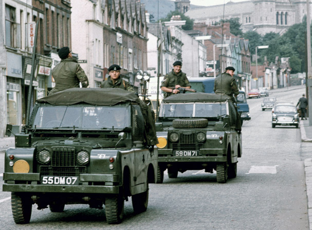
Foresight
Vision
Hindsight
5.3 Revitalising Midland – A Railway Town
PERTH, AUSTRALIA
DATE SEPTEMBER 1997 CLIENT SECTOR PUBLIC SITE URBAN SCALE TOWN VISION PLANNING URBAN DESIGN
Revisioning a former railway town has revived the spirit of the community, formed a new creative economic base and attracted investment to revitalise neighbourhoods and landscapes.
Figure 5.3.1:
Heritage image of Midland Railway Workshops
The township of Midland was established in 1891 at the junction of two main highways on the eastern fringes of Perth. Settlers had occupied the privately owned land since the 1830s, but the arrival of the Midland Railway Company in 1886 prompted its subdivision and sale. In 1902 the Western Australian Government Railway Workshops were relocated from Fremantle to Midland, and the rapidly expanding town was built on a history of heavy engineering, with a fine tradition of craftsmanship and innovation – skills that were passed from generation to generation. The Railway Workshops were vital to the development and maintenance of the Western Australian rail system, and a crucial training ground for the skilled workforce of some 4,000 people. A new rail station and shopping centre were built in the early 1970s, and the town’s fortunes looked assured. However, the closure of the Railway Workshops in 1994 had an immediate and devastating impact on Midland’s local economy and its multicultural community, including European migrant workers. It was not just the loss of their livelihoods, but also their traditions, camaraderie and pride in their work. Despite the best efforts of the authorities, including locating government and shire offices in the town centre, Midland fell into sharp decline and the community’s morale suffered. It was agreed by the City of Swan and the Western Australia Ministry of Planning that a community plan was needed to address the complex and interrelated challenges and opportunities. Ecologically Sustainable
Design (ESD), led by Chip Kaufman and Wendy Morris, was appointed to run a charrette process and develop integrated proposals, which could be implemented with the backing and involvement of the community.
Figure 5.3.2:
Midland Revitalisation Charrette
The ‘Midland Revitalisation Charrette’ was held in 1997 with the support of a wide range of local bodies, to develop a strategy for this declining sub-regional centre and bring together a diverse group of stakeholders to craft a shared vision for the future of the town. The charrette process ran for five days between 11 and 15 September 1997 at three locations in Midland. At each venue hundreds of local residents worked with the ESD team to consider the range of issues ‘all at once’. During the first evening meeting, the mechanics of the charrette process were outlined and the local community had an opportunity to voice their concerns. Over the next days the multidisciplinary team collaborated intensively with local residents, including young people, businesses, landowners and government agencies, to explore and indicatively design opportunities and solutions.
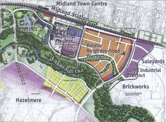
Figure 5.3.3:
Plan of Railway Workshops redevelopment area
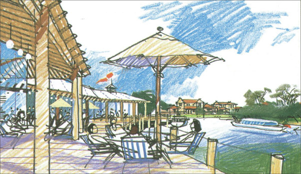
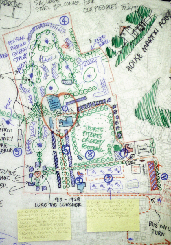
On the concluding evening Chip Kaufman presented the illustrated vision for Midland’s revitalisation. Design ideas and an economic strategy were presented for the whole of Midland, with the key focus on the heart of the town. In addition, a range of proposals were presented for transport improvements in and around the town and the rehabilitation of the Helena River and Blackadder Creek. A key theme running through the presentation was an appreciation of the many assets of the town, and how they could be brought to the fore using the concept of ‘unleashing the giant’. From those few concentrated days of workshops and brainstorming emerged what became the blueprint for the transformation that followed. The charrette identified the growth areas of Swan View, West Stratton, Swan Park and Midland TAFE (Technical and Further Education) as places that had the potential to be strengthened with infill development, improved local centres, better linkages, and safer, more attractive streets, parks and environmental areas. Key proposals for the heart of the redevelopment area included a 1-hectare (2.5-acre) oval of parkland, to be surrounded by 130 two-storey terraced houses, each with its own private front and rear gardens, and within easy walking distance of the town centre.
Figure 5.3.4:
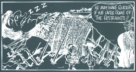
‘Unleashing the giant’ cartoon
Figure 5.3.5:
Sketch of ferry landing and marina at Woodbridge Landing
The charrette process enabled positive engagement with Aboriginal people who used to gather in a green space called Tuohy Gardens. This triangular street block with its confusing, uninviting pedestrian routes and hidden corners had become an ongoing problem area attracting antisocial behaviour. The charrette worked directly with the local Aboriginal community and proposed to solve all these problems by creating two new streets, redeveloping Tuohy Gardens as two-storey terraced housing, and by identifying a more suitable location nearby for Aboriginal gatherings and a cultural centre. Following the charrette, the Shire President Councillor Charlie Gregorini was delighted that so many people embraced the potential for growth and development. He acknowledged that the City of Swan had set a new standard for how local government could work with its community in planning future growth in a sustainable manner. Local resident Brian Hunt recalls: ‘Midland had been languishing for some time, and people had come together at various times before to try to decide what to do and they produced nothing. The charrette was really helpful in stimulating a positive attitude in the community – they had skilled people that could sketch, draw and analyse but didn’t preach.’ Virtually all community groups supported the proposed charrette outcomes, including, most importantly, the Midland District’s Chamber of Commerce and Industry. A steering committee was formed, with representation from the community and business groups and the council, which led to the state government establishing the Midland Redevelopment Authority (MRA) in 2000. This new agency was allocated land in the town centre, and the nearby 70-hectare (173-acre) Railway Workshops site, as the first stage of the redevelopment area. Building on community ownership of the vision, the MRA has demonstrated an unwavering commitment to ensuring that the community continues to share and shape the charrette’s dream and passion. Local communities and interest groups have been actively engaged in the project through further visioning exercises, forums, face-to-face liaison, local media, newsletters and reference groups. In particular, ESD were appointed to undertake another charrette in 2007 to review the process and outcomes and refresh the vision. Kieran Kinsella, CEO of the MRA, explains: ‘I came to deliver the charrette outcomes, which had really strong community support. We need to keep true to the issues that came out and we keep refreshing our masterplan every four to five years – the people of the town continue to advocate for the things still to be done.’ New life has been breathed into cultural landmarks, such as the site of the Midland Railway Workshops, which is central to the area’s sense of place. A new urban village has been created in the workshops precinct, with the retention and reuse of some of the original workshop buildings, and a mix of new residential, commercial, health, education and creative industry uses. Located west of the site, Woodbridge Lakes has been developed as a new environmentally friendly, medium-density neighbourhood with attractive public spaces and parklands. There are
committed affordable housing options to support a diverse population. Apartments and other higher-density dwellings are interspersed among parks, shops, cafes and transportation to provide an inner-city lifestyle. More than 150,000 square metres of new commercial and retail floor space has been created in the Clayton Street shopping hub, Midland Central.
Figure 5.3.6:
Midland Workshops Heritage Open Day
The Midland Workshops Heritage Open Day, hosted by the Metropolitan Redevelopment Authority, was held on Sunday 8 September 2014 and gave local residents, former workers and the wider Perth community an opportunity to look inside the iconic buildings and celebrate this important heritage precinct. Perhaps the greatest achievement of the MRA, and the principal reason for its success, has been the continuation of partnerships established at the time of the first charrette, which have been nurtured and maintained since by the various stakeholder groups. The organisations that helped formulate the concept plan for a revitalised Midland have remained active and enthusiastic participants in the process – not always in total agreement, but committed to realising a joint vision of a vibrant and exciting town. Midland is now brimming with confidence as local investors, developers, businesses and residents commit to the continuing journey ahead, and have become a formidable army of ambassadors for the town.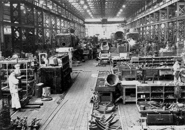
Foresight
Vision
Hindsight
5.4 Regeneration of a Historic Military Barracks
CATERHAM, SURREY, ENGLAND
DATE FEBRUARY 1997 CLIENT SECTOR PRIVATE SITE URBAN SCALE NEIGHBOURHOOD VISION URBAN DESIGN GOVERNANCE
Collaborative masterplanning transformed a former army barracks into a popular and award-winning mixed-use village community.
Figure 5.4.1:
Guards at Caterham
The Guards’ Depot in Caterham, known as Caterham Barracks, was established in 1877 as the basic training establishment for the five regiments of Foot Guards, part of an elite personal bodyguard to the reigning monarch. Enclosed by a perimeter wall, the barracks included a Grade II listed chapel, designed by William Butterfield in 1885. In 1960 the Guards’ Depot transferred to Pirbright, and the barracks were used to accommodate various regiments. Many Guardsmen who had trained at the depot settled in Caterham after completing their service, and the local community was able to use the barracks facilities for sporting events, including boxing tournaments, and cricket and football matches. Sadly, this changed when security was tightened in August 1975, after an IRA bomb targeting soldiers exploded in a local pub. The barracks’ closure in 1995 left a void in the community, and had a significant impact on the social and economic life of the town. A local authority community consultation process in 1997 resulted in a planning brief with minimal built development (sixteen new houses plus the barrack blocks converted to residential) and unrealistic expectations regarding community amenities. Although the brief was considered unviable by many developers, the site was bought by locally based Linden Homes. Linden recognised the local and historic importance of the barracks, and they were committed to delivering a high-quality neighbourhood. They also felt it was important to enable local residents and others to have a real input into the evolution of proposals, and that additional development would be acceptable if significant community benefits were delivered, thereby creating a more dynamic and sustainable community. Linden Homes appointed John Thompson & Partners (JTP) to create a masterplan for the site using a participatory process, including a
‘Community Planning Weekend’. This marked the first time that a large-scale collaborative planning process had been promoted in the UK by a private developer.
Figure 5.4.2:
Drawing from one of the hands-on planning groups
The Caterham Barracks Community Planning Weekend took place in the NAAFI building between 27 February and 3 March 1998, and was attended by more than 1,000 people. The event was structured around a combination of topic-based workshops, together with a large number of hands-on planning sessions, through which participants could discuss and actively contribute their design ideas. Teenagers from several local schools were involved, and local people could tour the barracks in a bus. Over the course of the weekend a consensus emerged in favour of creating a balanced village community, including more than 360 homes (around 300 new-build) and a mix of uses set in a high-quality environment that respected the history of the site. New homes were laid out around the cricket green and on traditional street patterns. There were community facilities of a high standard, and green spaces managed by a new Community Trust. Participants identified a number of possible community uses for existing buildings retained as part of the new neighbourhood, to be paid for by the increase in the number of homes provided on site. Uses for the buildings have, by and large, stood the test of time. Local resident Marilyn Payne led the call for more facilities for young people, and within a few months ‘Skaterham’, a youth project providing skateboard, inline and BMX facilities, was set up in the former gymnasium. In March 2002 it transferred from the gymnasium to the listed chapel, and now has thousands of members.
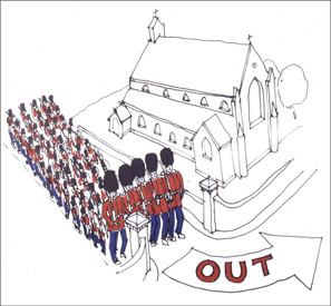
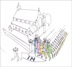
Figures 5.4.3 & 5.4.3A:
Guards marching out – community ‘guardians’ marching in cartoon
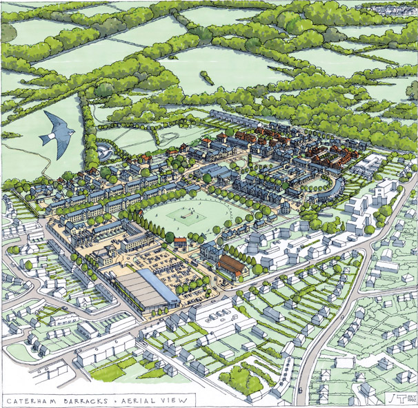
Figure 5.4.4:
Vision for Caterham Barracks – aerial drawing
The Community Planning Weekend marked the beginning of an ongoing process of collaboration between the community, the developers and the local authority, with the aim of creating a responsive new neighbourhood with a strong sense of place. A steering group was established to provide a forum for local residents, councillors and special interest groups. A number of specialist sub-groups met on over fifty occasions, involving over 100 local people. Ivan Ball, Linden’s Project Director for redevelopment of Caterham Barracks, found himself spending more and more time working with the community. He subsequently moved into the village and became known as ‘Mr Caterham’. In due course, a series of recommendations were presented to Tandridge District Council with full community backing. The council changed its policy for the site and granted outline planning approval in June 1999, with the proposals delivered through a six-phase programme that was completed in 2008. Governance of the new village at Caterham came about through the foundation of a Community Development Trust. This was the direct result of the Community Planning Weekend, during which local people expressed a desire for ongoing involvement in the creation and running of their community. The village at Caterham was one of the first places to integrate private and affordable housing. The design of the affordable housing was indistinguishable from the private accommodation for sale, thereby achieving a genuine integration of tenure. The Village has become known as a very healthy place to live, due to the provision of walking and cycle routes, and the access to open space. The ‘Village Flyer’ bus service began in September 2000, when the first residents moved in, to provide a transport link from the Village to Caterham railway station. Initially subsidised by Linden Homes, it is now funded through the residents’ service charge.
Figure 5.4.5:
The Arc, Caterham
Figure 5.4.6:
The Village at Caterham – village green
The community planning process resulted in a highly viable development: over 360 new homes and millions of pounds’ worth of community projects, including a nursery, a health and fitness centre, a swimming pool, a cricket pavilion, sports pitches, exhibition and rehearsal space, and an indoor skate park. The collaborative process and the resultant mixed-use development and community outcomes were researched and described in the publication ‘Social Sustainability’, published by JTP in 2013. The success of the Village at Caterham has been recognised through numerous national and international awards, including the RTPI National Awards for Planning Achievement 2000 ‘Award for Planning for the Whole Community’. More importantly, it is the views of the community that have defined the development. An early resident of the converted barrack blocks emphasises the excitement of community collaboration: ‘When you’re in on the beginning of things – which is what the whole thing here was about – there is that sense of buzz and excitement. What’s it going to turn out like? How much control will you have over it? Can you actually make it how you want it to be?’ And Ivan Ball concludes: ‘It’s just a fantastic scheme – you’ve got nice trees, nice old buildings, and it’s a big enough site that we’ve been able to put in all the new facilities. I know I’m terribly biased, but if you’re looking for a new home, this is as good as it gets.’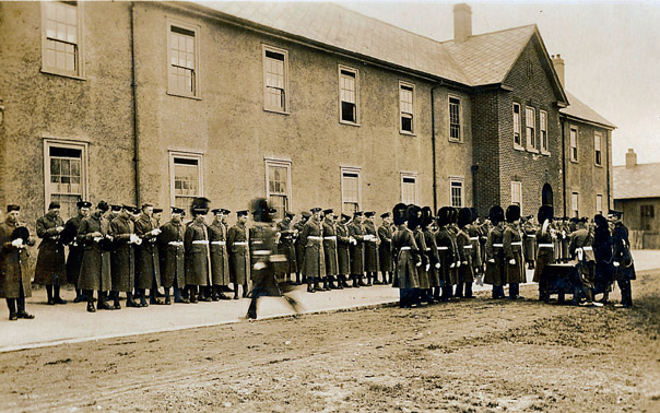
Foresight
Vision
Hindsight
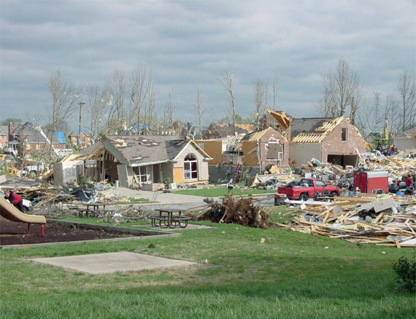
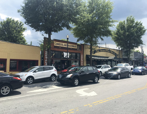
5.5 East Nashville Post-Tornado R/UDAT
NASHVILLE, TENNESSEE, US
DATE JULY 1999 CLIENT SECTOR PUBLIC SITE URBAN SCALE NEIGHBOURHOOD VISION PLANNING URBAN DESIGN
A consensus vision helped rebuild and revitalise a forgotten suburb, devastated by tornadoes in the 1930s and 1990s.
Figure 5.5.1:
The destructive impact of the tornado in East Nashville
For many years East Nashville was a forgotten part of the city, located on ‘the wrong side of the river’. This residential quarter had grown up in the early part of the twentieth century as a traditional, walkable neighbourhood of homes and community amenities, with local services at key junctions. Although it was separated from downtown Nashville by industrial land and the Cumberland River, the extensive network of trolley lines gave access to employment and services. Then a huge fire in 1916 and a tornado in 1933 damaged the area’s vitality, and the building of the interstate highway encouraged the movement of the middle classes to the outer suburbs. From then on and for decades, East Nashville was largely ignored. On 16 April 1998 another devastating tornado passed through Nashville’s town centre and inner-city neighbourhoods, and East Nashville was worst hit. Local estate agent Cindy Evans describes the impact: ‘The hurricane went downtown, broke office windows and then came across the river, and the restaurant where my friend worked had its roof blown off – she was blown from one room to another. Throughout the neighbourhood fallen trees were everywhere – you couldn’t see the street. It’s like we were hit by a bomb.’ Most tellingly, Cindy concluded: ‘It wasn’t until late at night that the news said East Nashville had been hit – that’s how inconsequential we were.’ The initial response to the tornado was impressive, with the East Nashville community and public sector pulling
together to clear streets, provide emergency help and restore services. Three months later, in July, Mayor Bredesen set up the Tornado Recovery Board, which decided to apply to the AIA to bring in an R/UDAT to create a plan for regeneration, simply because of its emphasis on community participation. It was felt that the tornado could be a catalyst to take a downtrodden neighbourhood in decline and help make it much better than it had been before. Carol Pedigo, one of the key forces behind bringing the R/UDAT to East Nashville, describes charrettes as: ‘The best-kept secret – you’re always better off with more ideas than just your own.’
Figure 5.5.2:
Open-mic day at the R/UDAT
In 1998 Hunter Gee was setting out on his career as an architect, and was very keen on community involvement. He was asked to chair the local steering committee, which included representatives of businesses, neighbourhood associations, public sector officials and councillors. The steering group raised the $50,000 to fund the R/UDAT and, as Hunter explains, ‘one of the keys to success was the work we did over months to get the entire community represented – we spent many months building buy-in’. The multidisciplinary R/UDAT team was led by Bill Gilchrist and comprised nationally recognised land-use professionals from across the region, with backgrounds in landscape, housing, transport, venues and stadiums, community networking, urban design and management information systems. The R/UDAT was held over four and a half days in July 1999. It started with a team tour of the area, followed by meetings with politicians and key stakeholders. Day two was an open-mic day at the Martha O’Bryan Center, where the team listened to local people who lined up to explain their likes, dislikes, needs and visions. The location of the meetings was critical, to encourage a wide cross-section of the community to attend, and the open-mic session was programmed ‘from 9am until the last person who has something to contribute’. Around 400 people were involved, and over 100 people spoke into the microphone. Key themes to emerge included the value of having a diverse community and the need to ensure that regeneration did not force people out of the area. As well as the need for reconstruction following the tornado, other concerns raised included social services, greenway development, parks and playgrounds and crime prevention. Participants stressed the need to attract people and better business to East Nashville, and residents said time and time again how they wanted the area to be restored to its original beauty and splendour. Following the open-mic session, the R/UDAT team worked intensively, day and night, right up to the public report back presentation on Monday 19 July. One thousand people turned out to hear the outcomes from the charrette, which were presented using an overhead projector and transparencies.
Figure 5.5.3:
Sketch of a revitalised ‘100% corner’ from the East Nashville R/UDAT
Figure 5.5.4:
Aerial sketch of Five Point, East Nashville
Three primary tasks were identified for the East Nashville community to undertake in order to enact the recommended changes. One was the need for community organisation. The second was a focus on developing public spaces and linkages. The third was the adoption of land-use policies that would enhance the unique character of this urban community. The recommendations focused on the two major strengths of East Nashville that should be nurtured and receive investment, namely the diversity of the community which lay at the heart of the area’s identity, and the essential quality and robustness of the urban fabric. The team identified the key importance of the commercial uses at road junctions within the neighbourhoods, and promoted these so-called ‘100% corners’. Hunter Gee recalls that the main recommendation was the creation of a community council to oversee implementation of the R/UDAT’s proposals. There was also a proposal to market the area and recognise that it had huge assets, such as the walkability of the neighbourhood. A logo was created and a body established called ‘Rediscover East’, which still exists today. Rebuilding didn’t happen overnight, of course: for ten years there were blue tarpaulins covering damaged buildings everywhere. One thing Hunter would change about the process, if he could, would be the availability of funding for public infrastructure improvements: ‘We could have found funding if we had staff – you need paid staff.’ A couple of years later, some R/UDAT team members returned to East Nashville and challenged the city to invest in more staff for Rediscover East. Hunter believes that the process of building the buy-in and holding the charrette set in motion a rising market that hasn’t stopped, even to this day. East Nashville is now listed as one of the hippest neighbourhoods, which brings with it its own ‘gentrification’ challenges, such as how to deliver affordable homes. In 2012, building on an idea first discussed and sketched at the R/UDAT in 1999, the Metropolitan Development and Housing Agency announced the redevelopment of Cayce Place for 32 hectares (80 acres) of public housing. This meant tripling the density to enable bringing in mixed uses, including health provision. Smith Gee studio held a charrette attended by over 100 local stakeholders and citizens, and the resulting plan will deliver more than 2,300 new homes, open spaces and 20,000 m2 (215,300 sq ft) of commercial and community uses. Despite the successes and more recent acclaim for East Nashville, it’s important to remember that the emotions and memories associated with the tornado’s devastation have not been entirely forgotten. Cindy recalls: ‘The tornado took down the huge sugar maples – when I drive home through these streets I can still remember how it used to be.’
Figure 5.5.5:
Rediscover East logo
Figure 5.5.6:
Revitalised and vibrant ‘100% corner’ in East Nashville
Foresight
Vision
Hindsight
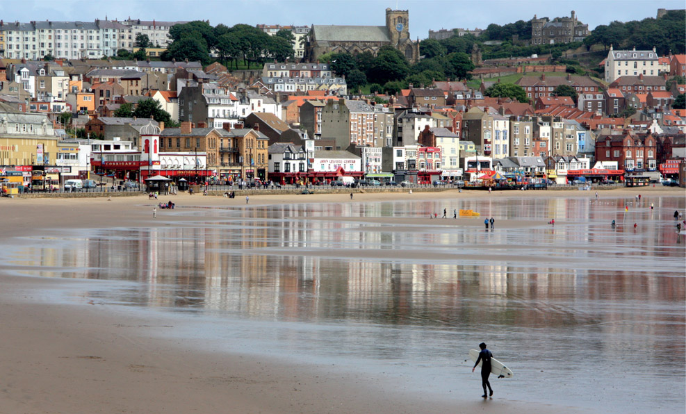
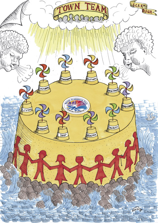
5.6 Town in Decline to most Enterprising Place
SCARBOROUGH, NORTH YORKSHIRE, ENGLAND
DATE APRIL 2002 CLIENT SECTOR PUBLIC SITE URBAN SCALE TOWN VISION PLANNING URBAN DESIGN GOVERNANCE
The community of an iconic but declining seaside resort were empowered to create and proactively deliver a vision for the cultural and economic renaissance of their town.
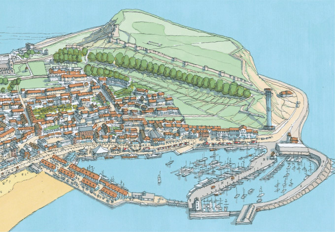
Figure 5.6.1:
View of South Bay, Scarborough, looking towards the castle
At Scarborough, North Yorkshire, springs were discovered in the early seventeenth century, bubbling from the base of South Cliff on to the seashore. This marked the beginning of England’s first seaside resort. Early visitors to the spa town were the aristocracy and landed gentry, who stayed for the summer season with their families and servants. The advent of the railways in the Victorian era led to the arrival of thousands
of day-trippers and holidaymakers, transforming the town’s local economy and leading to the construction of large hotels on the seafront and a wide range of leisure attractions. Scarborough’s expansion continued into the first part of the twentieth century, with municipal initiatives creating 142 hectares (350 acres) of public parkland. New housing estates were built on the outskirts of the town, and light industry arrived in the form of coach-building, printing, food-processing and engineering businesses. However, Scarborough’s fishing industry was in steady decline, and from the 1970s tourism also started to suffer, due to the growing popularity of package holidays to the Mediterranean. By the end of the twentieth century the town seemed unable to halt the decay and dereliction that was steadily eroding the assets of this once-splendid place. Scarborough’s geographical isolation, which had originally been part of its attraction, became a distinct threat. Its relatively poor road and rail links to York, the nearest city, meant that people quipped about it being ‘forty miles from England’. The town fell off the prestigious and lucrative political party conference circuit due to a lack of investment in hotel and conference facilities. By the turn of the millennium Scarborough had become a low-wage economy with a workforce ill-equipped to face the challenges of the twenty-first century. The empty holiday bed-and-breakfast accommodation was attracting hundreds of homeless people, some fresh out of prison, and pockets of poverty appeared, with one council ward being listed in the top 10 per cent most deprived in the country. At that time Scarborough was not looking to change – it was focused on being a seaside town, and nothing more. Business yields were poor in the hospitality sector, and discounting was seen as the only option to maintain a competitive edge. However, work led by Scarborough Council was having some positive effects, which were recognised by the Most Improved Resort Gold Award from Marketing in Tourism. European funding was also secured to help regenerate some of the town’s suburban housing estates. A major impetus came in the autumn of 2001 when Yorkshire Forward, then the Regional Development Agency for Yorkshire and Humberside, launched its Urban Renaissance programme, led by Alan Simpson. The programme, a response to Richard Rogers’s ‘Urban White Paper’ published the previous year, had the ambition of creating a ‘World Class Region’, and viewed environmental quality as a driver for social and economic regeneration. John Thompson & Partners (JTP) and West 8 from the Netherlands were appointed from the Yorkshire Forward consultant panel to create a vision for Scarborough, with an action plan for its delivery. The aim of the vision-building process was to work with the local community to explore every asset of the town and create a consensus as to how Scarborough could throw off its outdated image and move confidently into the future. Following an initial period of research and ‘community animation’, which involved talking to many residents and stakeholders, the process culminated in ‘Scarborough’s Renaissance Community Planning Weekend’. This five-day charrette was held at the Spa Conference Centre in April 2002, with over 1,000 people taking part in two days of topic workshops and hands-on planning sessions. The public event began with a welcome from Eileen Bosomworth, then leader of Scarborough Council, and an address by playwright Sir Alan Ayckbourn, long-term resident and director of the town’s well-known Stephen Joseph Theatre. His motivational speech highlighted the rare combination of assets, both environmental and community, that existed in Scarborough, and on which the renaissance of the
town could be built. Talented members of Rounders, the Stephen Joseph Youth Theatre, dramatised life in the town and the meaning of regeneration in a highly entertaining ten-minute performance.
Figure 5.6.2:
Stephen Joseph Theatre – Rounders’ dramatised interpretation of regeneration
Figure 5.6.3:
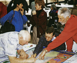
Participants at the Community Planning Weekend
Teenagers, youth workers and students from several schools participated in the charrette, an open and informal event that gave people the opportunity to take part in workshops on topics such as Arts, Culture and Entertainment, Housing and Young People. The final session on the Friday focused on hands-on planning, where ideas from the workshops were discussed in more
detail, around plans of the town, plotting opportunities and starting to produce ideas for positive change. One participant said that it was a liberating process compared with typical town meetings, as the event encouraged a much more pleasant and productive dialogue. The workshops continued on the Saturday morning, and in the afternoon participants divided into eight groups and went out into the streets to study particular parts of the town. Returning to the spa, the groups recorded their ideas on plans and presented them back to the whole assembly in a plenary session.
Figure 5.6.4:
The Ten Towns of Scarborough
One unexpected outcome was that local authority officers found themselves free to discuss ideas and were empowered to introduce concepts into the process (previously they had not felt able). Over the following three days, the twenty-seven-strong charrette team analysed and evaluated the outcomes from the two public days. The vision was presented to a large audience at the spa on the evening of Tuesday 30 April. A number of key themes emerged, which identified important areas of consensus. These were to promote the town’s strategic role in the region as a whole; to develop a quality public space strategy; to prioritise the development of flagship projects; to promote a cultural renaissance; to encourage economic development; to create strong, stable and healthy communities and to plan for growth. Throughout the vision-building process, it was acknowledged that Scarborough is a multifaceted town and should be recognised and supported as such. Its ‘ten towns in one’ character defined it as a cultural town, a festival town, a heritage town, a healthy town, a tourist town, a living town, a learning town, an investment town and a 365-day 360-degree town. The vision was neither a rigid plan nor a blueprint – it represented a new direction for the town and its people, and one that was based on shared and positive values and confirmed the need for change, for higher quality, for a new image and for a better environment. As a first step a new Town Team, in association with several Action Teams, was established. This Town Team was given the power, together with Yorkshire Forward and the borough council, to sign off Yorkshire Forward Renaissance funding coming into Scarborough.
Figure 5.6.5:
Aerial image of the vision for Scarborough Harbour
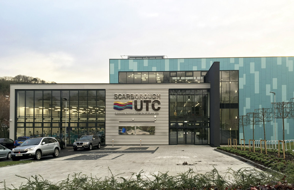
The Town Team drew up the ‘Scarborough Renaissance Charter’ in the months following the Community Planning Weekend. Town Team members were asked to help define the long-term strategy for Scarborough and clarify the objectives and action points that had been identified. They were asked to ‘leave politics at the door’. An early action, aimed at changing perceptions, was the grassing of St Nicholas Street in front of the Royal Hotel, and a free open-air showing of the movie Little Voice, which was made in Scarborough. A Renaissance Forum was established, meeting monthly with an attendance of between 100 and 150 people. Action Teams were formed, each focusing on a particular area of common interest and developing further key issues that had been identified at the Planning Weekend. A representative from each Action Team was nominated to join the Town Team, which thereby encompassed the interests of the Renaissance Forum as a whole. Fifteen years later, several of these groups continue to meet and discuss their areas of interest. The extensive ‘community animation’ was documented in ‘A Cultural Audit of Scarborough’, which unveiled the potential of the creative community to help drive change. Specific arts-related improvements have since been implemented, including regeneration of the Rotunda Museum, one of the first purpose-built museums in the world, the development of Woodend Creative Workspace with over fifty studio spaces, the restoration of the Scarborough Open Air Theatre, and ongoing arts and cultural festivals. Andrew Clay, director at Woodend, believes that ‘the Arts community feels secure and connected, whereas before people felt isolated – the strong legacy of the process is people being connected and feeling they can make things happen’. Over the years following the charrette, £25m of strategic investment influenced a private sector response of more than £300m investment in the town. This has resulted in the protection or creation of more than 1,000 jobs, an improvement in business relationships and the formation of new industries. An early focus was on the regeneration of the foreshore and harbour, described by Nick Taylor, Scarborough’s Renaissance Manager, as ‘the mantelpiece in the front room of the town’. Diversification of the town’s economy has resulted in a £24m investment in Scarborough’s business park, the construction of a new four-star hotel and an 8 per cent increase in profitability in the visitor economy. The success of Scarborough’s Renaissance has been recognised through a number of prestigious awards, all of which acknowledged the value of the participatory process: Enterprising Britain Awards First Prize (2008); European Enterprise Awards Grand Jury First Prize (2009); International Association for Public Participation’s (IAP2) Project of the Year (2009); Academy of Urbanism Great Town Award (2010). The council and the business community recently partnered to make a successful
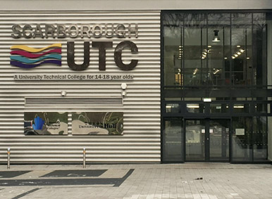
competitive bid to national government to fund a new University Technical College (UTC) in Scarborough.
Figure 5.6.6:
Scarborough University Technical College opened in 2016
The UTC opened in September 2016. It is providing skills training for national and local industry, including a new multimillion pound potash mine and the expansion of Government Communications Headquarters (GCHQ), which is bringing over 1,000 new jobs to the town. Both organisations have sponsored suites at the UTC, enabling students to be job-ready on completion of their education. David Kelly, Scarborough’s Head of Economic Development, believes ‘this would never have happened without the renaissance process fifteen years ago’.Foresight
Vision


Hindsight
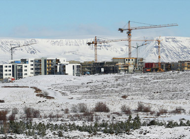
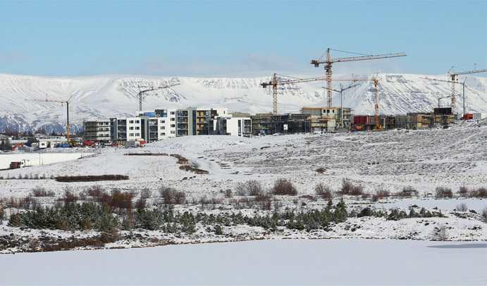
5.7 Urridaholt – Daring to be Different
REYKJAVIK, ICELAND
DATE NOVEMBER 2004 CLIENT SECTOR PRIVATE SITE RURAL SCALE NEIGHBOURHOOD VISION PLANNING GREEN DESIGN URBAN DESIGN
A new, walkable neighbourhood on the outskirts of Reykjavik was created, integrating mixed-use development with protected nature. This was the first international project to achieve final certification under the BREEAM Communities Standard 2012.
Iceland is a small island nation situated in the North Atlantic just below the Arctic Circle, with a temperate tundra climate warmed by the Gulf Stream. The country’s economy was severely affected by the global financial crisis in 2008, which caused a depression. The recovery of the economy has been aided by a surge in tourism, with visitors coming to enjoy the country’s unique culture and its volcanic and glacial landscape.
Figure 5.7.1:
View of Urridaholt and Urridavatn Lake
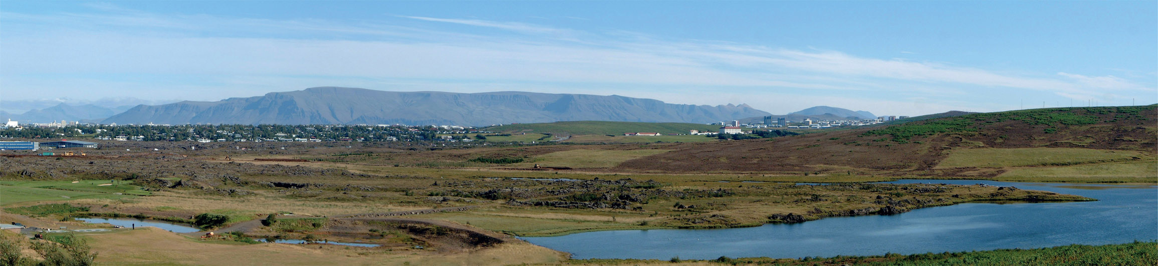
The vast majority of the country’s population of 340,000 live in Reykjavik, which
benefits from a ready supply of low-cost, renewable geothermal power. Iceland’s small population has resulted in cheap land and urban sprawl, with large, low-density residential suburbs creating an over-dependence on the car. Gardabær is a small suburban town on the outskirts of Reykjavik, which had been identified for expansion. The identified growth area included Urridaholt, a previously undeveloped hillside adjacent to the pristine Urridavatn Lake. The hill serves as a gateway from the city of Reykjavik to the natural landscape beyond. It rises around 50 m (160 ft) above a lava field, with spectacular views to the mountains, volcanoes and sea. In 2003 the developer of Urridaholt, Jon Palmi Gudmundsson, contacted Halldora Hreggvidsdottir from Alta Consulting, Iceland to ask Alta to do a Strategic Environmental Assessment (SEA). This was intended to evaluate the potential impact of a proposed residential and retail development at Urridaholt on the shallow Urridavatn Lake, and look at how any impacts could be mitigated. Based on the SEA, it was decided to go ahead with the urban expansion, and Alta was asked to project manage the development of a masterplan for Urridaholt and a nearby retail development. The year before, Halldora had worked with John Thompson & Partners (JTP) to run Iceland’s first ever Community Planning Weekend, and she suggested running the same type of charrette process to develop a consensus vision for the development of Urridaholt. An initial charrette was held with council politicians and officers, and included a site visit, briefing, dialogue workshops and hands-on planning design groups. It is typical for Icelandic suburban housing developments to be built out in standard
car-focused street layouts, with uniform low-density residential plots. Three days of collaborative working created a new high-level vision for a walkable, climatically responsive, mixed-use neighbourhood, with the lake and lava protected as much as possible.
Figure 5.7.2:
Sketch of Urridaholt
Following the charrette, ‘Seeing is Believing’ tours were arranged to mixed-use neighbourhoods in Sweden, Denmark, Germany and the UK, and this helped
convince the council to change the municipal plan to allow a mix of uses on the site.
Figure 5.7.3:
Aerial view of the vision for Urridaholt
Three months after the initial charrette, in spring 2005, the local community were invited to a Community Planning Weekend, held in a golf club overlooking the site. Participants were introduced to the proposed development concepts and were then invited to take part in workshops, walkabouts and hands-on planning sessions to consider challenges and opportunities for the site. The consensus that emerged through the process was the desire to create a highly sustainable community, with calmed streets and green links to the protected lake and the wider natural environment. Following the public workshops, the consultant team drew up a vision for the site, incorporating ideas from the Winter Cities movement, which was presented back to the community at Gardebær Music Hall. Gunnar Edmondson, current mayor of Gardebær, participated in the whole process: ‘It was very enjoyable to participate and good to see the ambitious approach being taken by the developers and the professionals from the beginning to ensure quality and good placemaking. It is a model for new developments that are now being planned in Gardebær.’ Based on the vision, a masterplan was developed that rejected suburban sprawl typologies in favour of a compact, diverse, mixed-use development. The masterplan focused on environmental and social sustainability, and was closely connected to the natural environment. It included 1,600 residential units, 90,000 m2 (970,000 sq ft) of office and retail space, an elementary school and kindergartens, and up to 65,000 m2 (700,00 sq ft) of space for civic use. Up to 9,000 people will be living and working there when it is fully occupied.
Figure 5.7.4:
Diagram of drainage concept for Urridaholt
Halldora believes that the decision to create a much more sustainable development would have been impossible without a charrette process. ‘Great benefits came from the charrettes – the whole council planning and environmental teams had worked together on a joint vision, and even though new ideas of change emerged, people understood and supported them.’ Participants pointed out the importance of protecting the lake and the cleanliness
of its water. This lead to the introduction of a sustainable urban drainage system (SUDS) in the neighbourhood, as traditional drainage solutions would have resulted in a loss of water catchment and the lake would have disappeared.
Figure 5.7.5:
Urridaholt under construction
This results in some very dominant landscape features, such as green wedges which carry the rainwater down the hill when needed, but also serve as green corridors through the neighbourhood, with walkable paths and vegetation to support natural fauna. This is the first time that SUDS has been implemented in a whole neighbourhood in Iceland, and the consultation assisted greatly. The masterplan was drawn up and an early development phase took place, which included IKEA, but the whole project came to a standstill due to the financial crash in 2008. The development team submitted Urridaholt for BREEAM Communities certification – a method for measuring and evidencing the sustainability of large-scale development plans. The Urridaholt project became the first international project to achieve a final certification under BREEAM Communities 2012, and the first masterplan in Iceland to receive BREEAM Communities certification. It is a 100-hectare (250-acre) development that has achieved an interim certification. The Local Plan for the north side (Phase 2) is the first of the phases in Urridaholt to achieve a final certification, and did so with a Very Good rating. After a five-year pause, development restarted in 2013, and Jon Palmi Gudmundsson recalls: ‘When we reviewed the plan five years after the project was halted, we saw that the emphasis we put on environmental aspects and timeless principles of urban quality had stood the test of time.’ Following the trauma of the financial crash, people in Iceland were looking for a more sustainable model for living.Foresight
Vision
Hindsight

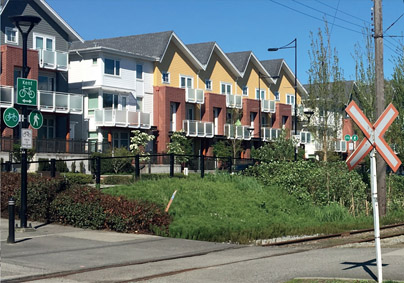
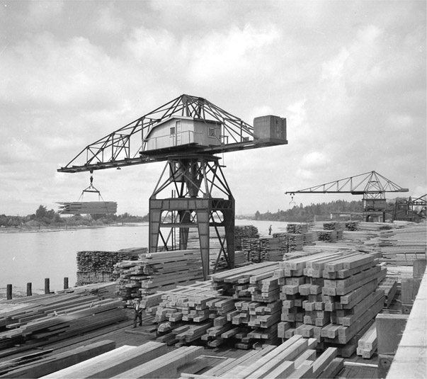
5.8 Former Mill to a Sustainable Neighbourhood
VANCOUVER, CANADA
DATE APRIL 2005 CLIENT SECTOR PRIVATE SITE URBAN SCALE NEIGHBOURHOOD VISION URBAN DESIGN GREEN DESIGN
A vision for a new sustainable neighbourhood, on the site of a former sawmill on the Fraser River, involved a vocal and networked community from Vancouver, where everyone’s favourite sport after hockey is town planning.
Figure 5.8.1:
Hammerhead crane at the Canadian White Pine Mill
The Fraser River was first navigated from its source to the Pacific Ocean in 1808, and over the next 100 years it grew in importance in the lives of the settlers from Great Britain who lived along its banks. Logs were floated down the Fraser to Vancouver, and in the early twentieth century new sawmills were built to process the timber on an industrial scale. In 1926 H. R. MacMillan founded the Canadian White Pine Mill, where massive hammerhead cranes hoisted timber to and from the river. In 1959 the White Pine Mill merged with the neighbouring Dominion Mill and, at its peak in the mid-1960s, the yard’s thousands of workers milled enough timber to build 21,000 homes a year. Then came a period of decline, before the mill finally closed in 2001, with most of the equipment and buildings shipped to New Zealand. In preparation for the site’s regeneration, members of the local community were involved, with the City of Vancouver, in creating the East Fraser Lands Policy Statement. The 53-hectare (130-acre) site was seen as the last neighbourhood-sized development opportunity in the city of Vancouver, and the Policy Statement envisioned a community of around 7,000 homes with a mix of facilities, parkland and a new town centre. The community found the early plans controversial. Concerns included traffic, schools and parks, and uncertainty about the funding of community benefits. Milt Bowling was one of several local community activists who had been working on a local park project. After hearing that Park Lane and Wesgroup were to be the developers, he was keen to meet them and find out how environmental issues were going to be addressed. After work had begun to decontaminate the site, the developers announced that they were planning to commission a charrette to be run by Florida-based New Urbanist practice DPZ in mid-April 2005. Milt recalls: ‘We had been working on the project for three or four years, and we’d never heard of a charrette before, but we thought, “Let’s do it!”’ The week-long charrette process took place in a 300-person capacity tent, erected on the site. The DPZ design team occupied one part of the tent; the remainder provided space for the public workshops. Charrette leader Andrés Duany introduced the process and explained the principles of
sustainable urbanism. He acknowledged the high quality of urban architecture in Central Vancouver, but said that the challenge was to take it to the next level in order to make the project ‘deeply, structurally environmental’.
Figure 5.8.2:
The site at the time of the charrette
The charrette began with a series of community lectures and workshops. These focused on different topics including transportation, environment, parks and recreation, land use and architecture. At times, discussion was heated, and Milt Bowling admitted they were a community who were used to making themselves heard: ‘We put Andrés on the hot seat a lot.’ Meanwhile, the design team worked away at a range of masterplan options, picking up on the discussions from the workshops and bringing in various genres and styles of urbanism. At various points the design team’s masterplans were reported back and discussed with the community.
Figure 5.8.3:
Charrette team working
Figure 5.8.4:
Sketch from the charrette
Figure 5.8.5:
Consented masterplan for River District
Matt Shillito, a planner with the City of Vancouver at the time, recalls: ‘Duany was very good at capturing attention and getting people in the room to consider trade-offs. He would close down topics we had discussed earlier in the week to ensure forward progress was maintained.’ From Day five the design work ramped up to the final presentation on Day seven. Everyone, including Andrés, was surprised that no clear masterplan had emerged, and so five options were presented. All had in common an urban street and block pattern with a high-density town centre and a quality green space network linking to and addressing the Fraser River. Reaction was guardedly positive after the feedback, and it was agreed that having creativity and input early in the process made a difference. The residents found it enjoyable, and one acknowledged that debate had been elevated ‘above the usual nuts and bolts that we talk about’. Following the charrette the design concepts was developed and taken through planning by Vancouver-based James Cheng Architects. Work on site started in 2010, including the construction of the River District Centre and Neighbourhood Restaurant, which was completed in 2011, as an early focus for the new community. At the time of writing, several residential phases to the west of the site are complete, with work on the town centre well under way to the east. The neighbourhoods are boldly high density, with residential buildings facing well-defined streets and public spaces. These have a timeless quality and create a high quality of place for the early residents to enjoy. Referring back to Duany’s challenge to create a ‘project that’s deeply, structurally environmental’, River District has won a range of local, national and international awards for its planning and development processes. Its rainwater management plan and green space strategy will ensure the purity of water running into the Fraser River and the creation of ecological habitats. River District Energy will provide space heating and hot water throughout the neighbourhood, with the capacity to use a variety of renewables and sustainable energy sources. The entire community is on its way to attaining LEED Gold and Built Green Gold status. Milt Bowling remembers that before the charrette took place there were people who were against anything and everything. However, as a representative of the community, he was able to encourage other people to speak calmly and make the most of the opportunity to be involved. Although the community didn’t get everything it had wanted – for example, rule changes subsequently led to a lower requirement for affordable housing – Milt was very positive about the process: ‘The charrette was awesome – you can get the community to agree a vision and I would highly recommend it to any community that wants to be involved.’
Figure 5.8.6:
Completed housing facing the railway
Foresight
Vision
Hindsight
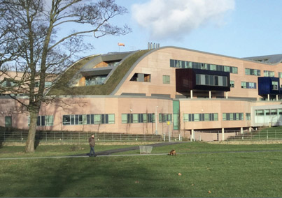
5.9 Alder Hey – The Hospital in a Park
LIVERPOOL, ENGLAND
DATE SEPTEMBER 2005 CLIENT SECTOR PUBLIC
SITE URBAN SCALE TOWN VISION PLANNING GREEN DESIGN ARCHITECTURE
Originally established during the First World War as a US army camp hospital, Alder Hey grew into one of the largest children’s hospitals in the Europe and a world leader in health care and research. After a century, it was time to modernise the facilities and build a new hospital. In October 2015, a radically new children’s hospital building was opened, and a new chapter began in Alder Hey’s history.
Figure 5.9.1:
The original Alder Hey Hospital
In the early 2000s Alder Hey consultant Dr Jane Ratcliffe was inspired by a vision of a ‘hospital in a park … I had this idea that it should be something that’s great fun for young people – a log cabin approach, at one with nature’. This developed into the idea of a hospital with views and access to the neighbouring Springfield Park environment, providing therapeutic benefits to patients and integrated with local neighbourhoods. At that time, however, Liverpool City Council was keen to consider other sites to aid regeneration elsewhere in the city. David Houghton was Alder Hey’s Estates Manager. Having heard Ben Bolgar from the Prince’s Foundation talk about collaborative planning at a conference, he asked Ben to formulate a process for Alder Hey. Ben felt that their typical Sunday to Friday ‘Enquiry by Design’ process was not appropriate for Alder Hey. So after some discussion a step-by-step process was agreed, and the new hospital design concepts emerged through a carefully sequenced charrette process involving professional stakeholders, patients and their parents, and the wider community. The first one-day mini-charrette involved six groups of nine people, including hospital and council representatives, to assess many site options around Liverpool. Most were quickly rejected; six remained. The groups undertook high-level holistic
analyses of each site, followed by a more themed assessment, including looking at transport and environmental issues. Having visited and evaluated each site, Alder Hey emerged as the groups’ clear preferred option.
Figure 5.9.2:
Charrette workshop
The next stage was a three-day public charrette to agree wider parameters of the Alder Hey design, such as the precise hospital site and to solve transport problems. Initially, this generated a fraught discussion between the hospital and local residents, which focused on parking in residential streets and the loss of Springfield Park, but the charrette process enabled the issues and ideas to be worked through, discussed and sketched. The design team pointed out that, although it was valued, the existing park was not particularly attractive or well used, and that there was an opportunity to provide a better-designed and equipped park through the development process. By building the new hospital in the southeast corner of Springfield Park, and incorporating a multi-storey car park, the local parking situation could be improved. A new park would be built on the old hospital site in a later phase. Phasing became a crucial factor in the collaborative process. This enabled the community to understand how construction and parking would be managed and how the redevelopment of the park would be planned. Neil Coventry, Planning Officer from Liverpool City Council, felt that hand sketching at the charrette was very effective: ‘The freshness of the drawings helped the community take on board the ideas. The design team didn’t fancify the drawings – they were put on the wall just as they were.’ During the charrette team-working stage there was disagreement over an element of the design work, and the final public presentation had to be drastically reduced. The report back therefore focused on the essential elements of the concept that had emerged through the workshops. As Ben Bolgar explains: ‘It turned out that the simplicity of the presentation was very positive, and people said, “This is fabulous – we wish people had spoken to us like this before – so simply and honestly.”’ Over time, support for ‘Alder Hey in the Park’ grew among the public, and The Friends of Springfield Park was established to involve the community in the design and future management of the reconfigured park. The third stage in the charrette process was organised without public involvement in order to consider the technical design of the hospital itself, with a view to submitting an outline planning application and formulating a brief for the public sector procurement process. Discussion focused on whether to design the hospital around the functional relationships within the institution, which can end up with complex bubble diagrams, as opposed to an urbanist masterplanning approach, which results in more flow and public and private spaces. As no consensus emerged, one team was asked to design the hospital from inside out, and the other to design a masterplan ‘loose fit’ hospital, which it was felt led to a better vision for the park and a more futureproofed design. Following the third charrette, the outline design parameters agreed during the workshop were developed into parameter
plans for the outline planning application. Once outline planning was achieved, a competitive design process was undertaken which resulted in the choice of a consortium comprising John Laing, Laing O’Rourke and Interserve, with architects BDP. Figures 5.9.3 & 5.9.3A: Alternative hospital concept designs The hospital trust was keen that the original design concepts were retained, and collaborated with BDP through further workshops to ensure this. BDP also consulted with the hospital management, staff, parents and children to make the brief richer and to incorporate the healing powers of nature and integration with the park into the scheme. One young boy said that he wanted the hospital to be ‘curvy ad swerve’ and not look like a hospital. A competition-winning drawing of a flower by then fifteen-year-old Eleanor Brogan was a particular inspiration for the final design. Eleanor went on to sit on the young people’s design team and ‘make vital decisions about the hospital from a patient’s perspective’. Ben Zucchi, Design Director at BDP, had to balance working with the community and designing a functioning hospital. The design concept, inspired by Eleanor Brogan’s flower, was of the park integrating with the fingers of the hospital and flowing in to meet the public atrium area.
Figure 5.9.4:
Flower by Eleanor Brogan
Now that the new Alder Hey Hospital is complete, the next phase of the project involves demolition of the old hospital and construction of a new residential-led
development. Unfortunately, the charrette approach was not used to formulate these proposals with the community, and they were not well received. Neil Coventry from Liverpool City Council believes they should have gone back to the community and used a workshop process, as before, to reduce the number of stumbling blocks that occurred. The process devised by the Prince’s Foundation, with Ben Bolgar acting as ‘honest broker’ and guiding participants through the process, ensured that crucial decisions were made in the right order with key stakeholders, turning scepticism and opposition into trust and support. The result is a new award-winning hospital, uniquely integrated into its parkland setting and providing a warm and inviting ‘home from home’ for young patients. Alder Hey has spacious wards with plenty of accommodation for parents, and its clinical education and research facilities are state of the art. Dr Ratcliffe believes that the charrette processes gave an egalitarian approach to planning, but this was not random – it had form: ‘Everybody can have a voice; it’s not led by somebody who thinks they know best.’ For Ben Bolgar the charrette approach unlocked impasses in the political process and delivered new design solutions that simply wouldn’t have been possible otherwise. ‘The outcome is the proof – how many modern hospitals do you know with nearly all of the windows opening on to parks and gardens?’ Dr Ratcliffe’s vision of ‘having nature come right into the hospital’ has been realised.
Figure 5.9.5:
Hospital viewed from Springfield Park
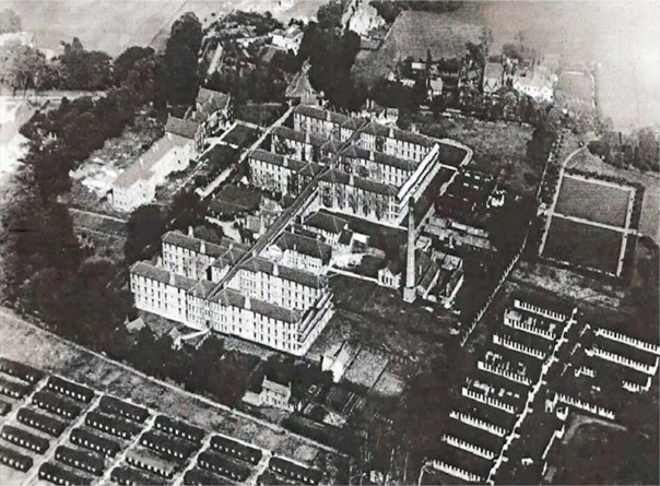
Foresight
Vision
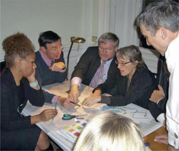
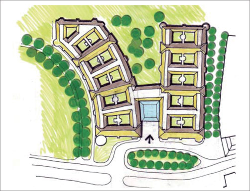
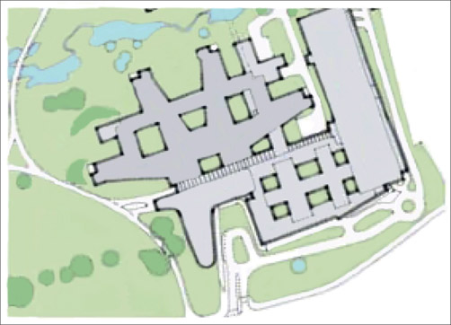
Hindsight
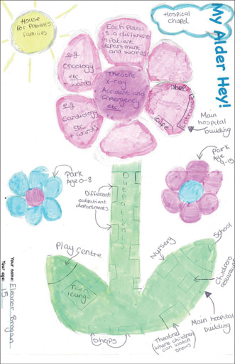
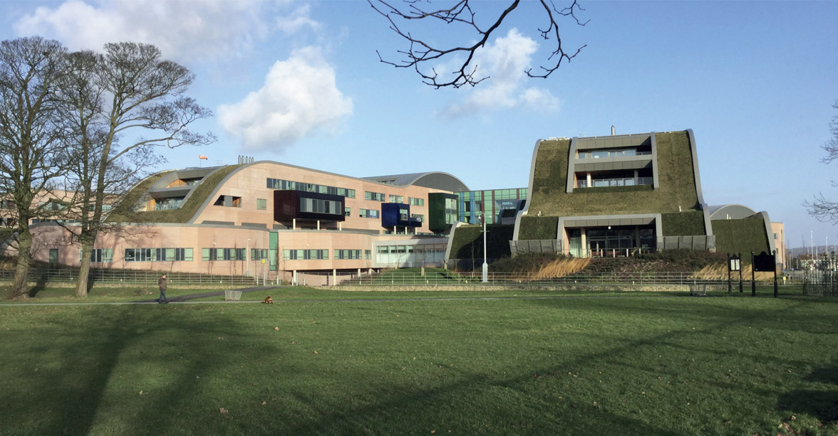
5.10 A Collage of Buildings on the River Thames
KEW BRIDGE, LONDON, ENGLAND
DATE JULY 2006 CLIENT SECTOR PRIVATE SITE URBAN SCALE NEIGHBOURHOOD VISION URBAN DESIGN ARCHITECTURE
The Kew Bridge site was always going to be a challenge to regenerate, being a key gateway to the London Borough of Hounslow, located in a conservation area on the banks of the River Thames, lying adjacent to the Grade II* listed Kew Bridge, near Kew Steam Museum’s 60 m (200 ft) high Grade I listed Italianate standpipe tower, and opposite the Kew Gardens World Heritage Site.
Figure 5.10.1:
Aerial view of the vacant Kew Bridge House site
The 0.7-hectare (1.7-acre) site had lain empty since Kew Bridge House office block and Horseferry Rowing Club were demolished in the late 1980s and early 1990s, leaving just the Waggon and Horses pub standing. In an effort to progress the redevelopment of this important site, Hounslow Council drew up and adopted a Planning and Urban Design Brief in September 2001. Their preference was for a mixed-use development for business and community uses, or mixed business and residential uses. Developer St George West London acquired the site in 2002 and drew up a scheme that was submitted for planning consent. Council officers recommended the proposal for approval, but fierce objections from the local community led to it being refused at planning committee stage. The application was then dismissed at appeal, although the planning inspector gave helpful guidance for any future proposals, including the importance of retaining views to the Grade I listed Italianate tower, and sight lines to steps up to Kew Bridge. Following this dismissal, St George wanted to take a fresh approach to the site and rebuild relationships with the local community. John Thompson & Partners (JTP) were appointed to draw up new proposals, through a community planning approach. John Thompson says: ‘The local community had run a successful campaign – it was probably the best-organised and most-qualified community we had ever met. We put a lot of energy into making the design process open and accessible, because
although the community were fine-tuned to object, they also realised that something was needed on the site.’
Figure 5.10.2:
Hands-on planning report back
The collaborative process began with meetings with local groups from Brentford and neighbouring Strand on the Green to introduce the new design team and find out more about community concerns and aspirations. In parallel, workshops were arranged with children from local schools, and meetings were held with the local authority and other statutory organisations. The ‘Kew Bridge Community Planning Weekend’ began with a briefing and an area tour for the facilitation team members. Around 100 people attended the two public workshops that took place on a Friday and Saturday in July 2006. A key focus of the public sessions was a thorough explanation of the planning brief requirements, and the additional guidance given by the inspector’s report. With this in mind, participants debated the issues and developed ideas for the site and its relationship with the surrounding area. Local resident Peter Browne recalls: ‘The event was held very professionally – the lead facilitator was saying, “This is what we are here for, this is what we are trying to do.” It channelled people’s input to what they could influence.’ Key themes to emerge included respecting site context and views, architectural design, height and massing, physical connections and sustainability. Another particular focus was on the need for public space by the riverside, as there was a lack of public access to the water. Important design principles included the need for the site to be opened up visually and physically, with through routes from Strand on the Green, and a landscaped public space. It was suggested that the building design could have a stepped form down to the river, and instead of one single building, there should be a collection of smaller buildings at a human scale. The building line should be set back from Kew Bridge Road, with the highest part of the scheme towards the centre or near the neighbouring Thameside Centre development, away from Kew Bridge. Malcolm Wood, former Land Director for St George, thinks there were several key benefits to holding a Community Planning Weekend. This included the opportunity to spend longer with local people. Walking around the area together helped the design team to develop relationships and understand local concerns. Breaking into hands-on planning design groups enabled people to recognise the complexities of developing a site, as well as giving them a voice. Following the public workshops, the charrette team drew up an illustrated vision, which was presented back to the community the following Thursday evening, Day seven of the Community Planning Weekend process. The vision included a development designed as ‘a collage of buildings’ with homes and ground floor commercial and community uses set around a public piazza next to the river. Importantly, the feedback also explained why certain ideas discussed during the workshops could not be incorporated. Malcolm Wood was very positive about the approach followed by JTP: ‘A weakness of this sort of process can be raising people’s expectations, but this was handled well at Kew Bridge, where we were clear and transparent about the parameters.’ With the report back taking place so quickly after the event, people could easily recall their involvement in the public workshops. They could see that they had been carefully listened to and that their ideas had been given proper consideration. The design approach was explained in depth. A key aspect was the creation of a large portion of public realm that was accessible to all. Figure 5.10.3: Explanatory scheme concept drawings
Figure 5.10.5:
Vignette with view through to Italianate water tower
There was a strong desire from local people to continue to be involved during the design development phase. As a result, regular design update meetings were held with St George and JTP, explaining the development of the proposals by using PowerPoint presentation and a three-dimensional model, which was reprinted between meetings to show the design changes.
Figure 5.10.4:
Model of the evolving scheme
Following a pre-submission exhibition, a detailed planning application for Kew Bridge was submitted in 2009, which was granted the following year. The new proposals differed significantly from the original, dismissed, scheme and included the protection of views identified by the inspector, a more responsive frontage to the river, and an increase in the setback from Kew Bridge Road. The final design focused on creating a new destination, which included a riverside piazza and an improved riverside walkway with a south-facing aspect over the Thames towards Kew Gardens. St George subsequently acquired the Waggon and Horses pub, as well as the neighbouring Thameside Centre offices. This extended the Kew Bridge site, and the additional area was incorporated into a new masterplan, which was granted planning approval in 2011. The development, completed in 2016, comprises a range of mixed uses including a new riverside pub, restaurants, shops, offices, a boating club and 308 new homes (149 more than the initial permission). The scheme opened up views to the river from Kew Bridge Road (an original aspiration from the Community Planning Weekend) and just over 50 per cent of the site area is publicly accessible open space. New trees and green spaces have created a high-quality landscaped environment, including a riverside walk. The result is a unique development that has enhanced its riverside location and created a new destination. John Thompson believes that Kew Bridge is one of the best examples of a well-designed ongoing collaborative design process, as people were made aware of the inevitable compromises that had to be made. Peter Browne, a local resident, describes how the collaborative process was a positive experience and achieved practical results that enhanced the local area in a way that the community wanted: ‘The community pushed for a different architectural style and layout, and this was taken on board. It has also enabled the people to use the public areas by the river, which were never used before. I have no doubt these community workshop processes are successful, and I have to say we could hold this one up as the gold standard.’
Figure 5.10.6:
Completed Kew Bridge neighbourhood
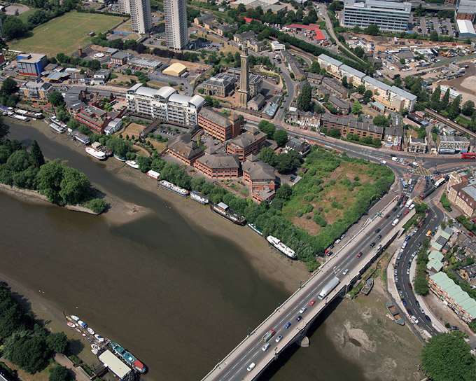
Foresight
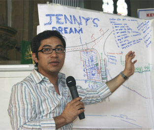
Vision
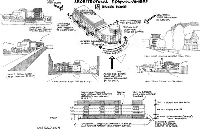
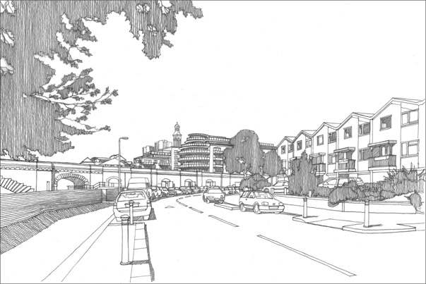
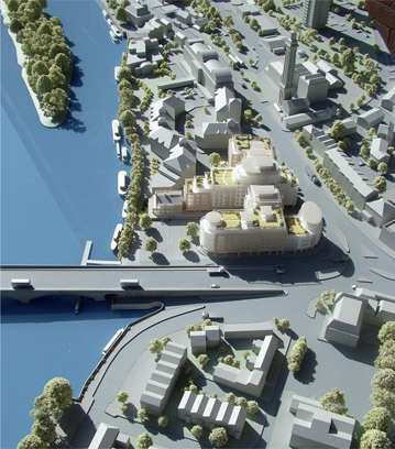
Hindsight
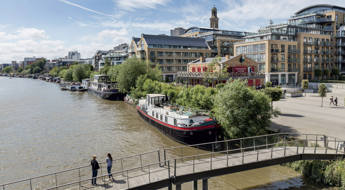
5.11 Restitching a UNESCO World Heritage City
LÜBECK ALTSTADT, GERMANY
DATE MARCH 2007 CLIENT SECTOR PUBLIC/THIRD SITE URBAN SCALE CITY VISION URBAN DESIGN
The ‘Mitten in Lübeck’ charrette stimulated more than 400 local people to contribute to the design of the public realm to restitch the historic fabric of a UNESCO World Heritage City.
Figure 5.11.1:
Aerial photo of Lübeck
Lübeck is a historic Hanseatic League City near Hamburg in northern Germany. The old quarter, identified by UNESCO as a World Heritage Site, is an island enclosed by the Trave River and the Elbe-Lübeck Canal, with a medieval plan reflecting the function of the island during its heyday as a port. Königstrasse, the central north–south street, is like a backbone with ‘ribs’ running down to the waterfront on either side. Goods were conveyed to and fro along the ribs to the magnificent merchants’ houses built along the central axis. The city consisted of seven neighbourhoods, each represented by its own church, and Lübeck is also known for being home to Thomas Mann at the time he wrote the novel Buddenbrooks (1901). The old quarter suffered damage from Allied bombs during the Second World War, and postwar reconstruction was functional but uninspiring in contrast to the grandeur, beauty and materiality of the traditional buildings and streets. The city centre also went through a phase of being dominated by vehicle traffic, until key streets were pedestrianised in the 1980s and 1990s. Today Lübeck has grown to a population of over 200,000, and the island itself remains the commercial and cultural heart. It is a major tourist attraction but also a living and working place, with retail facilities serving local people alongside shops and restaurants for visitors. By the early 2000s the city authorities had decided that they wanted to invest in the quality of the public realm, in part due to Lübeck’s UNESCO status. The funding was to be provided in large part by the Possehl Foundation, influential city guardians working to preserve the city’s beauty, among other things. However, the stakeholders could not agree on a course of action, and it was decided to throw the process open to the wider community in an attempt to create a consensus plan. In 2006 Von Zadow International (VZI) and John Thompson & Partners (JTP), were commissioned to carry out a Perspektivenwerkstatt (charrette), with Gehl Architects from Copenhagen forming part of the team. The first step of the process was the establishment of a steering group backed by a wider Unterstützerkreis (support circle) with around thirty members from the Lübeck community. The support circle has been a favoured approach in other community planning processes in Germany, as it engages a wide network directly in the organisation of the charrette. The resulting benefits include representatives becoming better acquainted with the process, spreading the word to their networks, helping to publicise the charrette widely, and ensuring better and more informed participation, leading to more involvement in the organisation of the event. VZI facilitated regular steering group and support circle meetings over several months to organise logistics (including recruiting a bilingual local team to help run the public workshops) and publicity in the run-up to the ‘Mitten in Lübeck Perspektivenwerkstatt’, which was held in March 2007. The charrette spanned seven days, beginning on a Thursday with a team briefing and site visit. On the Friday and Saturday the community were invited to participate in dialogue workshops, hands-on planning groups and walkabouts. In particular, groups considered the quality of existing streets and public spaces, bearing in mind a quality scoring methodology devised with Gehl Architects.
Figure 5.11.2:
‘Delta’ workshop considering design options for a key space in Lübeck
Hans-Walter Rechter, the cycling officer for Lübeck at the time of the charrette, recalls: ‘What was special was the broad participation of the population, and the interdisciplinary discussion, and the way the working groups resolved issues together.’ Another event participant commented: ‘It’s
surprising how much agreement there is between everyone – usually when we come together we just discuss controversies.’ The JTP team worked for four days from the Sunday morning to develop the vision for the city centre, which was presented back to the community on the Wednesday evening. The design concept built on the heritage of the city’s structure, including public realm and lighting proposals. These were based on the characterisation of different public spaces as, for example, ‘artistic’, ‘tranquil’, ‘arrival’, ‘see and be seen’, ‘high quality market square’, ‘history’, and so on. Following on from work done by the hands-on planning
groups, the design team undertook a ‘before and after’ evaluation of key public spaces. This assessed how the proposals would improve the spaces in terms of different aspects of quality.
Figure 5.11.3:
View from the new Schrangen pavilion terrace
One hands-on planning group, called ‘Delta’, had looked in detail at the circulation of traffic around the city. As a result, it was proposed to close Schmiedestrasse to enable the transformation of Klingenberg – a key space – into a lively public square. Part of the appeal of this idea was that participants recalled how much they had enjoyed using public spaces during the 2006 Football World Cup, hosted by Germany, when large screens were erected to show the matches in cities all over the country. The closure of the Schmiedestrasse was a possible measure that the local authority’s traffic department had been aware for decades, but that they had been hesitant to bring forward for fear of opposition from the local community. The open and collaborative atmosphere of the charrette created the conditions for the decision to be agreed – literally within a few minutes – assisted by the fact that the reporting back of this idea was done by local residents rather than a member of the professional team. While the focus of the initiative was on upgrading the public realm, an opportunity was identified for a new building to be created on an underused, linear pedestrianised space called Schrangen. A proposal emerged for a pavilion building containing a cafe with a roof terrace that would work as a viewing space on to activities in the square, with the cathedral as a magnificent backdrop. The vision received enthusiastic public and institutional support, and went on to form the brief for an international design competition. At the report back Bausenator Franz-Peter Boden, Councillor for Urban Planning, declared: ‘If all future community planning events in Lübeck are as competent and creative, I do not fear about Lübeck’s future.’ Following the Community Planning Weekend the city authorities arranged an international competition to carry out the visionary proposals. Fred London from JTP and a local charrette team member were invited on to the jury to maintain the continuity of the process and the concepts behind the design. A local practice won the competition, and many of the proposals have now been implemented, including the closure of the Schmiedestrasse and the creation of a new public space on the Klingenberg. The Lübeck community and visitors now enjoy beautifully designed pedestrian areas – several with water features – in an animated and people-focused city centre. The public realm improvements enhance the historic built environment of this important World Heritage destination. Hans-Walter Rechter concludes: ‘The workshops prepared the way for renewal of the Lübeck pedestrian zone, and today you can see the results daily. In particular, the reconfiguration of the Klingenberg would have been impossible to agree without the charrette.’
Figure 5.11.4:
New water feature in a pedestrianised street
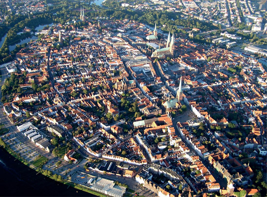
Foresight
Vision
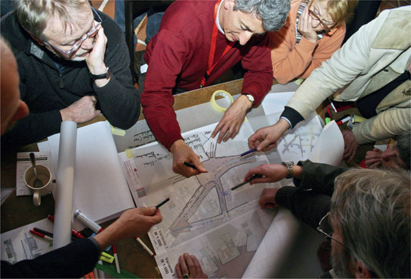
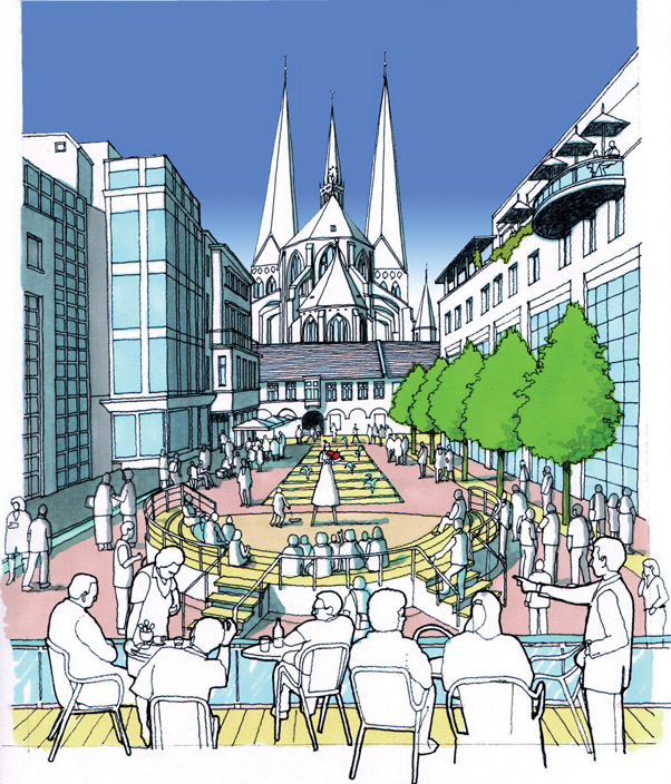
Hindsight
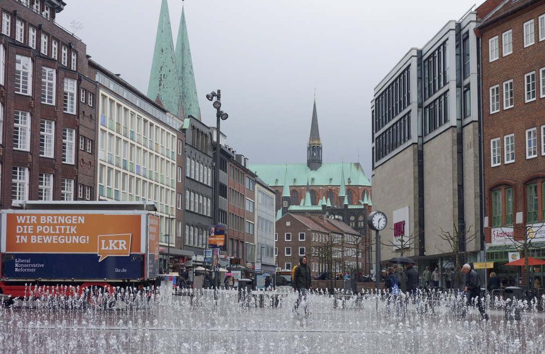
5.12 An Area Plan for the Home of Guinness
DUBLIN, IRELAND
DATE NOVEMBER 2007 CLIENT SECTOR PUBLIC SITE URBAN SCALE NEIGHBOURHOOD VISION PLANNING URBAN DESIGN
In 2007 Dublin was booming, and The Liberties, home of the Guinness Brewery since 1759, was in need of public sector investment and simultaneously facing huge pressure from private sector developers. Dublin City Council decided to work with the local community to draw up a Development Framework Plan – the aim being to regenerate The Liberties as a more exciting, attractive and liveable city quarter.
Figure 5.12.1:
Guinness Brewery
The Liberties is located directly southwest of the walls of Viking and medieval Dublin. Due to its location on the Liffey and Poddle rivers and at the junction of important routes from each corner of Ireland, it became a major industrial centre, and textiles led the way. Following the decline of the textiles industry in the late eighteenth century, the brewing industry took over as a major employer. In 1759, Arthur Guinness leased a 1.6-hectare (4-acre) site at £45 per year for 9,000 years. Guinness was to become the largest brewery in Ireland in 1838, and by the beginning of the twentieth century the largest in the world. From 1961 to 1991, a declining Dublin lost half of its population and saw high levels of deprivation in the city, including in The Liberties. But the rapid economic growth during the ‘Celtic Tiger’ period meant that by the turn of the twenty-first century the city’s fortunes had reversed. The population of The Liberties grew by 66 per cent over fifteen years, with an increasingly diverse community. The resulting patchwork of highly affluent and highly deprived neighbourhoods became one of the defining characteristics of the area. By 2007 The Liberties was facing significant development pressure and major change. Improvements to Dublin’s public transport infrastructure were planned which would significantly improve the connectivity of the area, and a number of large brownfield sites were becoming available for redevelopment. In addition, the Dublin City Council (DCC) housing in the area needed investment and renewal. Another issue of concern was a confirmation by Guinness owner Diageo that it was considering moving the 250-year-old brewery out of The Liberties. In 2007, DCC appointed John Thompson & Partners (JTP) with Metropolitan Workshop and John Spain Associates to draw up a Regeneration Framework Plan and to guide future investment and strike a balance between protecting the heritage of the historic city quarter. It would take into consideration the needs of the local residential and commercial community, and promote new development that would enable The Liberties to become a more exciting, attractive and liveable city quarter. A key element of developing the strategy was to engage with the community. Following a series of initial neighbourhood workshops held in the Pimlico, Liberties and Grand Canal/Basin Lane areas in early October, the ‘New Vision for The Liberties Community Planning Weekend’ ran from Thursday 8 to Wednesday 14 November 2007.
Figure 5.12.2:
Taking the charrette to Meath Street Market
The charrette began with a local traders’ workshop on the Thursday evening. Day two took place at St Catherine’s Church and started with a team briefing and tour of The Liberties area. The first session of public workshops commenced with a brief introduction and report back from a local school children’s workshop. Participants then took part in workshops and hands-on planning groups, discussing issues and ideas and recording their suggestions on plans. In addition, a team went out to the Meath Street Market to engage with people in the street. On Day three the venue changed to the Digital Hub in Crane Street, close to the Guinness Brewery, and concentrated on hands-on planning activities. Walkabout groups focused on different parts of the study area and returned to the venue to draw up ideas, before presenting them to the whole group in a plenary session. Evelyn Hanlon, the city council’s project manager, remembers the importance of choosing different types of venues – places that were familiar to local people. Following the public workshops, the team worked for four days to draw up a ‘Vision for The Liberties’, which was reported back to the community on the Wednesday evening as a PowerPoint presentation and summary newsletter. A number of key themes were identified. These focused on building trust and managing the process of change to improve the image of the area and bring benefits to the existing community, while ensuring integration with incoming people. New developments should complement, not threaten, the heritage of the area, and careful urban design should integrate old and new in a high-quality, safe and walkable urban environment. Encouraging tourism and supporting the creative, digital economy was to be an important part of developing a vibrant,
modern city quarter while also providing the community and educational amenities for a thriving residential population.
Figure 5.12.3:
Sketch from the Community Planning Weekend
The vision created three main character neighbourhoods to help give a mental map of The Liberties area and strengthen connections:
A key outcome of the collaborative process was the formation of The Liberties Public Forum and five focus groups, which met monthly for almost a year. Emerging proposals were regularly presented to the forum and amended in response to comments received. Facilitated by consultants, the focus groups developed action plans, which focused on Built Heritage & the Thomas Street ACA; Environmental Sustainability; Arts & Culture; Sports Leisure & Recreation and Biodiversity & Open Space. One characteristic of the process in The Liberties was the length of time it took to involve certain groups of people. The continuity of community engagement following the Planning Weekend was key to the successful connection with groups such as the community who ran the horse-drawn tours from the brewery. After some months they too started to come to the public events and contribute their concerns and ideas. After the initial stages of the community planning process, DCC held meetings with landowners. This resulted in land to the north of Thomas Street and up to the River Liffey being included in the redevelopment area. It was also agreed to upgrade the strategy to the production of a full Liberties Area Plan (LAP). The parameters for regeneration – and thus consultation – were widened, and a series of area meetings were held to include local people and stakeholders from the extended study areas in the process, which in turn further informed the LAP. Evelyn Hanlon considers that the process helped define The Liberties: ‘People wanted to be inside the boundary, so it was extended. There was a coming together of the people to be part of a recognised brand of The Liberties.’ At the time of the LAP process, Diageo, owner of Guinness, was talking about leaving Dublin. Evelyn feels that the engagement process was a key factor in Diageo deciding to remain in The Liberties. In 2012 Guinness announced a further €150m investment in the site. To enable people to better understand the proposals, a model of the area was commissioned by City Architect Ali Grehan. The making of a physical model was well worth the cost – it showed that the scale of proposals was appropriate, and not threatening. As a result, many concerns simply evaporated. At the time of writing The Liberties is undergoing a renaissance, with almost €1 billion of public and private sector investment in housing, commercial and tourism planned for the area. The Liberties Business Area Improvement Initiative has been set up to coordinate DCC and private sector investment in the physical environment, to promote cultural life and activities, and, together with its partners in The Liberties Business Forum, to promote and market The Liberties. This new confidence in and the desire to be associated with the area is well illustrated by the announcement in 2017 of a new €25m Irish whiskey distillery to be built by Diageo. In a press statement, Operations Director Colin O’Brien said: ‘The investment further demonstrates Diageo’s commitment to the growing vibrancy of The Liberties, one of the city’s most dynamic districts.’
Figure 5.12.4:
Aerial drawing of the vision for The Liberties

Foresight
Vision
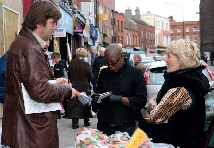
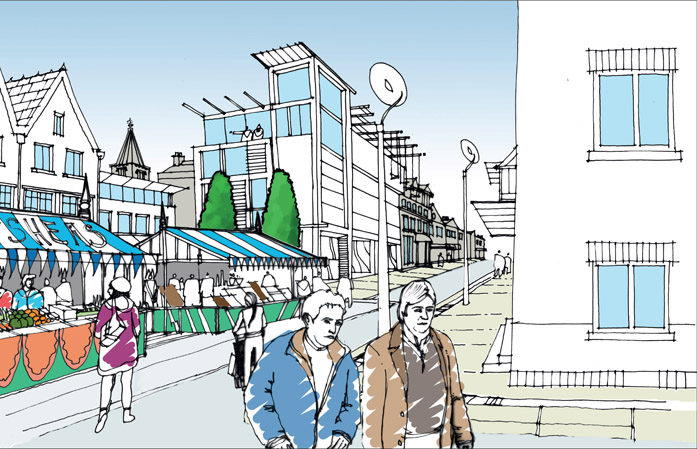
Hindsight
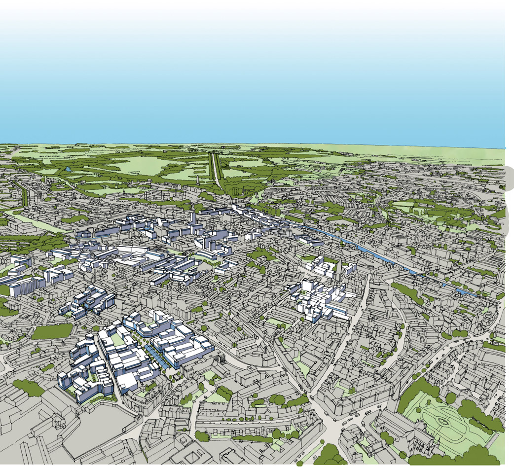
5.13 Revitalising the Town that Roofed the World
BLAENAU FFESTINIOG, GWYNEDD, WALES
DATE OCTOBER 2008 CLIENT SECTOR PUBLIC/THIRD SITE URBAN SCALE TOWN VISION URBAN DESIGN
Around Blaenau Ffestiniog they say that ‘the mountains have been turned inside out’. Approaching the town by rail through the verdant beauty of the Snowdonia National Park, the traveller’s experience is instantly transformed as the train passes through a gateway of huge slate-grey heaps of blasted rock, the vestiges of over two centuries of slate quarrying. The decline of the industry had a severe economic and social impact on the town, and a group of locals set about reviving its fortunes.
Figure 5.13.1:
View of Blaenau Ffestiniog with slate spoil in the foreground
Blaenau owes its origins to the slate industry. The town was predominantly built in the 1860s as a result of a phenomenal boom in production, when slate was sent all over the world. At its peak in the 1870s the town ‘that roofed the world’ was the second largest in Wales, with over 11,000 inhabitants. Then came decline, as cheaper imports from Spain and mass-produced clay tiles undermined the competitiveness of the Blaenau quarries. Today, the population is at less than half its peak, and the long decline of the slate industry has inevitably placed economic and social strains on the town. However, the remaining residents have a profound sense of community and a deep connection with the unique heritage and culture that grew out of the slate industry. By the early twenty-first century, Blaenau was at a tipping point. While there was low business confidence and a poor town centre offer, with a third of high street shops empty, there was also a huge opportunity for the town to capitalise on the burgeoning visitor economy in the area. The boundaries of Snowdonia National Park exclude Blaenau itself, but its setting puts the town at the centre of the iconic region. Residents insist that ‘It’s not the hole, it’s the heart.’ The heritage railway was a key attractor, but on arrival at the station passengers were faced with a blank retaining wall blocking the view to the town centre. There was little visible to entice visitors to stop.
Figure 5.13.2:
Stakeholders about to board the train at Tany-Bwlch station
The local community began to debate the need for a regeneration strategy, while at the same time the Ffestiniog Railway Company was considering what improvements could be made to the station area. An initial brainstorming day was convened by the community, in partnership with Gwynedd Council, to consider the issues and opportunities and come up with ideas for launching a new regeneration strategy. The council agreed to provide funding for a feasibility study and design development, in the knowledge that European Regional Development Funds were available to bid for if the right projects emerged. The regeneration project began in 2007 as a partnership between Gwynedd Council, the local community group Blaenau Ymlaen (Blaenau Forward) and the Welsh Government. Miller Research was appointed as lead consultant with regeneration specialist Chris Jones as project manager. Community engagement was to be paramount, with representatives from Blaenau Ymlaen on the project team from the outset to help steer the process. Major physical interventions were considered essential, the retail offer was to be improved, and tourism was to be invested in, celebrating the unique aspects of the town’s heritage, culture and setting. The aim was to implement an innovative design and planning strategy that showcased Blaenau Ffestiniog’s remarkable heritage, while looking to the future and proclaiming that the town was open for business. The community involvement needed to be genuine and highly relevant to the place and local culture. An innovative charrette process was devised to maximise engagement and maintain the required pace of the programme. A requirement was bilingual communication through the use of the Welsh and English languages. In addition, artist Howard Bowcott was part of the team engaged to work with the community. The first stakeholder workshop started at Tan-y-Bwlch station on the Ffestiniog Railway, some thirty minutes’ steam train ride from the town centre. As Chris Jones explains, in what is a metaphor for the whole process: ‘We took people on a journey.’ Before boarding the train, participants were divided into role-play groups of town centre users, such as local shoppers, a retired couple, a young family, investors and a young professional couple. People were asked: ‘What do you want to find when you arrive?’ Groups worked in the train carriage, discussing their thoughts and ideas. On arrival in Blaenau they explored the town, having been asked the questions ‘Does the town deliver what you want?’ and ‘What is missing and what could be improved?’ All of the groups then reconvened to feed back their experiences and to discuss and draw up their future aspirations for the town
centre. Instead of the ubiquitous sticky notes, Blaenau roofing slates were used, on which participants chalked up ideas and created a slate wall gallery of words for future action.
Figure 5.13.3:
Roof slate workshop
A wider community event followed the stakeholder session, during which local people were asked about their town centre by means of an ‘issues and opportunities’ mapping session, led by design team members. The use of slate tiles continued with the creation of an extensive list of visionary statements, in addition to some action points. This process attracted the direct participation of over 150 local residents plus online contributions. Following these two workshop days the design team drew up a vision for the town incorporating art in the public realm, with focus on the town’s gateways and the central area around the railway station. The proposed artworks, including four iconic slate pillars by the station, were inspired by the cultural heritage of the town. The vision was reported back first to the Blaenau Ymlaen board and then to the wider community. The design philosophy of the vision built on Blaenau’s heritage, culture and location and looked to the future with confidence. The slate tips and quarry railways became important reference points, with quarry inclines determining the key axis to the overall design. Outdoor tourism was identified as a key growth area, and the design and planning team worked closely with the Antur Stiniog downhill mountain bike trails, the green town initiative and walking and cycling activities. The philosophy informing the planning process was to provide the ‘glue’ that connected the various initiatives. On adoption of the vision, the team took the initial concept through to options development. Both Chris Jones and Howard Bowcott saw the retention of the consultant team as key to the integrity of the project and the continuity of a strong working relationship with the local community. An options development workshop for stakeholders and a public exhibition held in December 2008 helped local people and stakeholder organisations consider the choices and determine their main priorities.
Figure 5.13.4:
View along Church Street with new slate pillars at station entrance
Figure 5.13.5:
Design sketches of slate pillars
Slate pillars took the place of the retaining wall, their shape inspired by a slate chisel given to Howard by a member of the community. A further key element of the
design was the ‘Votty axis’, a straight slate transportation line down the hill to the town, which by consensus became the design driver and influenced the orientation of the pillars. Height was important for the pillars, and it was crucial for the community that they framed the space but were also oriented so that the view up the Votty axis was opened up. Figure 5.13.6: The pillars installed The project received support from over 90 per cent of the community and proceeded smoothly through planning. The planning committee meeting held in July 2009 was notable for the comments from members giving support and endorsement to the design, and community engagement as exemplars of best practice. The result of the process is high-quality public realm that connects key entry points, marked by the landmark slate pillars, to a revitalised town centre, and the slate heritage of the Votty axis. Imaginative use of contemporary art and design has been integrated throughout the scheme, celebrating the town’s unique heritage while building community pride and confidence and creating a natural stopping point for visitors, thereby encouraging spending in the town centre. Innovative, collaborative placemaking and investment helped revive a town centre previously stuck in a spiral of decline. At the time of writing, retail unit vacancy rates are at just 10 per cent, markedly down from 2007 levels. This has happened through a period of post-credit-crunch austerity, and despite some missed opportunities to further consolidate footfall in the town centre, such as the failure to extend the final stage of the Antur Stiniog downhill mountain biking trail to end in the town centre. Reflecting on the impact of the project, Chris Jones considers that the process, which was started by the community, has raised aspirations and led to a significant economic upturn. The scheme increased social cohesion and confidence in Blaenau, which is now well placed to build on the progress of the last few years. To a large extent, it is now up to the residential and business community to exploit the opportunity created by the investment, to continue to develop the services and hospitality in the town, to attract and retain visitors, and sustain a vibrant economy. Eifion Williams, a member of the Blaenau Ymlaen, sadly passed away in early 2017, but his comment underlines the importance of the process: ‘It has made North Wales the centre of activity – Blaenau started it off – the whole area has gained. We need now to take full advantage.’
Foresight
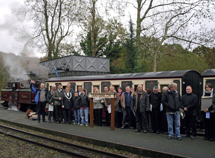
Vision


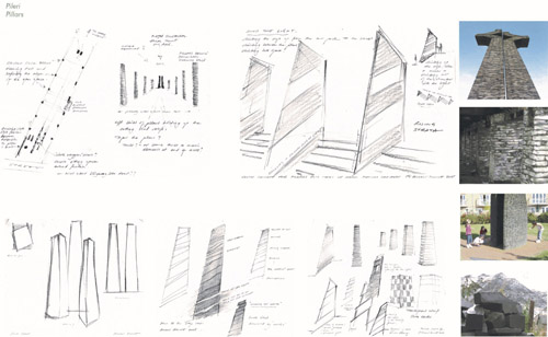
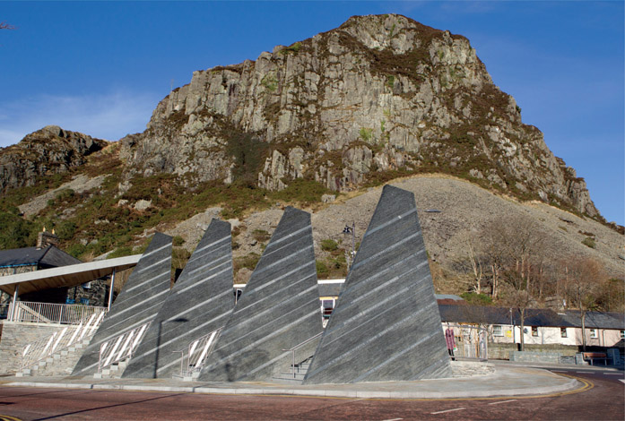
Hindsight
5.14 Regenerating a Historic Warehouse Precinct
DUNEDIN, NEW ZEALAND
DATE JUNE 2011 CLIENT SECTOR PUBLIC SITE URBAN SCALE NEIGHBOURHOOD VISION URBAN DESIGN
As a consequence of new earthquake-strengthening legislation, a fledgling initiative to save a unique built heritage became a comprehensive consensus-led strategy with endorsement from the city council. This resulted in the delivery of a thriving urban creative quarter, with new jobs, new residents and heritage buildings that were saved and refurbished.
Figure 5.14.1:
3D map of the warehouse district from the 1890s
Dunedin, the Gaelic name for Edinburgh, is a city of around 120,000 residents, situated in Otago, New Zealand’s South Island. One of New Zealand’s oldest cities, it contains the country’s first university and has many historic buildings. In recent years economic and population growth have stagnated, and the city council fell into debt. Adding to the challenges was evidence that the local community were divided in their views about what should be done. Dave Cull, a new mayor with a strong leadership style, was determined to arrest the stagnation and give new direction to the city. The Dunedin Central City Strategy was initiated under the leadership of City Development Manager Dr Anna Johnson and her colleague Dr Glen Hazelton. Glen had already saved some of the historic buildings in the city’s virtually abandoned Warehouse Precinct. The precinct was blighted due to zoning for big-box retail development and threatened with demolition due to the costs of newly introduced earthquake-strengthening requirements. In 2013 the council launched a regeneration initiative to create a coherent vision and the strategic initiatives required to achieve it. Key to this was gaining the confidence and support of the business sector and the wider community, identifying opportunities to boost prosperity and employment, and defining and countering risks that could weaken retail viability and diminish the character of built form and open space. To meet the challenges and deliver the objectives a collaborative charrette-based approach seemed the logical way forward, to integrate specialist knowledge with stakeholders’ views. Consultants Urbanismplus, led by Kobus Mentz, were appointed, with a team of sub-consultants. A substantial programme of events preceded the Dunedin Warehouse Precinct ‘Enquiry by Design’ (EBD) charrette, including public information communications, councillor sessions, focus group sessions and a public visioning workshop with about 100 participants. Ideas, aspirations and concerns were harvested, collated and fed back into the charrette process. A four-day intensive technical charrette used a ‘one team’ approach, with consultants paired with council technical officers. This enabled high-quality expertise to be combined with local knowledge and realism. The process resulted in good follow-through due to the ‘ownership’ of those tasked with implementing the strategies.
Figure 5.14.2:
Concept diagram for open space and event network
Confidence was built by first listening to the views and aspirations of stakeholders,
by undertaking to investigate them, then explaining what the investigations delivered and providing a strongly justified strategy. Even where outcomes were contrary to expectations, they were accepted because the initial suggestions had been taken seriously, and people felt they had been listened to. The final outcome included a strategy for movement, mixed uses, heritage, open space, employment, community and measures to strengthen the retail vitality and the arts precinct, and a public space upgrade of the Octagon, Dunedin’s signature central public open space. A set of public space, regulatory, procedural and financial changes were proposed with the aim of generating high-value employment in this area. Far-reaching traffic changes were proposed. These included returning to two-way the one-way pair of state highways running through the city centre, to reconnect the heart of the city centre with the historically significant Queens Gardens and the Warehouse Precinct. In addition, improved pedestrian connectivity between the city centre and the harbour was proposed for the long term. It was also recommended that visitor, student and nighttime experiences should be developed, with a programme of events associated with the various public spaces in the city centre. A key moment in the collaborative process was the enthusiastic buy-in from a previously divided public at the final project presentation, which emboldened elected members to give their full endorsement.
Figure 5.14.3:
Vignette of the revitalised Vogel Street
Figure 5.14.4:
Refurbished buildings on Vogel Street
The Dunedin Central City Strategy has been regarded a significant success, with many of its initiatives implemented. It offers a framework for future work, which will evolve as circumstances change. Initial
city council funding of NZ$500,000 was invested in public-realm improvements and further incentive funding for a building reuse grants scheme. Changes to the District Plan (the legislation controlling the land use and development) that encouraged redevelopment of historic buildings in the Warehouse Precinct were implemented, and the first $5m private sector anchor project proceeded there, resulting in new jobs.
Figure 5.14.5:
Cover of Planning Quarterly magazine featuring the Warehouse District Street Festival
Most notable has been the dramatic revitalisation of the Warehouse Precinct. With the public realm upgrade substantially complete, and funding and rule changes in place, the market has responded strongly. Numerous buildings dating back as far as 1888, some vacant for up to ten years, have been saved and reoccupied through a reuse grants scheme for earthquake-strengthening and facade improvements. Many new businesses, some of which are entirely new to Dunedin, now occupy refurbished buildings, including a new hotel in the formerly vacant historic post office. There are also several new apartment complexes, a pop-up theatre and pop-up urban winery, a microbrewery, a chocolate maker, artist studios and several cafes and coffee bars. An analysis of the return on investment showed that for a $1.1m council investment in grants and amenity upgrades, the city has levered in $52m of private investment. With the uplifted amenity of the area the property market has shifted, and now values the heritage buildings highly as both office and residential spaces. Once-derelict heritage buildings now offer high quality and high commercial returns. Tourism opportunities have increased, and the district as a whole is providing a high-profile opportunity to market the city. Prior to the EBD workshop, Dunedin City Council had suffered, like many other local authorities, from a silo-based approach to working. The charrette process enabled, for the first time, many departments to work together in a focused and intense way on how to create a vibrant city centre, with a connected and repurposed Warehouse Precinct. It also provided a forum for interaction between councillors, the community and staff that put everyone on an equal footing in a spirit of genuine collaboration to identify one vision for the centre of the city, and actions across the public–private spectrum to help achieve that vision. An unanticipated consequence of the process has been that Dunedin City Council’s public satisfaction ratings have improved, partly because of the implementation of this strategy. In a mid-2016 survey, residents’ ratings were up by six points (to 87 per cent) from the previous year for how Dunedin maintains and preserves its architectural heritage, up seven points (to 76 per cent) on how they see Dunedin as a creative city, and up thirteen points (to 48 per cent) on being satisfied or very satisfied that the city council delivers overall value for money. Mayor Cull described the strategy as ‘an inspirational vision and incisive strategic plan that illustrates urban design’s relevance in these challenging times’. It has arrested the decay in an important part of the city, rescued buildings that attest to the city’s history and identity, and stimulated investment. Public trust has, to a considerable extent, been restored. The precinct is now transformed, and the new community is looking for ways to get more involved in the next stage. Local worker and resident Veronica Eastell is very keen to continue with a participative approach to take things forward: ‘I’d love the charrette process to happen again – we are in the next phase of development, and more street life is what we now need the most. We have one street festival per year but we need to involve the community to make more things happen.’ This is a valuable testament to the success of the whole collaborative process, and the energy and aspiration it has released in the newly regenerated urban quarter.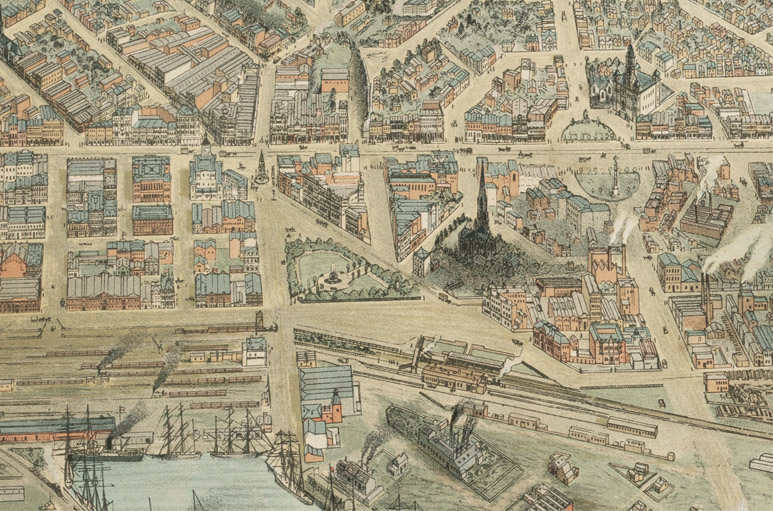
Foresight
Vision
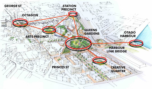
Hindsight
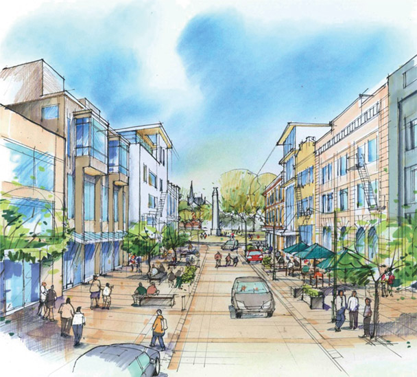

5.15 Whole-Town Visions for a Development Plan
WICK AND THURSO, SCOTLAND
DATE FEBRUARY 2012 CLIENT SECTOR PUBLIC SITE URBAN SCALE REGION/TOWN VISION PLANNING URBAN DESIGN
The Highland Council charrettes in Wick and Thurso (sponsored by the Scottish Government) enabled local people to help shape the future growth of their towns. Members of the public and local stakeholders worked in collaboration with council officers and project consultants to develop a vision and masterplan for each town, focused on housing and economic development, including offshore energy. The outcomes from the events were then fed into a new Caithness and Sutherland Local Development Plan process.
Thurso, the most northerly town on the Scottish mainland, overlooks the Pentland Firth and Orkney Islands. Despite having many assets, including a medieval urban core, a world-class surf beach, a railway station and a harbour, Thurso faces a number of economic challenges related in particular to the decommissioning of Dounreay nuclear research establishment, one of the first and once one of the most advanced nuclear research facilities in the world.
Figure 5.15.1:
Dounreay nuclear research establishment
Wick is divided by its river, with Wick town centre on the northern bank and Pulteneytown, home of the Old Pulteney whisky distillery, on the southern bank. The town centre contains a significant number
of listed buildings, including the Carnegie Library, laid out on a simple grid around the harbour. At one time Wick Harbour was home to the busiest herring port in Europe. However, with the decline of the old industries Wick also needed to reassess its economic future.
Figure 5.15.2:
Historic image of Wick Harbour
The Scottish Government established the Sustainable Communities Initiative Charrette Mainstreaming Programme in 2011, promoting the use of charrettes to involve local communities in shaping their place. This followed on from the success of three pilot charrettes led by Andrés Duany from Florida-based architects DPZ. As part of the programme, the Highland Council obtained funding to help in the early stages of preparing the Caithness and Sutherland Local Development Plan. It was an attempt to achieve consensus between as wide a range of partners as possible on the priorities for the future growth in the two main towns in the Caithness and Sutherland plan area, and to create a greater sense of collective ownership and empowerment to deliver the plan and improve communities.
Figure 5.15.3:
Publicity flyer for the Wick charrette
A team was appointed, led by John Thompson & Partners (JTP), with Gillespies, to facilitate the process in Thurso and Wick. The brief was to review key issues facing each town, to explore options and alternatives for delivering development, to propose actions for addressing these issues to deliver growth, and to formulate a land-use strategy. This involved undertaking design-led charrettes in both Thurso (including Scrabster) and Wick, resulting in two whole-town masterplans. The results of the events were to be fed into the first stage of the Caithness and Sutherland Plan, known as the Main Issues Report. Key stakeholders in Thurso and Wick were invited to launch events, which served to publicise the forthcoming charrettes. Many of those who met with the team agreed to pass on information to colleagues, neighbours and friends. Not everyone, however, was convinced by the use of the terminology ‘charrette’. The John O’Groat Journal wrote: ‘The fact that the events were tagged charrettes was not likely to make them any more appealing to the average Joe. Sounding like a cross between
“charade” and “Tourette’s”, their esoteric derivation from a practice at a Parisian architecture school was, we thought, hardly going to be a big vote winner.’ Figure 5.15.4: Launch of the Wick charrette Following the launches, and to ensure the widest possible representation from the local community and key stakeholders at the charrettes, a structured programme of engagement (community animation) was undertaken by a team led by community participation expert Dr Geoff Fagan of the CADISPA Trust (Conservation and Development in Sparsely Populated Areas). The brief had originally asked for a four-day charrette in each town, but to give the team sufficient time to hold workshops and work on the outputs, it was agreed to blend the charrettes together. This had the benefit of enabling the team to work between the two towns over six days, and learn lessons that could feed into both visions. The well-attended Thurso workshops were held on 22 and 24 February. Key issues discussed included the future vitality of the heart of the town as a commercial centre, the regeneration and enhancement of the riverside, and the western expansion of the town, including space for employment uses related to the growth of Scrabster Harbour.
Figure 5.15.5:
Introduction to the Thurso charrette
Participants also wanted to see new facilities and services to attract further visitors to Thurso, including cultural, heritage and water sports activities. The Wick workshops on 23 and 24 February were less well attended, and key issues raised included regeneration in the heart of the town on both sides of the river, investment in the harbour, and promoting and investing in Wick as a cultural and heritage visitor destination, as part of a wider Caithness offer. In both towns, there was an acceptance of the need for new residential and economic development to sustain the community and the economy, and a desire to be seen as part of the Caithness tourism trail. The charrettes were seen as open and transparent, with high-quality outputs, benefiting from the immediacy of interpreting ideas and concepts into drawings and proposals. However, the relatively low number and range of attendees in Wick led to uncertainty expressed by some over how representative the outputs were. Following the workshop days, the charrette team analysed and summarised the outcomes, and in consultation with council officers drew up an illustrated vision for each town, and an additional plan for wider Caithness, both of which were reported back to the communities of each town on Day six of each charrette. The charrette outcomes were welcomed in each town with a great deal of positive energy about development opportunities and the prospect of partnership working to deliver them. In their leader column following the report back presentations, the John O’Groat Journal wrote that the projects and initiatives ‘were selected and refined by what appeared to be a thoroughly democratic process involving all of the community minded citizens who turned up’. The leader continued: ‘We believe this gives the mandate for the project to be taken forward and included within the new development plan for both towns. Anyone who takes issue with the action plans who did not attend can now consider themselves on the back foot as they failed to take up the opportunity to deliver their tuppenceworth.’19 Subsequently, the impact of the charrette would have been far greater if the outcome had fed directly into a draft Local Development Plan. The Main Issues Report stage that followed, as dictated by Scottish Government legislation, reopened the debate on sites to be included in the plan, and as a result the outcome of the charrette became more diluted. At the time of writing, the Local Development Plan had reached final examination stage and was being independently assessed by a reporter on behalf of Scottish ministers.
Figure 5.15.6:
Sketch of the proposed new development on the bank of the River Thurso
Foresight

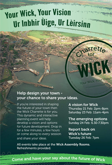
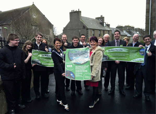
Vision
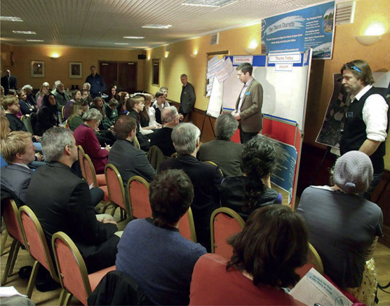
Hindsight
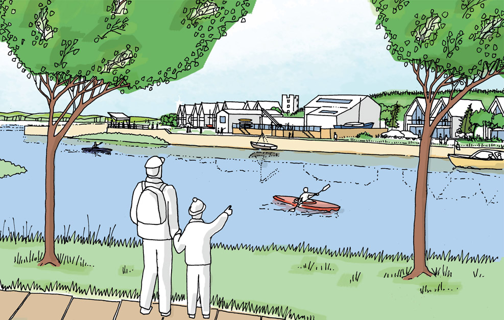
5.16 Creative Flood Protection Investment
WHITESANDS, DUMFRIES, SCOTLAND
DATE SEPTEMBER 2012 CLIENT SECTOR PUBLIC SITE URBAN SCALE NEIGHBOURHOOD VISION URBAN DESIGN GREEN DESIGN
Creative co-designing of flood protection works to revitalise Whitesands on the banks of the River Nith, the heart of ‘The Queen of the South’.
Figure 5.16.1:
Whitesands livestock market
Figure 5.16.2:
Whitesands inundated with flood water
Dumfries is a historic market town, set in Scotland’s Southern Uplands close to the border with England. The fast-flowing River Nith passes through the town on its course to the Solway Firth, and historians trace the earliest settlement at this strategic crossing point back to the Roman era. Through the following centuries Dumfries became a flourishing market town and inland port, and was granted Royal Burgh status by William the Lion in 1186. In the nineteenth and twentieth centuries various industries established themselves in Dumfries, and the town, which gained the nickname ‘The Queen of the South’, grew rapidly. Today Dumfries is home to around 40,000 citizens and has established a reputation as one of the best places to live in the UK. In the twentieth century the closure of the inland port and Whitesands livestock market shifted the town’s commercial centre of gravity uphill, away from the river. In addition, the Nith regularly overflowed its banks, causing severe flooding. As a consequence, the blighted Whitesands area came to be characterised by run-down buildings, marginal businesses and empty shops. The uncertainty about the provision of future flood protection was having a negative impact on the regeneration of the area, with knock-on effects on the performance and future planning of the wider town centre. In August 2012, Dumfries and Galloway Council (DGC) commissioned Gillespies and DG Design to prepare a masterplan for Whitesands. The overarching aims of the study were to address particular flooding issues and increase the vitality of the town centre as a whole. Whitesands lies within a conservation area and contains a number of listed buildings. The riverside setting, with its historic bridges and streets, is an integral part of the town’s heritage. The height and visual impact of any flood barrier within this sensitive environment would therefore need to be carefully planned. Professor Brian Evans was leader of the project. Having a multidisciplinary team working together over several days is a recognised and effective way of creating integrated solutions to resolve complex problems. As he says: ‘It takes leadership to persuade the client to undertake a charrette when, as in Dumfries, the technique had not previously been employed in the area.’ The team met with the DGC Strategic Projects Group to refine the programme and discuss the anticipated outputs. An introductory workshop was then held with DGC members and town stakeholders to explain the charrette process.
Figure 5.16.3:
Hands-on planning at Whitesands charrette
‘The Future of the Whitesands’ charrette took place between 12 and 19 September 2012 at a town centre hotel, and involved a series of interactive presentations, dialogue workshops, walkabouts and design workshops, as well as meetings with all stakeholders to discuss the key policies and issues relating to the site. The collaborative process enabled members of the public, local design professionals and project consultants to work together to develop a detailed vision for the site. Particular effort was made to talk with business owners at Whitesands, and on the Saturday a market stall was set up to seek the views of town centre users. Throughout the charrette participants were able to walk around the area in groups, looking at key views and the various conditions along the banks of the river. This opportunity for observation, along with discussion of issues and opportunities, was fundamental to the success of the process. It soon became evident that the technical vocabulary and complexity of flood risk issues was difficult but vital for local decision-makers and members of the community to grasp. Many hours were spent explaining and discussing concepts such as 1-in-25- and 1-in-100-year flood risks. The charrette process allowed time for this kind of detailed discussion, which was critical in order to reach understanding and agreement on the most appropriate risk level to plan for. The site area incorporated the existing riverside car parks and bus terminus, and the vision showed these transformed into a new multiuse, high-amenity landscape. As one participant commented, ‘Why should the cars have the best view?’ Whitesands would provide a place of arrival for visitors by bus, cycle and car, and the green landscape and ‘cafe society’ quality of the new Whitesands riverfront would complement the commercial and civic role of the High Street. The secondary streets between the two parallel
thoroughfares would be revitalised by the heritage-led regeneration of the surviving building fabric and remaining medieval patterns of plot shapes, wynds and closes. Figures 5.16.4 & 5.16.4A: Cartoon drawings explaining concepts for the Whitesands vision The leafy, countrified riverbanks immediately upstream and downstream from Whitesands were extended into the town centre, with both banks becoming a tree-lined setting for the River Nith. Key to everything, it was agreed that the level of protection adopted for Whitesands should be at least for a 1-in-25-year flood event. This would allow a significant degree of confidence to return to this part of the town centre while avoiding the considerable nuisance of regular flooding and allowing insurance cover to be explored. Where width allowed, the method of flood protection was to be a landscape bund behind the existing riverbank wall and riverside walkway. At the top of the bund an elevated walkway would give enhanced views of the river. Following the charrette, further design development that offered greater than the 1-in-25-year protection was explored, to seek better protection without significantly compromising views and to reflect Scottish Environmental Protection Agency guidance. Regular meetings were held with key stakeholders, and a series of community events were arranged to share the emerging proposals. These well-publicised and well-attended events revealed a high level of satisfaction with the clarity and relevance of display materials and the process in general, a good understanding of the issues, and a high level of general support for the proposals. At the second exhibition many people commented that the proposed new flood protection embankment was now too high in places. This concern led to a redesign of the scheme and a resultant reduction of the overall height of the embankment to a
maximum of 1.4 m. This would be topped by a glass balustrade to provide the required protection, with further protection from demountable panels to provide Dumfries town centre with a 1-in-75-year level of protection.
Figure 5.16.5:
The vision for Whitesands
However, support has not been universal, and concern among some businesses in the Whitesands area about the disruption during construction and the loss of parking in the immediate area has led to a campaign against the proposals. While these concerns were heard through the charrette and measures were taken to mitigate the impacts, the campaign demonstrates that sometimes not everyone will be satisfied with the outcomes despite the consensus-building process. Not everyone takes the opportunity to get involved at an early stage, for whatever reason, and so may not go through the process of dialogue and confronting difficult choices. The response from Colin Smyth, Chairman of the Environment, Economy and Infrastructure Committee at DGC was that ‘it’s unacceptable that Dumfries is the largest town in Scotland that doesn’t have a proper flood defence scheme – I urge the public to take a look at what has been agreed’. In 2015, three years after the charrette, the scheme to provide flood protection and regeneration for the Whitesands area was unanimously approved by the council. At the time of writing, the £25m scheme, based on a raised walkway concept with a combination of walls, glass balustrades, demountable panels and floodgates, will be submitted formally to the Scottish Government, advising them of the preliminary decision to confirm the scheme without modifications.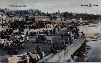
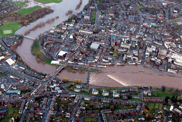
Foresight
Vision
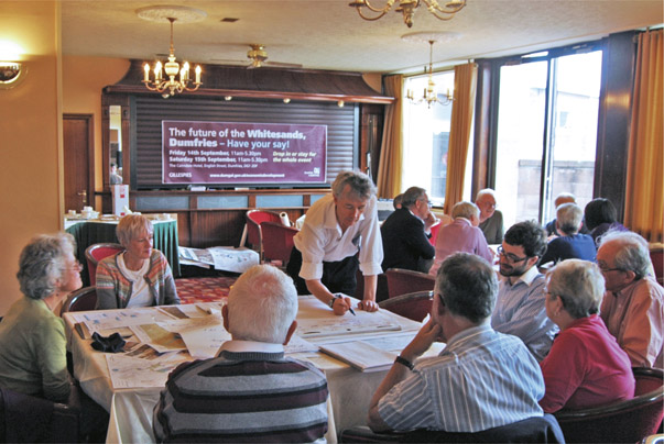
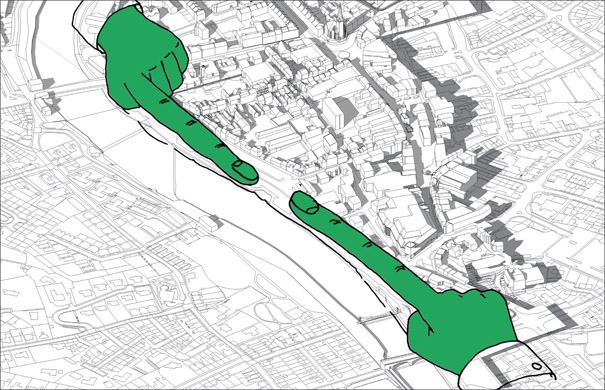
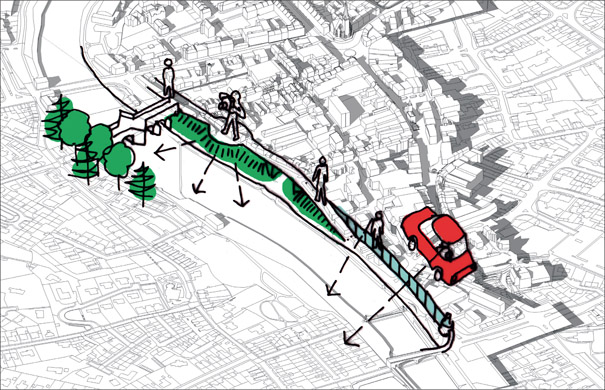
Hindsight
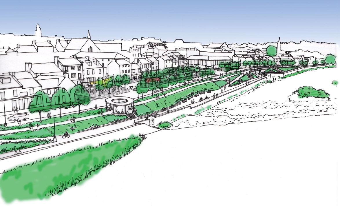
5.17 New Hamlets in the Rural Greenbelt
CADDINGTON, BEDFORDSHIRE, ENGLAND
DATE APRIL 2013 CLIENT SECTOR PRIVATE SITE RURAL SCALE NEIGHBOURHOOD VISION URBAN DESIGN GREEN DESIGN GOVERNANCE
A partnership approach between private, public and community sectors resulted in innovative and sensitive proposals for mixed-tenure housing in the rural greenbelt, with community facilities, green infrastructure and a new bus service all managed by a Community Trust.
Figure 5.17.1:
Prototype Vauxhall XVR concept car being tested at Chaul End
Caddington Woods (formerly known by the working title ‘Chaulington’) is a 27-hectare (67-acre) site in rural Bedfordshire, originally constructed by General Motors Vauxhall as a vehicle testing track. It was then used as a place to store vehicles assembled at the Luton factory. By 2013, as manufacturing processes evolved, such a large storage site was no longer needed. The site was considered potentially suitable for residential development, which would help Central Bedfordshire Council meet its housing need. However, given the site’s greenbelt setting, any such planning application would have to successfully demonstrate ‘very special circumstances’. For GM Vauxhall, which had been part of the local scene for over 100 years, redevelopment of the site was a reputational issue. The firm was keen to deliver something of high quality as a legacy to the area. With this in mind, Julian Lyon, GM Vauxhall’s European Real Estate Manager, approached Central Bedfordshire Council to discuss the site’s future. Councillor Richard Stay, former Deputy Leader of Central Bedfordshire Council and local ward member, remembers the occasion: ‘Julian contacted me and said he would like to have a conversation. We went down for a meeting and started a very successful partnership – over many months we arrived at something quite unique.’ Kevin Collins, Chair of the Slip End and Caddington Neighbourhood Plan Forum, was at the same meeting: ‘The assumption was that it would be housing, and we said
we didn’t want lots of high-density housing – we wanted something that would fit with the rural community.’
Figure 5.17.1A:
Aerial view of track
GM appointed a team, led by CBRE, with a view to using a community planning process, facilitated by John Thompson & Partners (JTP), to develop a vision for the site. After an initial meeting with community representatives at the Chaul End golf club, a sequence of steering group meetings was held to involve the community in the organisation of the ‘New Vision for Chaulington Community Planning Weekend’. Kevin Collins recalls how helpful it was for the Neighbourhood Plan Forum to be actively involved. With its links to the community, it meant that more people were encouraged to come along and participate. In the run-up to the charrette, Debbie Radcliffe, one of the team members, spent time cycling around the area, researching its history and meeting with members of the community in organised and ad hoc ways. The charrette was held in April 2013. It began with public workshops, held over two days, which gave participants the opportunity to share local knowledge and contribute to planning the future of the site. Alison Tero from CBRE recalls the welcoming atmosphere: ‘Everybody, of whatever age or role, was able to express their views and ideas – the facilitators set the tone.’ A key element of the event was the opportunity to visit the site in a minibus. This enabled people to see first-hand its special characteristics before they participated in co-design hands-on planning workshops. In most cases it changed people’s perception from ‘this is greenbelt’ to ‘this is a concrete car park’, and – more importantly – that ‘this is a screened site’. Figure 5.17.2: String of villages and hamlets along a ridge The hands-on planning sessions created clear concepts for the site. It was to be a distinct new settlement, part of the string of villages and hamlets located along a ridge, well connected to Caddington village to the south, with complementary, not competing, community facilities. Transport was also a key issue, and a proposal to provide a new subsidised bus service emerged during the charrette. The charrette team worked in a nearby hotel over the next three days to draw up the vision for the site. The illustrated masterplan showed a new development of around 325 homes divided into two hamlets, to maintain the integrity of the ‘string of villages’, with a range of house types reflecting local architectural styles and layouts, all set in a high-quality managed landscape. A village green with duck pond and a multiuse community building were located between the two hamlets. This provided a focus for the new communities, which were all connected to the bridleway and footpath network of the surrounding area. In the months following the charrette, the team drew up an outline planning application for the site, including a design code and demonstrating ‘very special circumstances’. Through this stage the residential team from CBRE market-tested the proposals with a range of developers so that when the application was submitted the team were confident it was fit for purpose.
Figure 5.17.3:
Hands-on planning group report back on emerging concepts
Figure 5.17.4:
Vignette of the village green with duck pond
Figure 5.17.5:
Aerial drawing of the vision for Chaulington
The charrette process had shown how the development could meet community needs and aspirations, while minimising impact on the greenbelt. Councillor Stay explains: ‘All the debate and dialogue enabled us to engage with our own planners, and the overall scheme went through planning with the support of the council.’
Figure 5.17.6:
Caddington Woods under construction
Once planning had been granted, the site was bought by housebuilder Redrow. At the time of writing the first phase of the new ‘Caddington Woods’ has been built and occupied, and a Community Trust is being established which will own forty-four homes in perpetuity, generating an annual rental income of over £300,000 to fund operations. These include running a new bus service, managing the multifunctional community building, and looking after the shared open space and woodland around the development. As initiator of the process, Julian Lyon reflects that ‘the charrette brought together many local people with different ages and backgrounds who found a real sense of what was possible. The principles developed at the workshops remained throughout our planning and sale process as the fundamental values and parameters for the development’.
Foresight
Vision
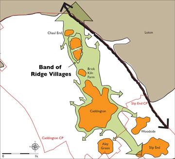
Hindsight
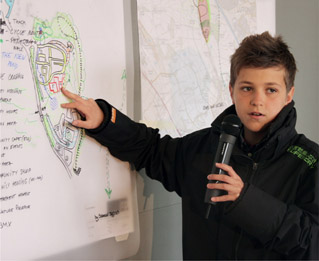
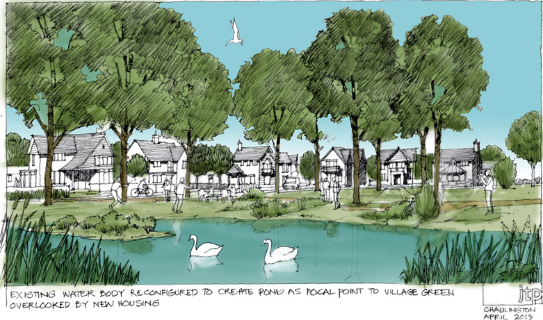
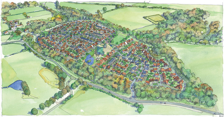
5.18 The Big Barnes Ponder
DATE OCTOBER 2013 CLIENT SECTOR COMMUNITY
BARNES, LONDON, ENGLAND SITE URBAN SCALE NEIGHBOURHOOD VISION URBAN DESIGN GOVERNANCE
An affluent suburban village community worked with professionals to address the decline of their High Street and create a holistic vision for the area’s future, and action teams to deliver it.
Barnes is a leafy and prosperous suburban village surrounded to the north by a loop of the River Thames and to the south by Barnes Common. St Mary’s parish church dates back approximately 900 years to Norman times, and the village has evolved over the centuries from being truly rural to now forming the neighbourhood heart for around 8,000 homes.
Figure 5.18.1:
Barnes Pond – the focal point of the community
In 2010 to 2011 the High Street was in trouble, with empty retail units and low footfall threatening the survival of well-
established independent shops. The situation was blamed on a combination of factors, including changes in shopping patterns, high rents and business rates, lack of ready cash following the credit crunch, and the dominance of traffic in the High Street, which created an uncomfortable environment. Figure 5.18.2: Nick Taylor from Scarborough, Barnes Town Centre Manager Emma Robinson and local MP Zac Goldsmith at the Barnes Ponder charrette Inspired by two community-based initiatives, Incredible Edible in Todmorden, Yorkshire and The People’s Supermarket in Camden, London, a group of Barnes residents came together to see what could be done, and eventually established a group called ‘Everyday Barnes’. Around this time, the UK’s coalition government commissioned retail expert Mary Portas to undertake a review of high streets in England. One of the recommendations was that communities should establish Town Teams to drive innovation and improvements in their high streets. A new Town Team was formed, and it was decided that the first step was to consult with the local community to create a vision for Barnes as a brief for future initiatives. It was agreed that a one-day charrette should be held called ‘The Big Barnes Ponder’, a pun on the local landmark of Barnes Pond.
Figure 5.18.3:
Workshop wall at the end of the session
To enable the creation of a holistic vision, the project was to be given a broad social and environmental remit, and not just cover retail and high street issues. Members of the Town Team agreed to take on tasks to organise and publicise the Ponder, which was launched two weeks before the charrette took place, by attracting young families with free face-painting for children and with huge pink bows tied to trees on Barnes Green. The Ponder was also widely publicised through local media including Barnes Community Association (BCA) Prospect magazine and the Barnes Bugle. This all created a great deal of interest and started people talking about the future of the village neighbourhood. The Big Barnes Ponder was held on Saturday 19 October 2013. It was facilitated by a team of professionals, working on an expenses-only basis. The charrette started early in the morning with a team tour of Barnes, organised by local resident and professional guide Sue Boyd. While this was happening, Ponder volunteers set up the venue with a background exhibition, workshop seating and refreshments donated by local businesses. Around eleven o’clock the Barnes community, including local Member of Parliament Zac Goldsmith, began to arrive to sign in, view the exhibition and take their seats for the workshop. After a brief introduction, the first sticky-note workshop commenced, with participants asked to consider and write down their issues, dreams and solutions for Barnes. This stimulated ninety minutes of active and progressive debate among the community. The resulting themes influenced the topics for the afternoon hands-on planning session. Six table groups focused on issues such as Getting About Barnes, Barnes Green to the River, Community Facilities and The High Street. Good-natured conversation and peals of laughter filled the room as people debated and sketched their ideas on to plans. Zac Goldsmith recalls: ‘I very much enjoyed the Ponder – the approach was getting people actively involved – bottom up has always been the best approach.’ By splitting into different work groups individuals could choose which ideas they had a passion for, look into these in more
depth, and then report back findings to everyone attending the session.
Figure 5.18.4:
Vision for closing Barnes High Street to traffic on festival and market days
People started to see a huge desire emerging to improve the village, draw the community closer together and create a more vibrant commercial environment. The public sessions finished with a way forward workshop discussion on how to move projects along and draw in more participation. At the end of the day the facilitation team held a debriefing meeting, fuelled by pizzas donated by a local restaurant. The team worked over the following days to distil the community vision, which was drawn up and reported back to the community ten days later to a packed hall. Three years on, Steven Mindel, who was active in the organisation of the charrette, had become BCA Chair. He reflects on the process: ‘You cannot downplay the importance of the Ponder – people like to talk to people. I loved the workshops and all the Post-it notes. Even with today’s sophisticated communication technology, until you speak to someone face to face and get the measure of the person you can’t do business with them.’ A key outcome from the Ponder was the setting up of six Ponder Action Teams to develop identified projects, which included a 20’s Plenty campaign to reduce speed limits, a new branding and marketing exercise for the village, and environmental improvements for Suffolk Road Recreation Ground, the High Street and along the river. Perhaps most crucially, Steven believes that the Ponder short-circuited the idea of a Neighbourhood Plan. It was undertaken with the input of experts working with the community but with nowhere near as much effort and without the cost. He says: ‘A Neighbourhood Plan can cost £60,000 to £100,000 – the Ponder was put on for just £3,000 and a lot of goodwill.’ Figure 5.18.5: New Barnes marketing logo – ‘Barnes: a welcome escape’ In response to the creation of the Ponder Vision, Richmond Council brought forward the creation of a Village Plan for Barnes, which now acts as Supplementary Planning Guidance. A visit to Barnes High Street today reveals a very different place. There is a healthy mix of national chains and independent shops, cafes and pubs, which creates a vibrant retail and community hub. An increased awareness of the High Street has encouraged people to support local shops and businesses and take part in a wide range of community and cultural activities. The new Olympic cinema, refurbished by a local couple, has created a magnet at one end of the High Street, and the recently opened M&S Foodhall is a draw at the opposite end. The result is a significant leap in footfall. The Ponder projects are starting to bear fruit. The council has invested £20,000 in a placemaking study of the High Street/Church Road corridor. There is also a focus on Suffolk Road Recreation Ground, and funds have been set aside and a friends’ group established to drive through improvements. Ambitious long-term plans are focusing on creating a new garden bridge on a disused part of Barnes Bridge, boardwalks along the river, and opening up new spaces for people to enjoy. In 2016, three years after the participatory Ponder, Barnes was rated ‘the hippest village in West London’ by a local property magazine, demonstrating that when a community comes together with a unity of purpose, much can be achieved from within the community and by attracting outside investment. The charrette enabled local people to create a community-led vision for the future of their village, and Emma Robinson, Barnes Town Centre Manager, agrees: ‘The approach to the event encouraged residents to think creatively about their dreams.’ At the time of writing, Ponder teams are still energised and working to deliver key projects with broad community support. Those at the centre of delivering the vision trace the origins of the village renaissance back to the open, participatory Big Barnes Ponder, a process run with very limited financial resources, but which released huge amounts of community goodwill and social capital.
Figure 5.18.6:
Vision for the new Barnes Garden Bridge
Foresight
Vision
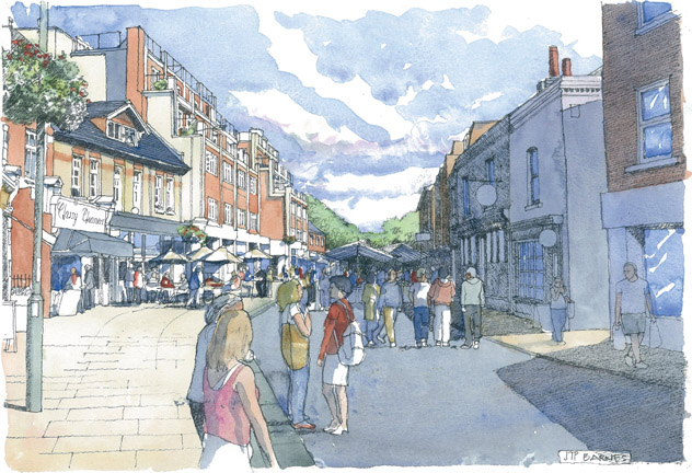
Hindsight
5.19 Designing Community Governance for a New Town
LIANGZHU CULTURAL VILLAGE, HANGZHOU, CHINA
DATE JUNE 2015 CLIENT SECTOR PRIVATE SITE URBAN SCALE TOWN VISION GOVERNANCE
A new vision was created to enable the community of a new garden town named Liangzhu Cultural Village, on a site from the 5,000-year-old Liangzhu jade culture, one of the world’s great civilisations, to develop a new structure for self-governance and a charter for the future – 5000+1.
Figure 5.19.1:
Exhibit at the Liangzhu Culture Museum
The Liangzhu culture was one of the world’s great ancient civilisations, known for its city building, advanced agricultural practices and intricately worked jade and other artefacts. The culture inhabited the wetland plain of the Yangtze River Delta between Daxiong Mountain and the Dazhe Mountains. The Liangzhu Ancient City is said to have been the largest city during this time, with an internal area of 290 hectares (more than 700 acres), and surrounded by clay walls, with six city gates. Archaeological finds date the culture to around 5,000 years ago, but the lack of finds more recent than 4,500 years old has led researchers to believe that the culture’s demise was brought about by extreme environmental changes, possibly caused by a meteor impact, which led to the flooding of the plain on which it is situated. In November 2007 the Zhejiang provincial government announced the discovery of relics related to the city wall, which located the site at the centre of the Liangzhu culture. Architect David Chipperfield was commissioned to design the new Liangzhu Culture Museum, which was completed and opened in 2008. Liangzhu Cultural Village is a new garden town located in Hangzhou’s Yuhang District, about 20 kilometres (12 miles) away from Hangzhou city centre. Vanke, China’s largest developer, started construction in 2000 and, in stark contrast to the myriad high-rise towers of Hangzhou, Liangzhu Cultural Village is a mix of apartment blocks and houses set in a stunning landscape. As
well as the museum, the village boasts a variety of attractions, including shops and restaurants, a church, a cultural centre and a children’s park. By 2015 the population had reached over 10,000, with an additional 40,000 new citizens planned by 2022. In a conscious attempt to create a strong civil society the planners drew up a ‘village treaty’, a document signed by Liangzhu’s 3,000 households. The town has been recognised as an exemplar town in China. Figure 5.19.2: Liangzhu Cultural Village central street During the early life of the new town, Vanke had acted as the town council, running and maintaining the physical and social infrastructure of the town. But, as part of its exit strategy from the town, Vanke wanted to assess the achievements of the town so far and discuss with the residents the key issues of its future development, including the town’s long-term management and governance. Commissioned by the Vanke Group, JTP held a Community Planning Weekend at Hangzhou Liangzhu Cultural Village in June 2015. The event lasted five days, and included participatory workshops for invited residents. Following a team briefing day on the Friday, more than seventy villagers joined the weekend workshops. These began on the Saturday afternoon with an introduction to the international experience of the facilitation team and the aim of the event. Residents then participated in a discussion workshop facilitated by the local Chinese-speaking team to talk about issues, dreams and solutions for the town. The UK-based team members had headsets that conveyed simultaneous translation into English. During the workshops one of the participants, Mr Shen, a resident and manager of the project, gave a presentation to stimulate debate. The presentation included the need for a town vision to create a beautiful, social and welcoming town, models for town governance and options for funding a new town council. Initially, residents were invited to talk about their ‘problems’, and this drew out, as intended, some negative issues from participants, including some directed towards Vanke. But then one of the residents suggested that rather than being negative the participants should be working together to solve problems. From this point, the atmosphere became more harmonious and constructive. On the Sunday morning, residents participated in three hands-on planning groups around plans of the new town. The themes were ‘Transportation, landscape and ecology’, ‘Community self-management organisation’ and ‘Community facilities – education, culture, art, hospital, etc.’. Participants chose which table to join, and drew out their ideas with the help of the JTP facilitation team. At the end of the session, each table selected a representative to present their group’s ideas, which revealed the wide depth and breadth of their thinking. After the Sunday workshop, the JTP team, client and representatives of the residents met again to agree the consensus from the event. This included drawing up a programme of action for one week, three months and six months in order to solve the key issues that residents had brought up. During this session the concept of ‘5000+1’ was developed to describe the new future for Liangzhu Cutural Village, which built on the Liangzhu culture’s 5,000-year history.
Figure 5.19.3:
Hands-on planning group working
The JTP team worked for the next three days to bring together recommendations for the future of the Cultural Village, which was reported back on Day five of the Community Planning Weekend. As a first step, it was explained that local residents wanted a platform for better communication to work towards a better, more beautiful Liangzhu. They also wanted to plan more community amenities and services, better integration of visitors and residents, and a new town charter and governance structure for the longer term. By initiating a collaborative planning process, Vanke as the developer enabled and created an environment of genuine engagement and interaction in which, through honest and open dialogue, consensus could be developed. At the time of writing, two years on from the Community Planning Weekend, a range of new initiatives are in place or being developed. Most importantly for the long-term future of the town, a Community Trust has been established, which will deliver a sustainable governance structure for the community.
Figure 5.19.4:
Hands-on planning report back
‘Quick wins’ have included the promotion of
the town’s identity through the production of an artist-designed ‘villager fan’, ‘villager T-shirt’ and other items. There are also more than forty active interest groups, such as a new mum’s group and a foodie group. The elderly people’s quarter is thriving, with a range of activities focusing on elderly people and their families. Figure 5.19.5: Participants at the charrette The Liangzhu Centre of Arts, designed by Japanese architect Tadao Ando, is now open as a place for Liangzhu villagers to gather together for talks, events and sharing sessions. Mr Shen advises that most community events are still organised by Vanke. It may be some time before the community runs the centre, but there is a positive belief that this time will come. At the end of the Community Planning Weekend the community was highly motivated and expressed a desire to take more responsibility for managing the town together with the developer and the government. The process injected great confidence and spirit into the community, enabling it to move forward.
Foresight
Vision

Hindsight

5.20 An Alternative Vision for Paddington Place
PADDINGTON, LONDON, ENGLAND
DATE MAY 2016 CLIENT SECTOR THIRD SITE URBAN SCALE NEIGHBOURHOOD VISION URBAN DESIGN
A charrette process was used as a quick and effective way to create an alternative community-backed vision for a masterplan-based approach to a controversial development proposal.
In January 2016, following a public outcry, the proposal for a seventy-two-storey tower designed by Renzo Piano, nicknamed the ‘Paddington Pole’, was withdrawn. The Great Western Developments Ltd scheme had sought to create a new ‘gateway’ for Paddington station and neighbouring St Mary’s Hospital, deliver improvements to the Network Rail and tube stations, and provide housing and commercial uses as well as new public realm.
Figure 5.20.1:
View from Paddington station to the former Royal Mail sorting office
Figure 5.20.2:
Consensus masterplan
Create Streets, a thinktank focusing on towns and cities, launched an open ideas competition to find a new high-quality alternative scheme for Paddington to encourage public debate and influence future proposals. The competition site area was bigger than that of the Paddington Pole proposal to encourage a more integrated and strategic masterplanning approach. The site lies next to one of the city’s most important train stations – Paddington, with its Grade I listed train shed. It is also close to conservation areas, historic buildings and Royal Parks. Architects JTP teamed up with Civic Voice, the national charity for the civic movement in England, to hold a Community Planning Weekend to demonstrate how the participatory charrette process, involving the community working with professionals, could create viable alternative proposals for a complex inner-city site over a few days. Civic Voice has a network of over 75,000 individual members and its mission is the
development of a society where everyone can say ‘I care about where I live’.
Figure 5.20.3:
Design workshop
People movement experts Movement Strategies and crowd movement analysts Disperse also joined the team. Over the course of the May Day bank holiday, local people and others with an interest in the future of Paddington were invited to participate in two days of workshops and walkabouts to create a new vision for the site and its relationship with the surrounding area. They shared their ideas to the design team through walkabouts, workshops and hands-on planning groups. The community were supportive of the comprehensive, mixed-use regeneration of this important area – but they wanted to see the site planned in a historically sensitive manner and at an appropriate scale to create an attractive, vibrant new heart for Paddington. Other themes to emerge from the process were that:
Figure 5.20.4:
Vision for Paddington Place with refurbished sorting office building
These themes were central to the design produced by the JTP team following the Community Planning Weekend. After a few days of intensive team working, the consensus vision was reported back to the community on 3 May 2016. The design proposals reflected the desire for an integrated and animated network of streets and spaces for Paddington Place. In this respect the local community’s wishes corresponded to the timeless principles of walkable urbanism and sustainable placemaking. Following the presentation, the vision was submitted as the entry to the Create Streets design competition. JTP and Civic Voice were awarded joint first prize for their competition entry. Sophie Massey Cook, one of the judges, said: ‘We were impressed by the level of community participation undertaken in such a short timeframe. We were also impressed by the urban fabric, and the quality of the public spaces and blocks.’ The prizes were awarded by journalist Sir Simon Jenkins at a ceremony in July 2016. Nicholas Boys Smith, of the thinktank, concluded: ‘Civic Voice and JTP’s submission shows that you can work rapidly and productively with a local community to achieve intense and potentially beautiful urban development proposals. With widespread coverage in the London media the Paddington Pole competition helped move the debate on from simple opposition to oversized development to pragmatic support for a street-based alternative.’ In the months following the competition a new proposal designed by Renzo Piano was unveiled by the developers for a nineteen-storey office building, which was given the nickname the Paddington Cube. Although the scheme evoked further criticism, including for its design and the lack of housing, many people felt that some elements, particularly in relation to the public realm and pedestrian movement, had been improved. Despite a further campaign against the new scheme and many objections, planning approval was granted by Westminster City Council in early 2017.
Figure 5.20.5:
The Mint Yard – internal public square
Foresight
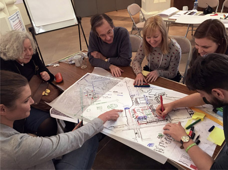
Vision
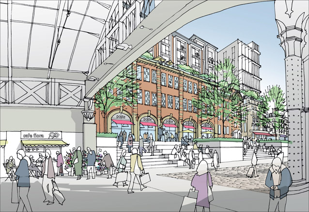
Hindsight