
Costa Rica's largest lake, sited beneath the Arenal volcano, attracts anglers and watersports enthusiasts; yet its waters have also been used to create clean energy in a hydroelectric power plant at Presa Sangregado.
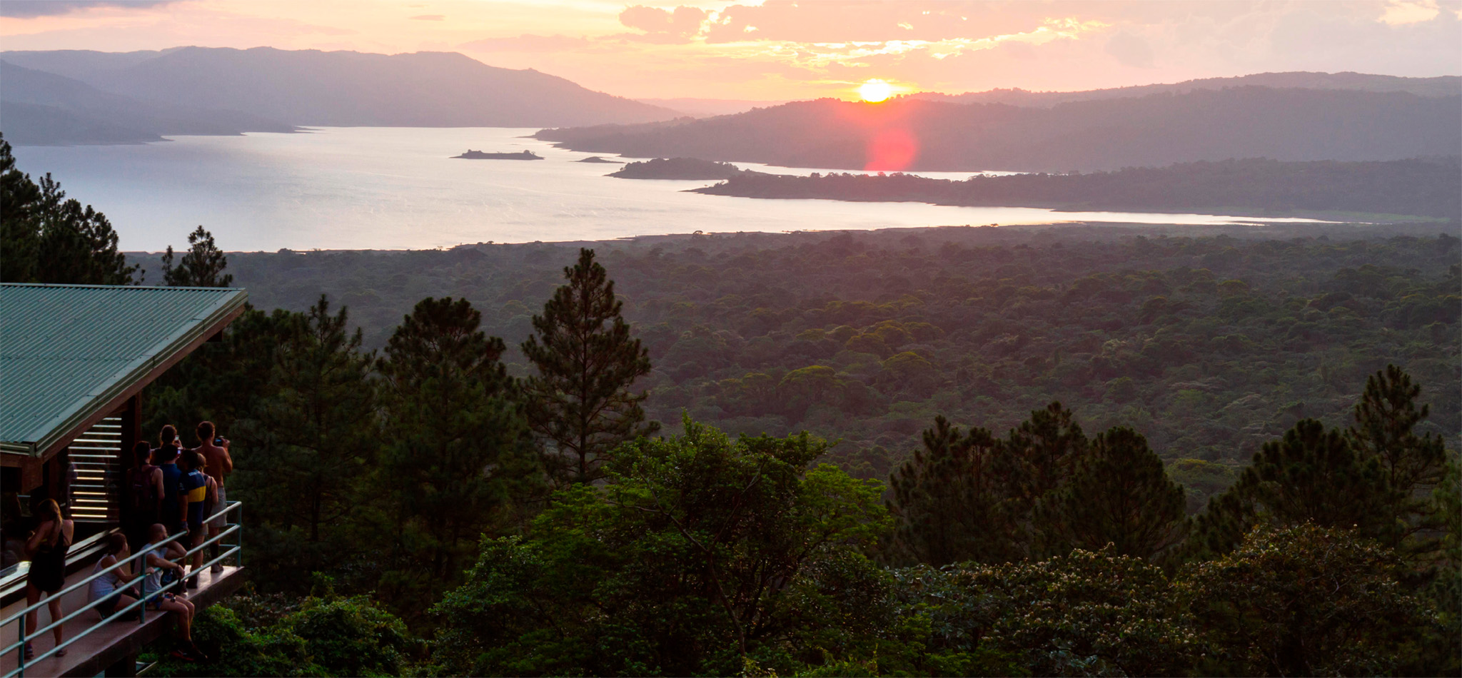
t Lake vistas from Volcán Arenal, as the sun drops behind distant hills
Experience Northern Zone

n Double-tap image to read the labels
Ringed by hills, with Volcán Arenal standing tall to the east, Lake Arenal has a breathtaking setting at an elevation of 1,800 ft (540 m). Created in the 1970s when the Instituto Costarricense de Electricidad (ICE) dammed the eastern end of the valley, the 48-sq-mile (124-sq-km) lake fills a tectonic depression that forms a gap between Tilarán and the Cordillera de Guanacaste.
Archaeologists have identified the remains of pre-Columbian settlements in the area. Today, the lake is ringed by small hamlets; the sole township is Nuevo Arenal, on the lake’s north shore. The hotels and restaurants lining this side of the lake make a pleasant break from driving. The easternmost shores are forest-clad, while huge swaths of verdant pasture lie to the south and west. Lake Arenal is encircled to the west and north by the winding Route 142, which links Tilarán with La Fortuna. East of Nuevo Arenal, the road deteriorates and is frequently blocked by landslides.
The lake is swept by near-constant winds, providing windsurfers with world-class conditions. However, the greatest attractions of the area are the picture-postcard vistas of majestic Arenal volcano reflected in the lake, which are best appreciated from the southwest shore.
Volcán Arenal, which dominates the landscape, adds another element to the attractions around the lake, in the form of bubbling hot springs. These range from low-key pools, ideal for an informal soak, to luxurious spa resorts, and can be the perfect end to a day of hiking or lake activities.
Did You Know?
Of the three craters created by the 1968 eruption of Volcan Arenal, only one still exists today.
The dirt road along the southeastern shore of Lake Arenal leads past Parque Nacional Volcán Arenal to Rancho Margot, a self-sustainable organic farm, hotel, and activity center beside the Río Caño Negro. Educational tours of the eco-oriented farm, including cow milking, give fascinating insights into sustainable agriculture. Visitors can also enjoy the wildlife rescue, rehabilitation, and breeding center. Many sporting enthusiasts come here for activities such as kayaking, horseback riding, fishing, and hiking in Rancho Margot’s forest reserve. There are also twice-daily yoga sessions, spa treatments, and Spanish classes on offer. Meals are served in a colonial farmstead.
Experience Northern Zone
Wind Turbines
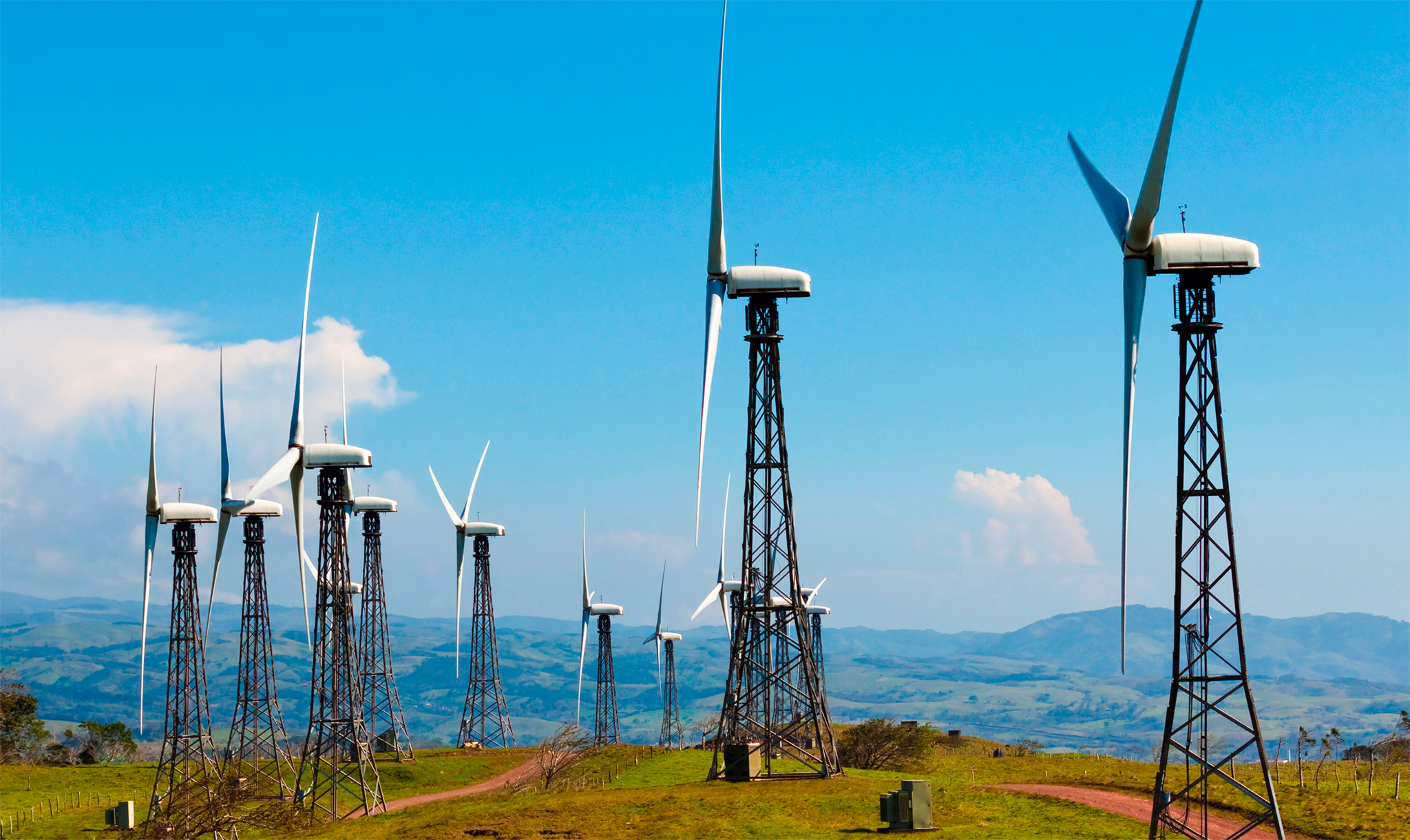
Rising over emerald pastures on the western shores of Lake Arenal, two parallel ridge crests are dotted with over 100 wind turbines, each 120 ft (35 m) high. Situated near the village of Tejona, which has some of the highest average wind speeds in the world, this wind farm is the largest in Central America, with a projected annual production of up to 70 MW. Electricity is sold to the state-owned ICE (Instituto Costarricense de Electricidad), adding to the country's admirable levels of sustainable energy.
Replacing the old village, which was flooded in 1973 by the formation of the lake, this orderly town is a service center for the lake region. It has the area’s only fuel station as well as a number of good restaurants. A dirt road leads north through the valley of the Río Quequer, linking Nuevo Arenal to San Rafael on scenic Highway 4.
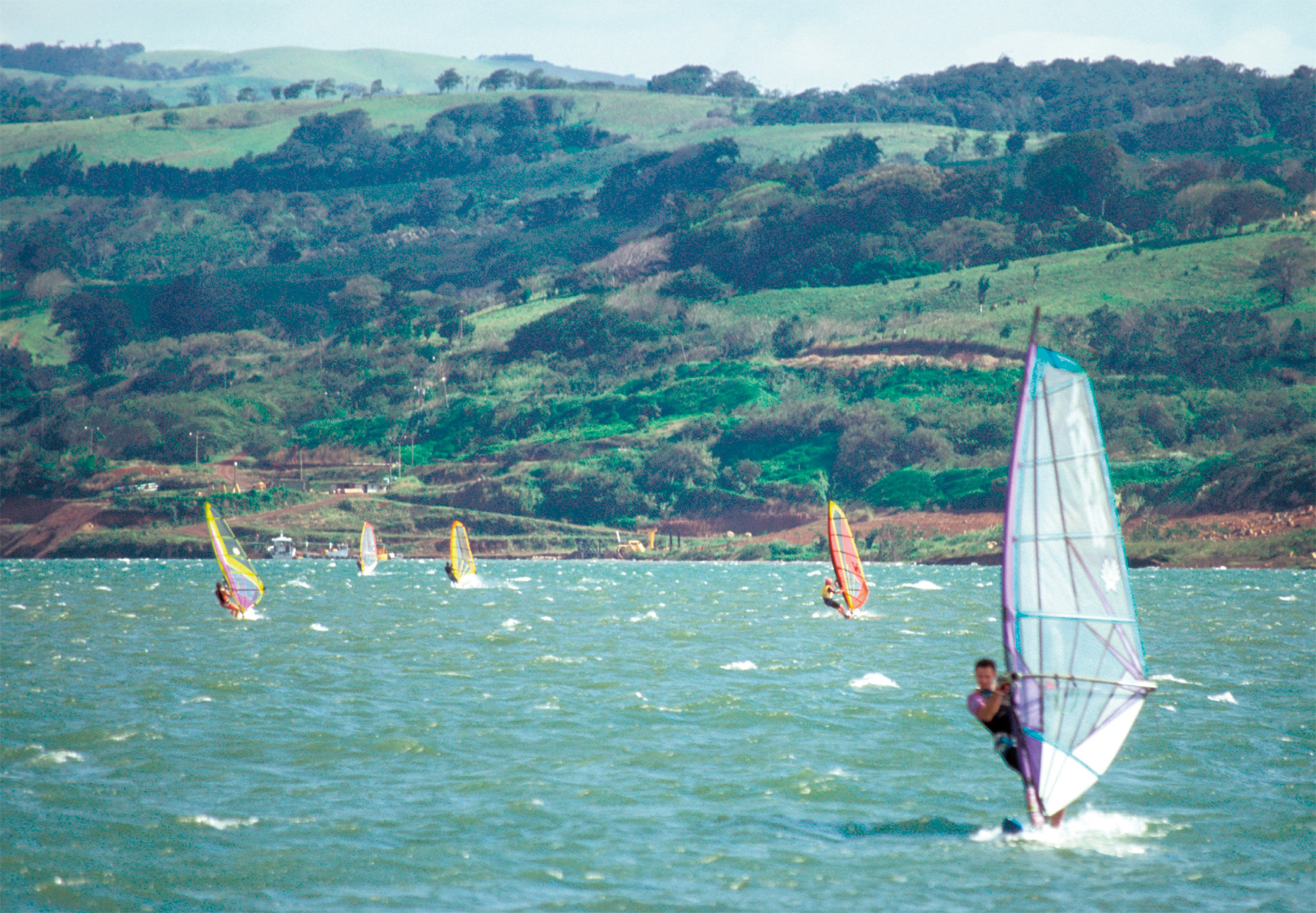
t Windsurfers skimming the suitably windswept waters of picturesque Lake Arenal
Swept by steady, strong northeasterly winds between November and March, Lake Arenal is rated as one of the finest windsurfing sites in the world. The Tico Windsurf Center, located southwest of Nuevo Arenal, caters for all levels of windsurfers and kitesurfers. In addition to renting out sailboards and stand-up paddleboards, it offers multiday packages and beginners’ and advanced lessons between the months of November and April. As water levels fluctuate during the year, islands appear and disappear, making navigation part of the fun during low-water level periods.
This 288-ft- (88-m-) long, 184-ft- (56-m-) high earthen dam was completed in 1979 across the path of RÍo Arenal in order to create the lake. Today the dam generates 12 percent of the country’s clean energy.

t The colorful entrance to Toad Hall, an ideal stop off point for a bit of art
This well-restored hacienda has reaching views across the lake and the surrounding forest. Tours of the area and into Parque Nacional Volcán Arenal can be arranged, and art supplies are left out for visitors in the popular café.

INSIDER TIP
Cute Coatis
Although they are adorable, resist the urge to feed the coatis that often wait along the roadside for tourists to stop. Not only is it illegal, it is dangerous to the animals’ health.
Experience Northern Zone
Volcanoes in Costa Rica
Located in one of the world's most volcanic zones, Costa Rica has seven active volcanoes and at least 60 that are either dormant or extinct. Concentrated in the northwestern and central regions, most are steep-sided cones formed by silica-rich magma, and are highly explosive. Arenal is the most active.

t Illustration of the plates beneath the earth’s crust
Volcanoes are created by plate tectonics, the movement of the interlocking plates that make up the earth’s crust riding on the magma (molten rock) in the mantle. Most volcanoes occur at the boundaries where plates meet or move apart, with magma bursting through cracks.
Lying between 100 and 150 miles (160–240 km) inland of the subduction zone of the Cocos and the Caribbean plates, Costa Rica’s landmass sits on the Caribbean plate, beneath which the thinner east-moving Cocos plate is being forced down. This intense pressure melts the rocks and magma wells up to create volcanoes.
Smoke and ash are often steadily emitted by active volcanoes, such as Volcán Arenal, even when "resting", and smoking cinder blocks sometimes roll down the slopes. During its active phase, Arenal will erupt every few hours, with hot lava oozing down its slopes and superheated avalanches of gas, ash, and rock moving at astonishing speeds.

t Clouds of steam puffing atmospherically from vents around the lake-filled crater of Volcán Poas, which has erupted 40 times since 1828