A Driving Tour
Sierra de Francia and Sierra de Béjar

n Locator Map (for more detail see Area Map)
These attractive schist hills buttress the western edges of the Sierra de Gredos. Narrow roads wind their way through picturesque chestnut, olive and almond groves, and quaint rural villages of wood and stone. The highest point of the range is La Peña de Francia, which, at 1,732 m (5,700 ft), is easily recognizable from miles around. The views from the peak, and from the roads leading up to it, offer a breathtaking panorama of the surrounding empty plains and rolling hills.
EXPERIENCE Castilla y León
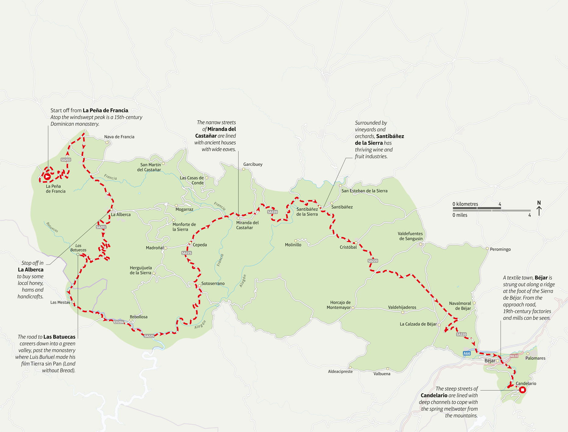
n Double-tap image to read the labels
Length 72 km (45 miles)
Stopping-off points Candelario, Miranda del Castañar and La Alberca all have good eating places, and are renowned for their hams and sausages
Terrain Narrow, winding roads climb up steep mountains
Did You Know?
The Sierra de Francia is home to one of the highest shrines to the Virgin Mary in the world.