
1
Introduction to Satellites and their Applications
The word ‘Satellite’ is a household name today. It sounds so familiar to everyone irrespective of educational and professional background. It is no longer the prerogative of a few select nations and not a topic of research and discussion that is confined to the premises of big academic institutes and research organizations. It is a subject of interest and discussion not only to electronics and communication engineers, scientists and technocrats; it fascinates hobbyists, electronics enthusiasts and to a large extent, everyone.
In the present chapter, the different stages of evolution of satellites and satellite launch vehicles will be briefly discussed, beginning with the days of hot air balloons and sounding rockets of the late 1940s/early 1950s to the contemporary status.
1.1 Ever-expanding Application Spectrum
What has made this dramatic transformation possible is the manifold increase in the application areas where the satellites have been put to use. The horizon of satellite applications has extended far beyond providing intercontinental communication services and satellite tele-vision. Some of the most significant and talked about applications of satellites are in the fields of remote sensing and Earth observation. Atmospheric monitoring and space exploration are the other major frontiers where satellite usage has been exploited a great deal. Then there are the host of defence related applications, which include secure communications, navigation, spying and so on.
The areas of application are multiplying and so is the quantum of applications in each of those areas. For instance, in the field of communication related applications, it is not only the long distance telephony and video and facsimile services that are important; satellites are playing an increasing role in newer communication services such as data communication, mobile communication, and so on. Today, in addition to enabling someone to talk to another person thousands of miles away from the comfort of home or bringing cultural, sporting or political events from all over the globe live on television, satellites have made it possible for all to talk to anyone anywhere in the world, with both people being able to talk while being mobile. Video conferencing, where different people at different locations, no matter how far the distance is between these locations, can hold meetings in real time to exchange ideas or take important decisions, is a reality today in big establishments. The Internet and the revolutionary services it has brought are known to all of us. Satellites are the backbone of all these happenings.
A satellite is often referred to as an ‘orbiting radio star’ for reasons that can be easily appreciated. These so-called orbiting radio stars assist ships and aircraft to navigate safely in all weather conditions. It is interesting to learn that even some categories of medium to long range ballistic and cruise missiles need the assistance of a satellite to hit their intended targets precisely. The satellite-based global positioning system (GPS) is used as an aid to navigate safely and securely in unknown territories.
Earth observation and remote sensing satellites give information about the weather, ocean conditions, volcanic eruptions, earthquakes, pollution and health of agricultural crops and forests. Another class of satellites keeps watch on military activity around the world and helps to some extent in enforcing or policing arms control agreements.
Although mankind is yet to travel beyond the moon, satellites have crossed the solar system to investigate all planets. These satellites for astrophysical applications have giant telescopes on board and have sent data that has led to many new discoveries, throwing new light on the universe. It is for this reason that almost all developed nations including the United States, the United Kingdom, France, Japan, Germany, Russia and major developing countries like India have a fully-fledged and heavily funded space programme, managed by organizations with massive scientific and technical manpower and infrastructure.
1.2 What is a Satellite?
A satellite in general is any natural or artificial body moving around a celestial body such as a planet or a star. In the present context, reference is made only to artificial satellites orbiting the planet Earth. These satellites are put into the desired orbit and have payloads depending upon the intended application.
The idea of a geostationary satellite originated from a paper published by Arthur C. Clarke, a science fiction writer, in Wireless World magazine in the year 1945. In that proposal, he emphasized the importance of this orbit whose radius from the centre of Earth was such that the orbital period equalled the time taken by Earth to complete one rotation around its axis. He also highlighted the importance of an artificial satellite in this orbit having the required instrumentation to provide intercontinental communication services because such a satellite would appear to be stationary with respect to an observer on the surface of Earth. Though the idea of a satellite originated from the desire to put an object in space that would appear to be stationary with respect to Earth's surface, thus making possible a host of communication services, there are many other varieties of satellites where they need not be stationary with respect to an observer on Earth to perform the intended function.
A satellite while in orbit performs its designated role throughout its lifetime. A communication satellite (Figure 1.1) is a kind of repeater station that receives signals from the ground, processes them and then retransmits them back to Earth. An Earth observation satellite (Figure 1.2) is equipped with a camera to take photographs of regions of interest during its periodic motion. A weather forecasting satellite (Figure 1.3) takes photographs of clouds and monitors other atmospheric parameters, thus assisting the weatherman in making timely and accurate forecasts.

Figure 1.1 Communication satellite

Figure 1.2 Earth observation satellite

Figure 1.3 Weather forecasting satellite (Courtesy: NOAA and NASA)
A satellite could effectively do the job of a spy in the case of some purpose-built military satellites (Figure 1.4) or of an explorer when suitably equipped and launched for astrophysical applications (Figure 1.5).
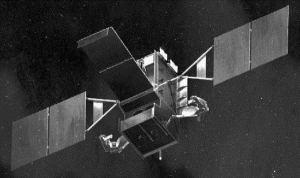
Figure 1.4 Military satellite (Courtesy: Lockheed Martin Corporation)
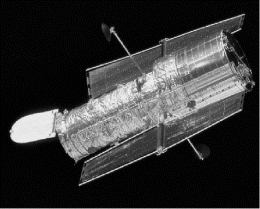
Figure 1.5 Scientific satellite (Courtesy: NASA and STScl)
1.3 History of the Evolution of Satellites
It all began with an article by Arthur C. Clarke published in the October 1945 issue of Wireless World, which theoretically proposed the feasibility of establishing a communication satellite in a geostationary orbit. In that article, he discussed how a geostationary orbit satellite would look static to an observer on Earth within the satellite's coverage, thus providing an uninterrupted communication service across the globe. This marked the beginning of the satellite era. The scientists and technologists started to look seriously at such a possibility and the revolution it was likely to bring along with it.
1.3.1 Era of Hot Air Balloons and Sounding Rockets
The execution of the mission began with the advent of hot air balloons and sounding rockets used for the purpose of the aerial observation of planet Earth from the upper reaches of Earth's atmosphere. The 1945–1955 period was dominated by launches of experimental sounding rockets to penetrate increasing heights of the upper reaches of the atmosphere. These rockets carried a variety of instruments to carry out their respective mission objectives.
A-4 (V-2) rockets used extensively during the Second World War for delivering explosive warheads attracted the attention of the users of these rockets for the purpose of scientific investigation of the upper atmosphere by means of a high altitude rocket. With this started the exercise of modifying these rockets so that they could carry scientific instruments. The first of these A-4 rockets to carry scientific instruments to the upper atmosphere was launched in May 1946 (Figure 1.6). The rocket carried an instrument to record cosmic ray flux from an altitude of 112 km. The launch was followed by several more during the same year.

Figure 1.6 First A-4 rocket to be launched (Courtesy: NASA)
The Soviets, in the meantime, made some major modifications to A-4 rockets to achieve higher performance levels as sounding rockets. The last V-2A rocket (the Soviet version of the modified A-4 rocket), made its appearance in 1949. It carried a payload of 860 kg and attained a height of 212 km.
1.3.2 Launch of Early Artificial Satellites
The United States and Russia were the first two countries to draw plans for artificial satellites in 1955. Both countries announced their proposals to construct and launch artificial satellites. It all happened very quickly. Within a span of just two years, Russians accomplished the feat and the United States followed quickly thereafter.
Sputnik-1 (Figure 1.7) was the first artificial satellite that brought the space age to life. Launched on 4 October 1957 by Soviet R7 ICBM from Baikonur Cosmodrome, it orbited Earth once every 96 minutes in an elliptical orbit of 227 km × 941 km inclined at 65.1° and was designed to provide information on density and temperature of the upper atmosphere. After 92 successful days in orbit, it burned as it fell from orbit into the atmosphere on 4 January 1958.

Figure 1.7 Sputnik-1 (Courtesy: NASA)
Sputnik-2 and Sputnik-3 followed Sputnik-1. Sputnik-2 was launched on 3 November 1957 in an elliptical orbit of 212 km × 1660 km inclined at 65.33°. The satellite carried an animal, a female dog named Laika, in flight. Laika was the first living creature to orbit Earth. The mission provided information on the biological effect of the orbital flight. Sputnik-3, launched on 15 May 1958, was a geophysical satellite that provided information on Earth's ionosphere, magnetic field, cosmic rays and meteoroids. The orbital parameters of Sputnik-3 were 217 km (perigee), 1864 km (apogee) and 65.18° (orbital inclination).
The launches of Sputnik-1 and Sputnik-2 had both surprised and embarrassed the Americans as they had no successful satellite launch to their credit till then. They were more than eager to catch up. Explorer-1 (Figure 1.8) was the first satellite to be successfully launched by the United States. It was launched on 31 January 1958 by Jupiter-C rocket from Cape Canaveral. The satellite orbital parameters were 360 km (perigee), 2534 km (apogee) and 33.24° (orbital inclination). Explorer's design was pencil-shaped, which allowed it to spin like a bullet as it orbited the Earth. The spinning motion provided stability to the satellite while in orbit. Incidentally, spin stabilization is one of the established techniques of satellite stabilization. During its mission, it discovered that Earth is girdled by a radiation belt trapped by the magnetic field.
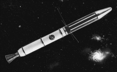
Figure 1.8 Explorer-1 (Courtesy: NASA/JPL-Caltech)
After the successful launch of Explorer-1, there followed in quick succession the launches of Vanguard-1 on 5 February 1958, Explorer-2 on 5 March 1958 and Vanguard-1 (TV-4) on 17 March 1958 (Figure 1.9). The Vanguard-1 and Explorer-2 launches were unsuccessful. The Vanguard-1 (TV-4) launch was successful. It was the first satellite to employ solar cells to charge the batteries. The orbital parameters were 404 km (perigee), 2465 km (apogee) and 34.25° (orbital inclination). The mission carried out geodetic studies and revealed that Earth was pear-shaped.
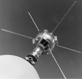
Figure 1.9 Vanguard-1 (TV-4) (Courtesy: NASA)
1.3.3 Satellites for Communications, Meteorology and Scientific Exploration –Early Developments
Soviet experiences with the series of Sputnik launches and American experiences with the launches of the Vanguard and Explorer series of satellites had taken satellite and satellite launch technology to sufficient maturity. The two superpowers by then were busy extending the use of satellites to other possible areas such as communications, weather forecasting, navigation and so on. The 1960–1965 period saw the launches of experimental satellites for the above-mentioned applications. 1960 was a very busy year for the purpose. It saw the successful launches of the first weather satellite in the form of TIROS-1 (television and infrared observation satellite) (Figure 1.10) on 1 April 1960, the first experimental navigation satellite Transit-1B on 13 April 1960, the first experimental infrared surveillance satellite MIDAS-2 on 24 May 1960, the first experimental passive communications satellite Echo-1 (Figure 1.11) on 14 August 1960 and the active repeater communications satellite Courier-1B (Figure 1.12) on 4 October 1960. In addition, that year also saw successful launches of Sputnik-5 and Sputnik-6 satellites in August and December respectively.
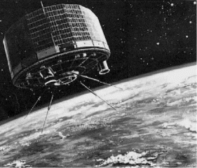
Figure 1.10 TIROS-1 (Courtesy: NASA)

Figure 1.11 Echo-1 (Courtesy: NASA)
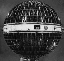
Figure 1.12 Courier-1B (Courtesy: US Army)
While the TIROS-1 satellite with two vidicon cameras on board provided the first pictures of Earth, the Transit series of satellites was designed to provide navigational aids to the US Navy with positional accuracy approaching 160 m. The Echo series of satellites, which were aluminized Mylar balloons acting as passive reflectors to be more precise, established how two distantly located stations on Earth could communicate with each other through a space-borne passive reflector. It was followed by Courier-1B, which established the active repeater concept. The MIDAS (missile defense alarm system) series of early warning satellites established beyond any doubt the importance of surveillance from space-borne platforms to locate and identify the strategic weapon development programme of an adversary. Sputnik-5 and Sputnik-6 satellites further studied the biological effect of orbital flights. Each spacecraft had carried two dog passengers.
1.3.4 Non-geosynchronous Communication Satellites: Telstar and Relay Programmes
Having established the concept of passive and active repeater stations to relay communication signals, the next important phase in satellite history was the use of non-geostationary satellites for intercontinental communication services. The process was initiated by the American Telephone and Telegraph (AT&T) seeking permission from the Federal Communications Commission (FCC) to launch an experimental communications satellite. This gave birth to the Telstar series of satellites. The Relay series of satellites that followed the Telstar series also belonged to the same class.
In the Telstar series, Telstar-1 (Figure 1.13), the first true communications satellite and also the first commercially funded satellite, was launched on 10 July 1962, followed a year later by Telstar-2 on 7 May 1963. Telstar-2 had a higher orbit to reduce exposure to the damaging effect of the radiation belt. The Telstar-1 with its orbit at 952 km (perigee) and 5632 km (apogee) and an inclination of 44.79° began the revolution in global TV communication from a non-geosynchronous orbit. It linked the United States and Europe.
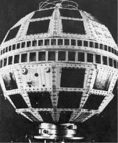
Figure 1.13 Telstar-1 (Courtesy: NASA)
Telstar-1 was followed by Relay-1 (NASA prototype of an operational communication satellite) launched on 13 December 1962. Relay-2, the next satellite in the series, was launched on 21 January 1964. The orbital parameters of Relay-1 were 1322 km (perigee), 7439 km (apogee) and 47.49° (inclination). The mission objectives were to test the transmissions of television, telephone, facsimile and digital data.
It is worthwhile mentioning here that both the Telstar and Relay series of satellites were experimental vehicles designed to discover the limits of satellite performance and were just a prelude to much bigger events to follow. For instance, through Telstar missions, scientists came to discover how damaging the radiation could be to solar cells. Though the problem has been largely overcome through intense research, it still continues to be the limiting factor on satellite life.
1.3.5 Emergence of Geosynchronous Communication Satellites
The next major milestone in the history of satellite technology was Arthur C. Clarke's idea becoming a reality. The golden era of geosynchronous satellites began with the advent of the SYNCOM (an acronym for synchronous communication satellite) series of satellites developed by the Hughes Aircraft Company. This compact spin-stabilized satellite was first shown at the Paris Air Show in 1961. SYNCOM-1 was launched in February 1963 but the mission failed shortly after. SYNCOM-2 (Figure 1.14), launched on 26 July 1963, became the first operational geosynchronous communication satellite. It was followed by SYNCOM-3, which was placed directly over the equator near the international date line on 19 August 1964. It was used to broadcast live the opening ceremonies of the Tokyo Olympics. That was the first time the world began to see the words ‘live via satellite’ on their television screens.

Figure 1.14 SYNCOM-2 (Courtesy: NASA)
Another significant development during this time was the formation of INTELSAT (International Telecommunications Satellite Organization) in August 1964 with COMSAT (Communication Satellite Corporation) as its operational arm. INTELSAT achieved a major milestone with the launch of the Intelsat-1 satellite, better known as ‘Early Bird’ (Figure 1.15), on 5 April 1965 from Cape Canaveral. Early Bird was the first geostationary communications satellite in commercial service. It went into regular service in June 1965 and provided 240 telephone circuits for connectivity between Europe and North America. Though designed for an expected life span of only 18 months, it remained in service for more than three years.
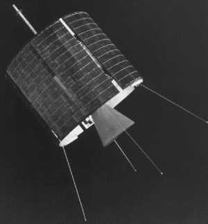
Figure 1.15 Intelsat-1 (Reproduced by permission of © Intelsat)
While the Americans established their capability in launching communications satellites through launches of SYNCOM series of satellites and Early Bird satellite during the 1960–1965 era, the Soviets did so through their Molniya series of satellites beginning April 1965. The Molniya series of satellites (Figure 1.16) were unique in providing uninterrupted 24 hours a day communications services without being in the conventional geostationary orbit. These satellites pursued highly inclined and elliptical orbits, known as the Molniya orbit (Figure 1.17), with apogee and perigee distances of about 40 000 km and 500 km and orbit inclination of 65°. Two or three such satellites aptly spaced apart in the orbit provided uninterrupted service. Satellites in such an orbit with a 12 hour orbital period remained over the countries of the former Soviet bloc in the northern hemisphere for more than 8 hours. The Molniya-1 series was followed later by the Molniya-2 (in 1971) and the Molniya-3 series (in 1974).
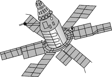
Figure 1.16 Molniya series satellite

Figure 1.17 Molniya orbit
1.3.6 International Communication Satellite Systems
The Intelsat-1 satellite was followed by the Intelsat-2 series of satellites. Four Intelsat-2 satellites were launched in a span of one year from 1966 to 1967. The next major milestone vis-à-vis communication satellites was achieved with the Intelsat-3 series of satellites (Figure 1.18) becoming fully operational. The first satellite in the Intelsat-3 series was launched in 1968. These satellites were positioned over three main oceanic regions, namely the Atlantic, the Pacific and the Indian Oceans, and by 1969 they were providing global coverage for the first time. The other new concept tried successfully with these satellites was the use of a de-spun antenna structure, which allowed the use of a highly directional antenna on a spin-stabilized satellite. The satellites in the Intelsat-1 and Intelsat-2 series had used omnidirectional antennas.

Figure 1.18 Intelsat-3 (Reproduced by permission of © Intelsat)
The communication satellites' capabilities continued to increase with almost every new venture. With the Intelsat-4 satellites (Figure 1.19), the first of which was launched in 1971, the satellite capacity got a big boost. Intelsat-4A series introduced the concept of frequency re-use. The frequency re-use feature was taken to another dimension in the Intelsat-5 series with the use of polarization discrimination. While frequency re-use, i.e. use of the same frequency band, was possible when two footprints were spatially apart, dual polarization allowed the re-use of the same frequency band within the same footprint. The Intelsat-5 satellites (Figure 1.20), the first of which was launched in 1980, used both C band and Ku band transponders and were three-axis stabilized. The satellite transponder capacity has continued to increase through the Intelsat-6, Intelsat-7 and Intelsat-8 series of satellites launched during the 1980s and 1990s. Intelsat-9 and Intelsat-10 series were launched in the first decade of the new millennium. These series of satellites were followed by a number of more launches. As of October 2013, Intelsat operated 28 satellites and supports more than 30 DTH platforms world-wide.
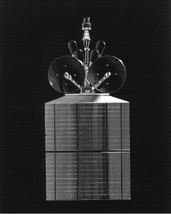
Figure 1.19 Intelsat-4 (Reproduced by permission of © Intelsat)

Figure 1.20 Intelsat-5 (Reproduced by permission of © Intelsat)
The Russians have also continued their march towards development and launching of communication satellites after their success with the Molniya series. The Raduga series (International designation: Statsionar-1), the Ekran series (international designation: Statsionar-T), shown in Figure 1.21, Ekspress-AM series, Molniya series and the Gorizont series (international designation: Horizon) are the latest in communication satellites from the Russians. All three employ the geostationary orbit.
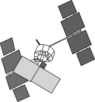
Figure 1.21 Ekran series
1.3.7 Domestic Communication Satellite Systems
Beginning in 1965, the Molniya series of satellites established the usefulness of a domestic communications satellite system when it provided communications connectivity to a large number of republics spread over the enormous land-mass of the former Soviet Union. Such a system was particularly attractive to countries having a vast territory. Canada was the first non-Soviet country to have a dedicated domestic satellite system with the launch of the Anik-A series of satellites (Figure 1.22), beginning in 1972. The capabilities of these satellites were subsequently augmented with the successive series of Anik satellites, named Anik-B (beginning 1978), Anik-C (beginning 1982), Anik-D (also beginning 1982), Anik-E (beginning 1991), Anik-F (beginning 2000) and Anik-G (beginning 2013). Anik-G1, first satellite in the series, is a multi-mission satellite designed to provide direct-to-home (DTH) television service in Canada and also broadband voice, data and video services in South America. The satellite was launched on April 16, 2013 by Proton/Breeze-M rocket.
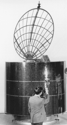
Figure 1.22 Anik-A (Courtesy: Telesat Canada)
The United States began its campaign for development of domestic satellite communication systems with the launch of Westar satellite in 1974, Satcom satellite in 1975 and Comstar satellite in 1976. Satcom was also incidentally the first three-axis body-stabilized geostationary satellite. These were followed by many more ventures. Europe began with the European communications satellite (ECS series) and followed it with the Eutelsat-II series (Figure 1.23) and Eutelsat-W series of satellites. In addition to the Eutelsat satellites, other series of satellites, namely the Hot Bird, Eurobird and Atlantic Bird series, were launched to expand the horizon of the services offered and the coverage area of the satellites of the EUTELSAT organization. In 2012, EUTELSAT renamed all the satellite series under the brand name of Eutelsat.
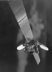
Figure 1.23 Eutelsat-II (Reproduced by permission of © Eutelsat)
Indonesia was the first developing nation to recognize the potential of a domestic communication satellite system and had the first of the Palapa satellites placed in orbit in 1977 to link her scattered island nation. The Palapa series of satellites have so far seen four generations named Palapa-A (beginning 1977), Palapa-B (beginning 1984), Palapa-C (beginning 1991) and Palapa-D (beginning 2009). Palapa-D was launched on August 31, 2009 aboard Chinese Long March 3B rocket.
India, China, Saudi Arabia, Brazil, Mexico and Japan followed suit with their respective domestic communication satellite systems. India began with the INSAT-1 series of satellites in 1981 and has already entered the fourth generation of satellites with the INSAT-4 series. INSAT-4CR (Figure 1.24) was launched in September 2007. The latest in the INSAT-4 series is the INSAT-4G satellite, launched on 21 May 2011 aboard the Ariane-5 rocket. However, the latest in the INSAT-3 series is the INSAT-3D satellite launched on 26 July 2013 aboard the Ariane-5 rocket. Arabsat, which links the countries of the Arab League, has also entered the fifth generation with the Arabsat-5 series of satellites. Three satellites Arabsat-5A, -5B and -5C have been launched in this series.
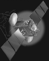
Figure 1.24 INSAT-4A (Courtesy: ISRO)
1.3.8 Satellites for other Applications also made Rapid Progress
The intention to use satellites for applications other than communications was very evident, even in the early stages of development of satellites. A large number of satellites were launched mainly by the former Soviet Union and the United States for meteorological studies, navigation, surveillance and Earth observation during the 1960s.
Making a modest beginning with the TIROS series, meteorological satellites have come a long way both in terms of the number of satellites launched for the purpose and also advances in the technology of sensors used on these satellites. Both low Earth as well as geostationary orbits have been utilized in the case of satellites launched for weather forecasting applications. Major non-geostationary weather satellite systems that have evolved over the years include the TIROS (television and infrared observation satellite) series and the Nimbus series beginning around 1960, the ESSA (Environmental Science Service Administration) series (Figure 1.25) beginning in 1966, the NOAA (National Oceanic and Atmospheric Administration) series beginning in 1970, the DMSP (Defense Meteorological Satellite Program) series initiated in 1965 (all from the United States), the Meteor series beginning in 1969 from Russia and the Feng Yun series (FY-1 and FY-3) beginning 1988 from China. Major meteorological satellites in the geostationary category include the GMS (geostationary meteorological satellite) series from Japan since 1977, the GOES (geostationary operational environmental satellite) series from the United States (Figure 1.26) since 1975, the METEOSAT (meteorological satellite) series from Europe since 1977 (Figure 1.27), the INSAT (Indian satellite) series from India since 1982 (Figure 1.28) and the Feng Yun series (FY-2) from China since 1997.

Figure 1.25 ESSA satellites (Courtesy: NASA)
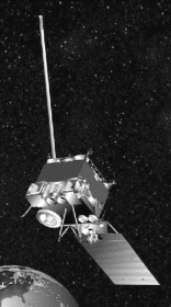
Figure 1.26 GOES satellite (Courtesy: NOAA and NASA)
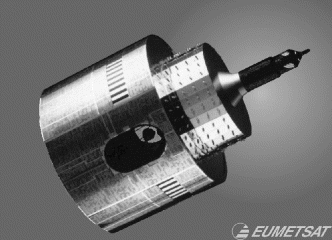
Figure 1.27 METEOSAT series (Reproduced by permission of © EUMETSAT)

Figure 1.28 INSAT series (Courtesy: ISRO)
Sensors used on these satellites have also seen many technological advances, both in types and numbers of sensors used as well as in their performance levels. While early TIROS series satellites used only television cameras, a modern weather forecasting satellite has a variety of sensors with each one having a dedicated function to perform. These satellites provide very high resolution images of cloud cover and Earth in both visible and infrared parts of the spectrum and thus help generate data on cloud formation, tropical storms, hurricanes, likelihood of forest fires, temperature profiles, snow cover and so on.
Remote sensing satellites have also come a long way since the early 1970s with the launch of the first of the series of Landsat satellites that gave detailed attention to various aspects of observing the planet Earth from a space based platform. In fact, the initial ideas of having satellites for this purpose came from the black and white television images of Earth beneath the cloud cover as sent by the TIROS weather satellite back in 1960, followed by stunning observations revealed by Astronaut Gordon Cooper during his flight in a Mercury capsule in 1963 when he claimed to have seen roads, buildings and even smoke coming out of chimneys from an altitude of more than 160 km. His claims were subsequently verified during successive exploratory space missions.
Over the years, with significant advances in various technologies, the application spectrum of Earth observation or remote sensing satellites has expanded very rapidly from just terrain mapping called cartography to forecasting agricultural crop yield, forestry, oceanography, pollution monitoring, ice reconnaissance and so on. The Landsat series from the United States, the SPOT (satellite pour l'observation de la terre) series from France and the IRS (Indian remote sensing satellite) series from India are some of the major Earth observation satellites. The Landsat programme, beginning with Landsat-I in 1972, has progressed to Landsat-8 through Landsat-2, -3, -4, -5, -6 and -7 (Figure 1.29). Landsat-8, the most recent in the Landsat series, was launched on 11 February 2013. The SPOT series has also come a long way, beginning with SPOT-1 in 1986 to SPOT-6 launched in 2012 through SPOT-2, -3, -4 and -5 (Figure 1.30). IRS series launches began in 1988 with the launch of IRS-1A and the most recent satellites launched in the series are IRS-P6 called Resourcesat 1 (Figure 1.31) launched in 2003 and IRS-P5 called Cartosat 1 launched in 2005. Cartosat 2, Cartosat 2A, Cartosat 2B and Resouresat 2 launched in 2007, 2008, 2010 and 2011 respectively are other remote sensing satellites of India. Sensors on board modern Earth observation satellites include high resolution TV cameras, multispectral scanners (MSS), very high resolution radiometers (VHRR), thematic mappers (TM), and synthetic aperture radar (SAR). RISAT-1 launched on April 26, 2012 is the recent satellite whose all weather radar images will facilitate agriculture and disaster management.

Figure 1.29 Landsat-7 (Courtesy: NASA)
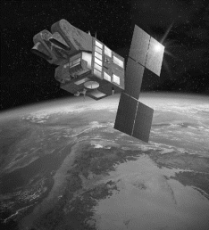
Figure 1.30 SPOT-5 (Reproduced by permission of © CNES/ill.D.DUCROS, 2002)

Figure 1.31 Resourcesat (Courtesy: ISRO)
1.3.9 Small or Miniature Satellites
One of the methods of classifying satellites is on the basis of the in-orbit mass of the satellite. Based on this criterion, satellites are generally classified as large, medium, mini, micro, nano, pico or femto. Mini, micro, nano, pico and femto satellites are collectively categorized as small or miniature satellites. Table 1.1 shows the classification of satellites based on wet mass, i.e. the mass of the satellite including fuel. The commercial space sector today is identified by geostationary communications satellites. One of the major driving forces responsible for the relevance of small satellites over the years has been the need to enable missions that larger satellites could not have accomplished. These included constellations for low data rate communications, in-orbit inspection of larger satellites and university-related research. Other facilitating factors have been the requirement for smaller and cheaper launch vehicles as against larger rockets capable of producing much greater thrust and consequently greater financial cost for larger and heavier satellites. Also, smaller satellites can be launched in multiple numbers and as piggybacks using excess capacity on larger launch vehicles. They have a lower cost of manufacture, ease of mass production and faster building times, making them the ideal test bed for new technologies. Small satellites are not the exclusive prerogative of departments of defence and other major R&D organizations. They are also a big attraction for commercial industry and universities. According to an estimate, close to 1000 satellites will be launched between 2000 and 2020 in the category of small satellites, including mini, micro, nano, pico and femto satellites.
Table 1.1 Classification of satellites based on wet mass
| Satellite class | Wet mass (kg) |
| Large | >1000 |
| Medium | 500–1000 |
| Mini | 100–500 |
| Micro | 10–100 |
| Nano | 1–10 |
| Pico | 0.1–1 |
| Femto | <0.1 |
1.3.9.1 Medium Satellites
Medium satellites have wet mass in the range 500–1000 kg. Medium satellites, although smaller and simpler than large satellites, use the same technologies as those used in large satellites. A large number of satellites designed for remote sensing and weather forecasting applications fall into the category of medium satellites. These are discussed in Chapters 10 and 11.
1.3.9.2 Mini Satellites
Mini satellites have wet mass in the range 100–500 kg. A large number of satellites intended for military surveillance and intelligence, scientific studies and some satellites designed for weather forecasting and earth observation applications belong to this category. Some examples of mini satellites include Jason-1, Jason-2 and SARAL satellites for remote sensing applications, the SMART-1 (Small Missions for Advanced Research in Technology) satellite for scientific studies, ELISA-1 to ELISA-4 (Electronic Intelligence by Satellite) and SPIRALE (Système Préparatoire Infra Rouge pour l'Alerte) for military intelligence, and the METEOSAT series for global weather forecasting. Jason-1 and Jason-2 satellites, respectively launched in 2001 and 2008, are a joint project between NASA (USA) and CNES (France) and are intended to monitor global ocean circulation and global climate forecasts, and to measure ocean surface topography. SARAL (Satellite with CityArgos and Altika) is an altimetry technology mission by ISRO (India) and CNES launched in February 2013 from Indian PSLV-C20. The mission is complementary to Jason-2 satellite. ELISA-1 to ELISA-4 are a suit of French military satellites. The ELISA programme is a demonstration system that paves the way for a planned radar monitoring system. SPIRALE launched in February 2009 and is intended to detect the flights of ballistic missiles in the boost phase by using infrared satellite imagery. SMART-1 from the European Space Agency (Figure 1.32) was launched in September 2003 and is intended to orbit the moon. This satellite carried instruments for lunar imaging, identification of chemical elements on the lunar surface, identification of mineral spectra of olivine and pyroxene. The satellite was deliberately made to crash into the moon's surface in September 2006.
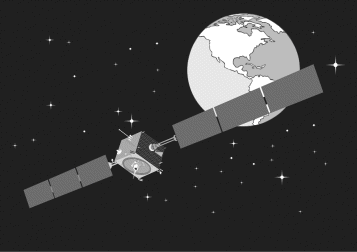
Figure 1.32 SMART-1
1.3.9.3 Micro Satellites
Micro satellites fall into the 10–100 kg wet mass category. Many of the well-known early satellites launched during the 1950s to 1970s belong to the micro satellite category primarily because of the limited launcher capacity available during this period. Some common examples are Sputnik (1957), Vanguard-1 (1958), Telstar-1 (1962), Syncom-1 (1963), Early Bird (1965) and Apollo-P and F1 (1971). With advances in technology enabling sophisticated payloads to be developed into smaller volumes, there has been a renewed interest in the scientific commercial market for micro satellites. The trend began with the launch of UoSAT-1 in 1981, which was the first satellite to carry a microprocessor. Modern micro satellites carry an onboard computer enabling them to carry out in-orbit programmable operations outside the range of the ground station. Some examples of micro satellites launched after UoSAT-1 during the 1980s include the Cosmos series, which forms part of military tactical communications constellations, the Iskra series of amateur radio relay satellites, the Fuji-1 Japanese radio relay satellite and Rohini-3, which is intended for remote sensing experiments. This trend has continued through the 1990s and 2000s. Some well-known examples include Astrid-1 (1995) and Astrid-2 (1998), intended for scientific studies, FalconSat-1 (2000) for technology demonstration to carry out analysis of ion current collection in plasma wake, UNISAT-2 (2002) for scientific research, HAMSAT (2005) for amateur radio communications, ANDE (Atmospheric Neutral Density Experiment) (2009) to measure density and composition of the low earth orbit atmosphere while being tracked from ground, WNISAT (2012) for remote sensing applications and NEOSSat (Near Earth Object Surveillance Satellite) (2013) (Figure 1.33) for discovering and tracking asteroids that might pose a threat to Earth and for tracking satellites and orbital debris.

Figure 1.33 NEOSSat
1.3.9.4 Nano Satellites
Nano satellites have wet mass between 1 and 10 kg. They are launched both as individual satellites and as groups of satellites designed to work together to perform the intended tasks. Some designs require a larger satellite, generally called the ‘mother satellite’, for communication with ground controllers or for launching and docking with nano satellites. The term ‘satellite swarm’ is commonly used to designate a group of these satellites. With advances in electronics technology, particularly in size miniaturization for a given functional capability, nano satellites are rapidly occupying the space for applications that previously required the use of micro and mini satellites. One such example is that of a constellation of 35 nano satellites each weighing 8 kg replacing a constellation of five RapidEye satellites each weighing 156 kg for Earth imaging applications at the same mission cost and significantly increased revisit time of 3.5 hours as against 24 hours. Some other examples of nano satellite missions include UniBRITE and BRITE, which form part of the BRITE constellation of six satellites, designed to make precise measurements of the brightness variations of a large number of bright stars, AAUSAT-2 and AAUSAT-3, developed by Aalborg University in Denmark, and STRAND (Surrey Training Research and Nano satellite Demonstrator), developed by Surrey University and the ELaNa (Educational Launch of Nano satellites) (Figure 1.34) mission of NASA in partnership with different universities to launch small satellites for research purposes.
Figure 1.34 ELaNa (Courtesy: NASA)
A term commonly used with nano and pico satellites is ‘CubeSat'. CubeSat is a type of small satellite of 10 cm cube dimensions and a mass that is not greater than 1.33 kg. The standard 10 × 10 × 10 cm basic CubeSat is also called a 1U CubeSat, where 1U stands for one unit. CubeSats are scalable in increments of 1U along one axis only. Consequently, 2U, 3U and 4U CubeSats will have dimensions of 20 × 10 × 10 cm, 30 × 10 × 10 cm and 40 × 10 × 10 cm, respectively. Since all CubeSats are 10 × 10 cm irrespective of length, they can all be launched and deployed from a common deployment system.
1.3.9.5 Pico Satellites
Pico satellites have wet mass between 0.1 and 1 kg. They are usually launched as a group of satellites (‘satellite swarm') to work in formation for the intended mission objectives. As for nano satellites, some designs of pico satellites also require a larger mother satellite for communication with ground controllers or for launching and docking with pico satellites. The standard CubeSat design described in the previous section is an example of the largest pico satellite or the smallest nano satellite.
Pico satellites offer an excellent way for graduate and PhD students to get hands-on experience with satellite system design. One such example is the pico satellite UWE-1 (University of Würzburg's experimental satellite) with a mass of less than 1 kg. The satellite was developed and built by students of the University of Würzburg and Fachhochschule Weingarten, Germany. It was launched in 2005 to test adaptations of internet protocols to the space environment, characterized by significant signal propagation delays due to the large distances and much higher noise levels compared to terrestrial links. Pico satellites and launch opportunities for sub-kg class pico satellites are now commercially available.
1.3.9.6 Femto Satellites
Femto satellites have wet mass between 10 and 100 g. Again, like nano and pico satellites, some designs require a larger mother satellite for communication with ground controllers. With advances in micro and nano technologies, it is today feasible to build satellite subsystems and even the entire satellite itself on a chip. Such satellites are known as chipsats. Three prototype chip satellites were launched to the International Space Station (ISS) on Space Shuttle Endeavor on its final mission in May 2011. The tiny chip satellites, nicknamed ‘Sprite’, were mounted on the Materials International Space Station Experiment (MISSE-8) pallet, which in turn was attached to the ISS to test how well they functioned in that harsh environment. These fingernail sized satellites were designed to collect the solar wind's chemistry, radiation and particle-impact data. In another example, KickSat mission plans to launch 250 of these tiny Sprite satellites into low Earth orbit (Figure 1.35). The launch is planned on a SpaceX Falcon-9 launch vehicle in early 2014. The mission will provide an opportunity for individuals to have personal satellites at a cost of about US$300 per satellite. Sprite is the size of a postage stamp with its hardware comprising of solar cells, a radio transceiver and a microcontroller with memory and sensors on a smaller scale. The first version is capable of transmitting its name and a few bits of data. Future versions, however, could include other types of sensors for enhanced functionality.
Figure 1.35 KickSat mission
1.4 Evolution of Launch Vehicles
Satellite launch vehicles have also seen various stages of evolution in order to meet launch demands of different categories of satellites. Both smaller launch vehicles capable of launching satellites in low Earth orbits and giant sized launch vehicles that can deploy multiple satellites in geostationary transfer orbit have seen improvements in their design over the last five decades of their history. The need to develop launch vehicles by countries like the United States and Russia was in the earlier stages targeted to acquire technological superiority in space technology. This led them to use the missile technology developed during the Second World War era to build launch vehicles. This was followed by their desire to have the capability to launch bigger satellites to higher orbits. The next phase was to innovate and improve the technology to an extent that these vehicles became economically viable, which meant that the attainment of mission objectives justified the costs involved in building the launch vehicle. The technological maturity in launch vehicle design backed by an ever-increasing success rate led to these vehicles being used for offering similar services to other nations who did not possess them.
The situation in different countries involved in developing launch vehicles is different. On the one hand, there are nations keen to become self-reliant and attain a certain level of autonomy in this area; there are others whose commercial activities complement a significant part of their national activity.
Beginning with a one-stage R-7 rocket (named Semyorka) that launched Sputnik-1 into its orbit in 1957, Russia has developed a large number of launch vehicles for various applications. Some of the prominent ones include the Vostok series, the Molniya series (Figure 1.36), the Soyuz series, the Proton series (Figure 1.37), the Zenit series and Energia series (Figure 1.38). Energia is capable of placing a payload of 65 to 200 tonnes in a low Earth orbit.

Figure 1.36 Molniya series (Reproduced by permission of © Mark Wade)
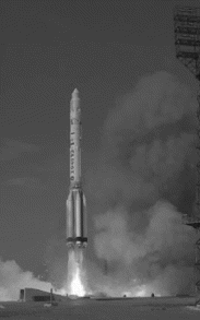
Figure 1.37 Proton series (Courtesy: NASA)
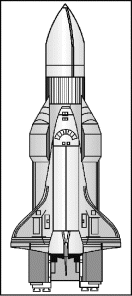
Figure 1.38 Energia series (Reproduced by permission of © Mark Wade)
Important launch vehicles developed by the United States include the Delta series (Figure 1.39), the Atlas series, the Titan series (Figure 1.40), the Pegasus series and the re-usable famous Space Shuttle (Figure 1.41). Buran (Figure 1.42) from Russia is another re-usable vehicle similar in design and even dimensions to the American Space Shuttle. The main difference between the two lies in the fact that Buran does not have its own propulsion system and is launched into orbit by Energia launch vehicle. The Ariane launch vehicle from the European Space Agency (ESA) has entered the fifth generation with the Ariane-5 heavy launch vehicle. Ariane-5 ECB (Enhanced Capability-B) (Figure 1.43) has the capacity of launching 12 tonnes to the geostationary transfer orbit.
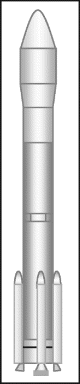
Figure 1.39 Delta series

Figure 1.40 Titan series (Courtesy: NASA/JPL-Caltech)
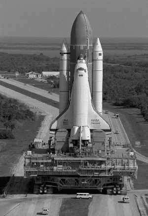
Figure 1.41 Space Shuttle (Courtesy: NASA)
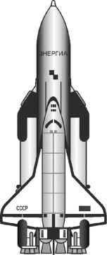
Figure 1.42 Buran series
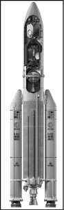
Figure 1.43 Ariane-5ECA (Reproduced by permission of © ESA-D. DUCROS)
Long March (Figure 1.44) from China, the PSLV (polar satellite launch vehicle) and the GSLV (geostationary satellite launch vehicle) (Figure 1.45) from India and the H-2 series from Japan are some of the other operational launch vehicles. Prominent launch vehicles, both expendable and re-usable, are discussed in detail in section 3.3 of Chapter 3.
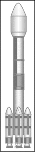
Figure 1.44 Long March
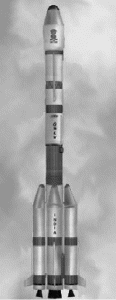
Figure 1.45 GSLV (Courtesy: ISRO)
1.5 Future Trends
The technological advances in the field of satellites will be directed with an aim of reducing the cost and size of the satellites as well as improving the quality of the services provided. One of the main technological trends is to develop satellites with a longer mission life. Smaller satellites are being developed as they can be launched using smaller launchers, thereby cutting the overall mission expenditure.
1.5.1 Communication Satellites
In the case of communication satellites, key technologies include development of large-scale multi-beam antennas to allow intensive reuse of frequencies, USAT terminals to replace VSAT terminals, ground user terminals, development of signal processing algorithms to perform intelligent functions on-board the satellite including signal regeneration, overcoming the signal fading problem due to rain and allowing use of smaller antennas. Flexible cross-link communication between satellites will be developed to allow better distribution of traffic between the satellites. The trend will be to use millimetre or EHF bands of the spectrum to cope with the increased demand for broadband services. This will require the development of technologies to cope with rain-fade problems in these bands. Newer LEO and MEO satellite constellations will be launched mainly for enhancing land-mobile services.
1.5.2 Weather Forecasting Satellites
Future weather forecasting satellites will carry advanced payloads including multispectral imagers, sounders and scatterometers with better resolution. Hyper-spectral measurements from newly developed interferometers will be possible in the near future. These instruments will have more than a thousand channels over a wide spectral range. Also, the satellite data download rates are expected to exceed several terabytes per day.
The GOES-R satellite planned to be launched in the year 2015 will carry several sophisticated instruments including the Advanced Baseline Imager (ABI), Space Environment In-Situ Suite (SEISS), Solar Imaging Suite (SIS), Geostationary Lightning Mapper (GLM) and Magnetometer. SEISS further comprises two Magnetospheric Particle Sensors (MPS-HI and MPS-LO), an Energetic Heavy Ion Sensor (EHIS) and a Solar and Galactic Proton Sensor (SGPS). The SIS payload has a Solar Ultraviolet Imager (SUVI), a Solar X-Ray Sensor (XRS) and an Extreme Ultraviolet Sensor (EUVS).
1.5.3 Earth Observation Satellites
For Earth observation satellites, technological advancements will lead to better resolution, increase in observation area and reduction in access time, i.e time taken between the request of an image by the user and its delivery. Plans for future missions and instruments include entirely new types of measurement technology, such as hyper-spectral sensors, cloud radars, lidars and polarimetric sensors that will provide new insights into key parameters of atmospheric temperature and moisture, soil moisture and ocean salinity. Several new gravity field missions aimed at more precise determination of the marine geoid will also be launched in the future. These missions will also focus on disaster management and studies of key Earth System processes — the water cycle, carbon cycle, cryosphere, the role of clouds and aerosols in global climate change and sea level rise.
1.5.4 Navigational Satellites
Satellite based navigation systems are being further modernized so as to provide more accurate and reliable services. The modernization process includes launch of new more powerful satellites, use of new codes, enhancement of ground system, and so on. In fact satellite based systems will be integrated with other navigation systems so as to increase their application potential.
The GPS system is being modernized so as to provide more accurate, reliable and integrated services to the users. The first efforts in modernization began with the discontinuation of the selective availability feature, so as to improve the accuracy of the civilian receivers. In continuation of this step, Block IIRM satellites now carry a new civilian code on the L2 frequency. This helps in further improving accuracy by compensating for atmospheric delays and will ensure greater navigation security. Moreover, these satellites carry a new military code (M-code) on both the L1 and L2 frequencies. This provides increased resistance to jamming.
Block-IIF satellites have a third carrier signal, L5, at 1176.45 MHz. The first Block-II F satellite was launched in May 2010. As of August 2013, there are four operational Block-II F satellites in GPS constellation. They have larger design life, fast processors with more memory, and a new civil signal. The GPS-III phase of satellites is at the planning stage. These satellites will employ spot beams. The use of spot beams results in increased signal power, enabling the system to be more reliable and accurate, with system accuracy approaching a metre. As of August 2013, Block III satellites are in production and deployment phase. As many as 32 Block III satellites with a design life of 15 years have been planned. First Block-III satellite (Block IIIA-1) is scheduled for launch in 2014. As far as the GLONASS system is concerned, efforts are being made to make the complete system operational in order to exploit its true application potential. Second and third generation GLONASS satellites have improved lifetimes over first generation GLONASS satellites (GLONASS-M has a design lifetime of seven years and GLONASS-K of 10 to 12 years). GLONASS-K satellites will offer an additional L-band navigational signal.
Another satellite navigation system that is being developed is the European Galileo system. Galileo navigation system development has been structured into the following three phases. The first phase has been the experimental phase to experiment with and verify the critical technologies needed for the Galileo system to operate in the medium earth orbit (MEO) environment. Two experimental satellites namely GIOVE-A (Galileo In-Orbit Validation Element-A) and GIOVE-B respectively launched on December 28, 2005 and April 27, 2008. The second phase is intended to be the In-Orbit Validation (IOV) phase. The main objective of the IOV phase is validation of system design using a scaled down constellation of only four satellites, which along with a limited number of ground stations is the minimum number needed to provide positioning and timing data. The four satellites were launched in pairs. The first pair of two satellites was launched on October 21, 2011 and the second pair was launched on October 12, 2012. The third phase will achieve fully operational Galileo system comprising 30 satellites (27 operational and three active spares), positioned in three circular Medium Earth Orbit (MEO) planes at 23 222 km altitude above the Earth, and with each orbital plane inclined at 56 degrees to the equatorial plane. The system will be operational in the near future. Indian IRNSS (Indian Regional Navigational Satellite System) and Chinese Compass are the other satellite navigation systems under development.
Navigation satellite services will improve as the services provided by the three major navigation satellite systems (GPS, GLONASS, and GALILEO) will be integrated and the user will be able to obtain position information with the same receiver from any of the satellites from the three systems.
1.5.5 Military Satellites
The sphere of application of military satellites will expand further to provide a variety of services ranging from communication services to gathering intelligence imagery data, from weather forecasting to early warning applications, from providing navigation information to providing timing data. They have become an integral component of the military planning of various developed countries, especially of the USA and Russia. Developing countries are designing their military satellites so as to protect their territory. The concept of space based lasers is evolving wherein the satellites carrying onboard high power lasers will act as a nuclear deterrent. These satellites will destroy the nuclear missile in its boost phase within the country that is launching it.
Further Reading
- Labrador, V. and Galace, P. (2005) Heavens Fill with Commerce: A Brief History of the Communications Satellite Industry, Satnews Publishers, California.
Internet Sites
Glossary
- Ariane:
- European Space Agency's launch vehicle
- Astronaut:
- A space traveller, i.e. a person who flies in space either as a crew member or a passenger
- Astrophysics:
- Study of the physical and chemical nature of celestial bodies and their environments
- Buran:
- A re-usable launch vehicle, Russian counterpart of a space shuttle
- Early Bird:
- Other name for Intelsat-1. First geostationary communications satellite in commercial service
- Explorer-1:
- First successful satellite from the United States
- Femto satellite:
- Satellite with wet mass < 100 g
- Footprint:
- The area of coverage of a satellite
- Geostationary orbit:
- An equatorial circular orbit in which the satellite moves from west to east with a velocity such that it remains stationary with respect to a point on the Earth. Also known as the Clarke orbit after the name of the science fiction writer who first proposed this orbit
- GPS:
- An abbreviation for the global positioning system. It is a satellite-based navigation system that allows you to know your position coordinates with the help of a receiver anywhere in the world under any weather condition
- GSLV:
- Abbreviation for geostationary satellite launch vehicle. Launch vehicle from India
- INTELSAT:
- Acronym for International Telecommunications Satellite Consortium operating satellites internationally for both domestic and international telecommunication services
- Landsat:
- First remote sensing satellite series in the world from USA
- Large satellite:
- Satellite with wet mass of > 1000 kg
- Medium satellite:
- Satellite with wet mass in the range 500–1000 kg
- Micro satellite:
- Satellite with wet mass in the range 10–100 kg
- Mini satellite:
- Satellite with wet mass in the range 100–500 kg
- Molniya orbit:
- A highly inclined and elliptical orbit used by Russian satellites with apogee and perigee distances of about 40 000 and 500 km and an orbit inclination of 65°. Two or three such satellites aptly spaced apart in the orbit provide an uninterrupted communication service
- Multispectral scanner (MSS):
- A multispectral scanning device that uses an oscillating mirror to continuously scan Earth passing beneath the spacecraft
- NASA:
- National Aeronautics and Space Administration
- Nano satellite:
- Satellite with wet mass in the range 1–10 kg
- Palapa:
- First domestic communication satellite from a developing country, Indonesia
- Payload:
- Useful cargo-like satellite being a payload of a launch vehicle
- Pico satellite:
- Satellite with wet mass in the range 0.1–1 kg
- Satellite:
- A natural or artificial body moving around a celestial body
- Sounding rocket:
- A research rocket used to obtain data from the upper atmosphere
- Space shuttle:
- A re-usable launch vehicle from the United States
- Spin-stabilized satellite:
- A satellite whose attitude stabilization is achieved by the spinning motion of the satellite. It employs the gyroscopic or spinning top principle
- Sputnik-1:
- First artificial satellite launched by any country. Launched on 4 October 1957 by erstwhile Soviet Union
- Thematic mapper:
- A type of scanning sensor used on Earth observation satellites
- Three-axis stabilized satellite:
- A satellite whose attitude is stabilized by an active control system that applies small forces to the body of the spacecraft to correct any undesired changes in its orientation
- TIROS:
- First series of weather forecast satellites, launched by United States
- Transponder:
- A piece of radio equipment that receives a signal from the Earth station at the uplink frequency, amplifies it and then retransmits the same signal at the downlink frequency
- Westar:
- First domestic communication satellite from the United States