
UNEXPECTED SIGHTS ON A CANAL TOUR
1. The Dutch National Bank
The vaults of the Dutch National Bank are sunk some 48 ft (15 m) below ground level. In the event of an alarm, they have been designed to allow the waters of the Singelgracht to flood into them.
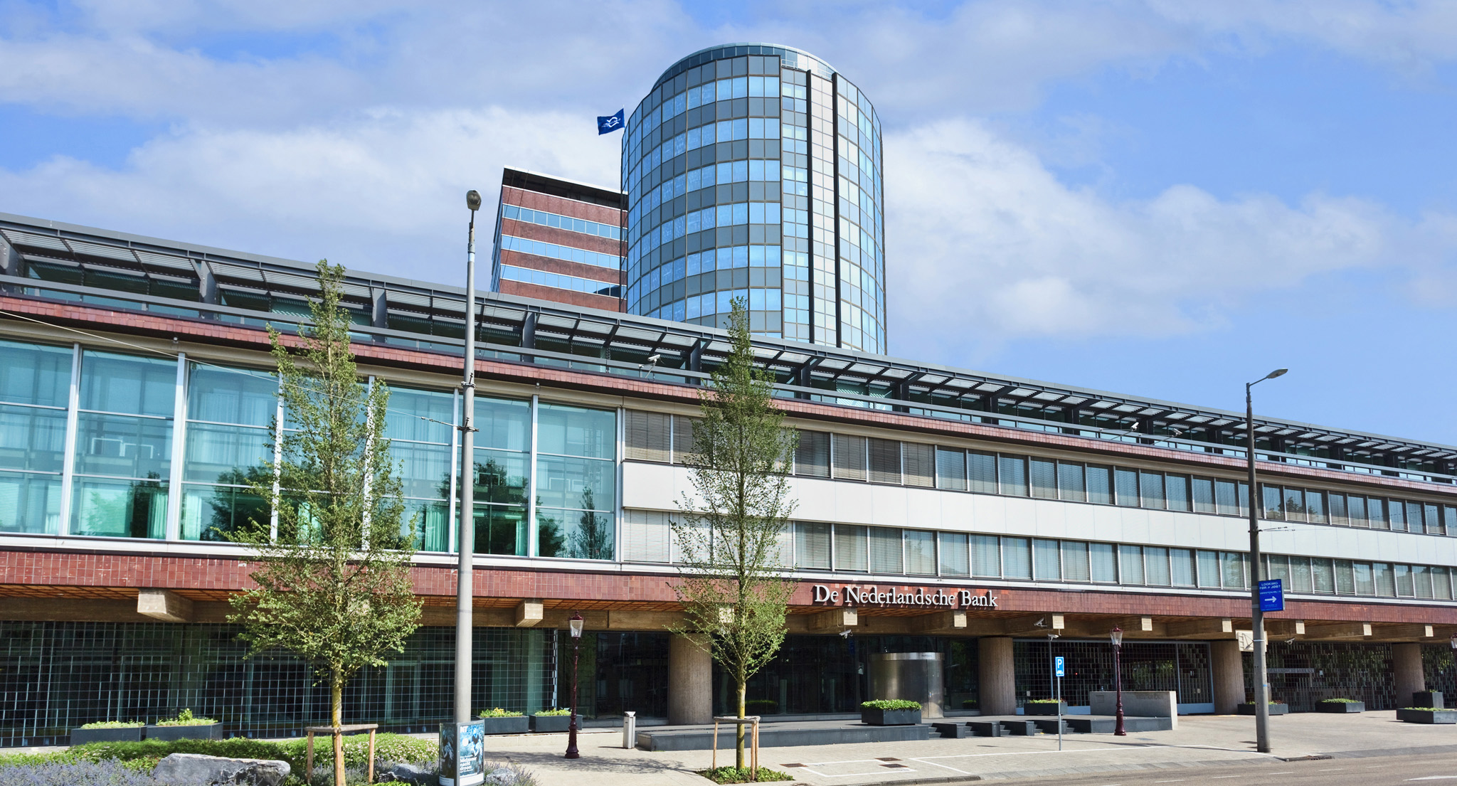
The exterior of the Dutch National Bank building
2. The Prison Bridge
The Torensluis—the widest bridge in the city—spans the Singel on the site of a 17th-century tower. A lockup, sometimes open to the public, was built into its foundations.
3. The Cat Boat
Hundreds of abandoned felines and strays are given refuge in De Poezenboot (The Cat Boat), moored on the Singel.
4. The Drunken Czar
In 1716, Peter the Great got drunk at his friend Christoffel Brants’ house at Keizersgracht 317, and kept the mayor waiting at a civic reception. That night, he stayed at the house of the Russian ambassador, Herengracht 527, where Napoleon stayed in 1811.
5. The Narrowest House
Singel 7: the smallest house in Amsterdam? No, it’s the back door of a wedge-shaped house.
6. Blue Angel
Cast your eye upward to the beautiful Blue Angel statue perched on the former Levensverzekering Maatschappij—Noord-Braband building, at the corner of Singel and Haarlemmerstraat.
7. The Most Crooked Café
Teetering Café de Sluyswacht, built in 1695, makes an alarming sight as you glide by along the Oudeschans.
8. The Wrapped-Up House
Look carefully at Victoria Hotel, near the station, and you will see two tiny 17th-century houses in the monumental 19th-century façade. A little old lady, so the story goes, refused to sell, so the hotel had to wrap itself around the houses.
9. Museumhaven, Oosterdok
The jetty leading up to the elevated hood of Nemo Science Museum is lined with vintage boats and barges dating from the 19th century.
10. The Tower of Tears
Originally part of the medieval city wall, this 15th-century tower has the saddest of names: Schreierstoren, from where weeping women waved farewell to their seafaring men.
THE GRACHTENGORDEL
Declared a UNESCO World Heritage Site in 2010, Amsterdam’s magnificent semicircle of four canals—the Singel, Herengracht, Keizersgracht, and Prinsengracht—is the city’s defining characteristic. Lined by elegant gabled houses and connected by intimate cross-streets, the three outer canals were devised in the early 17th century to cope with the rapid rise in population. Previously a moat, the Singel was now considered a part of the ring, as houses were built on it during this period. Built in two stages, this costly plan was purely aesthetic—the land along the banks was sold in single, long plots that were taxed on width; the wealthy bought two together.
Amsterdam had its unlikely beginnings some 400 years earlier, when a fishing settlement grew up on the marshy banks of the river Amstel. (It was dammed in 1222—hence the name, a contraction of Amstelledamme.) As the town expanded, canals were cut to drain more land and provide transport channels; the outer canals were fortified. A glance at a map shows the limits of the medieval town, bounded by the curved Singel, with the rest of the Grachtengordel fanning out beyond.
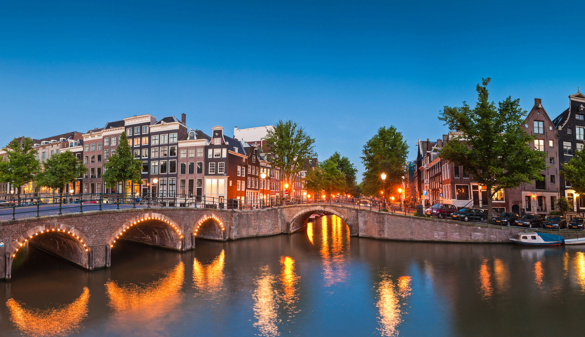
The Grachtengordel looks its best bathed in dusk light.
TOP 10 BRIDGES
1. Magere Brug (Amstel)
Magere Brug, literally “skinny bridge,” was built over the River Amstel in 1934.
2. Python Bridge
3. Jan Schaefer Bridge
4. Nieuwe Amstelbrug (Amstel)
5. Berlagebrug (Amstel)
6. Torensluis (Singel)
7. St. Antoniesluis (Zwanenburgwal)
8. Seven (humpback) bridges (Reguliersgracht)
9. White wooden drawbridges (Western Islands)
10. Sleutelbrug (Oudezijds Voorburgwal)