16.3 NEOSS Example: An Earth Observing Satellite System for NASA
We’ll introduce an example of a complex system for use throughout the remainder of the chapter to formulate different architecture optimization problems. We call this system NEOSS, for NASA Earth Observing Satellite System (Figure 16.2). As its name indicates, NEOSS is a collection of satellites that carry a set of remote sensing instruments that provide observations of Earth’s land, oceans, and atmosphere in the form of data products. [3]
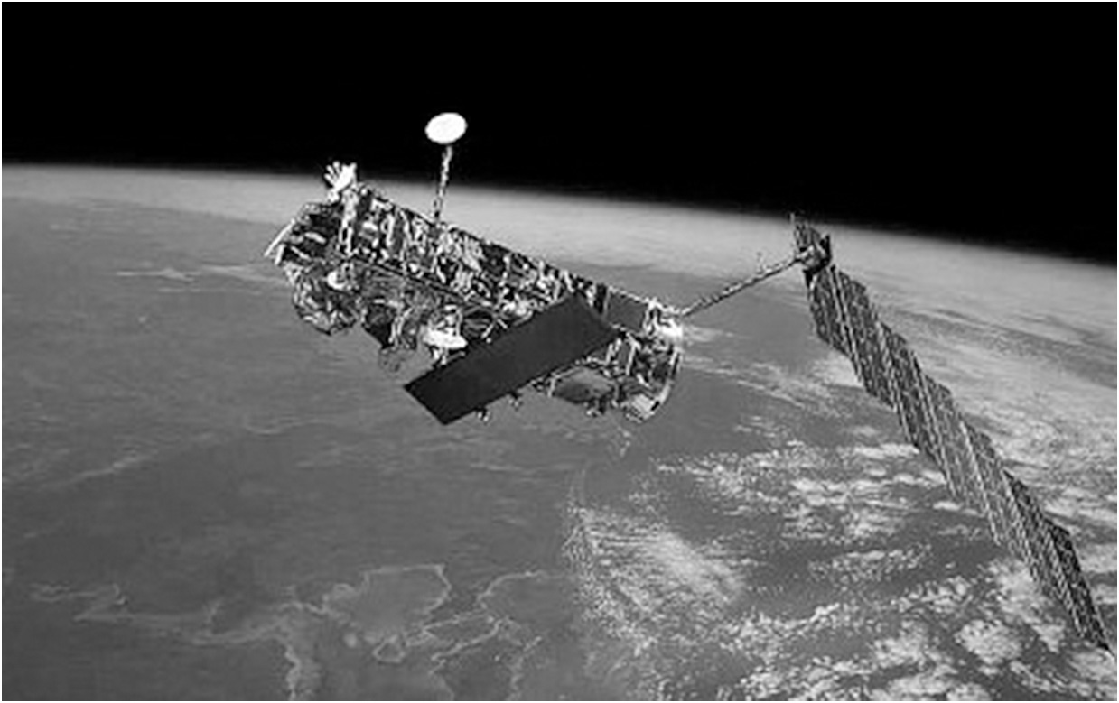
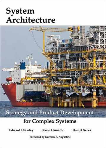
Figure 16.2 ESA’s Envisat (top) and NASA’s A Train (bottom), two examples of potential NEOSS architectures. (Source: (a) Esa/epa/Corbis (b) Ed Hanka/NASA)
The main stakeholders of NEOSS are the many scientists who will be the primary users of the data products produced by NEOSS. Most of the goals that flow logically from scientists’ needs concern the attributes (spatial resolution, temporal resolution, accuracy) of different data products (soil moisture, atmospheric temperature, sea level height). Scientists are also very concerned about data continuity: They have lengthy, consistent records of data that they want to extend for as long as possible. A good value function for NEOSS should consider satisfaction of data product requirements from scientific communities, data continuity, and some notion of cost, schedule, and risk. [4]
What is the most important decision for NEOSS? The answer may seem intuitive. The most important decision is the selection, from the set of all candidate instruments, of remote sensing instruments that will be included on a spacecraft. For example, in order to measure the land’s topography, we may choose to develop a laser altimeter, a synthetic aperture radar, or both. Note that we are effectively mapping a solution-neutral function (measuring topography) to a form (laser, radar, or both) and therefore to the corresponding solution-specific functions. In this example we have eight candidate instruments: a radar altimeter, a conical microwave radiometer, a laser altimeter, a synthetic aperture radar, a GPS receiver, an infrared spectrometer, a millimeter-wave sounder, and a high-resolution optical imager.
Although selecting instruments is the most important decision, the satellites themselves may have a strong impact on the stakeholder needs. For example, higher orbits lead to coarser spatial resolution but better coverage. Power limitations and interactions with other instruments aboard the satellite (such as electromagnetic interference) can impact value. Thus the assignment of instruments to satellites and orbits will also have a major impact on value. For this example we will allow constellations with 1 to 3 planes and 1 to 4 satellites per plane in true polar, sun-synchronous, and tropical orbits at 400, 600, and 800 km.
Finally, the launch dates of these satellites are also important, because they drive the ability of the system to meet data continuity needs. If an existing satellite taking an important measurement is going to be de-orbited soon, the value of a replacement is higher if its launch date avoids a gap in the data series.
Hence, if we separate the selection of instruments from their assignment to satellites, a first model for the architecture of NEOSS is given by three major groups of decisions, which we called instrument selection, instrument packaging, and satellite scheduling.
Instrument selection. Given the set of eight candidate instruments, which instruments or sensors (sometimes called payloads in aerospace terminology) do we choose to perform the required measurements?
Instrument packaging. Given the set of candidate orbits, and given the instrument set chosen in the instrument selection problem, which satellites and orbits do we choose to fly these payloads on? More precisely, do we operate one or many satellites (for example, single satellite, tandem, or constellation)? What altitude, inclination, and other orbital parameters do we choose? In the case of a constellation, how many orbital planes are the satellites in, and how many satellites do we have in each plane?
Satellite scheduling. Given the satellite missions defined by the previous decisions, how do these individual missions coordinate with each other as a program? Note that missions cannot be considered in isolation, as a consequence of the data continuity issues mentioned before, but also because they are linked through a common budget.
We have provided an overview of the three major groups of architectural decisions for the NEOSS system: instrument selection, instrument packaging, and satellite scheduling. In the next section, we will show that the structure behind these decisions appears often in architecture problems for other systems, which leads to the definition of a set of Patterns for use in system architecture decisions.