
The previous recipes used standard WFS requests. GeoServer also supports a few optional parameters that you can include in your requests. In this recipe, we will see how to ask GeoServer, which is reprojecting the data from the native SRS to another SRS, to use a vendor parameter.
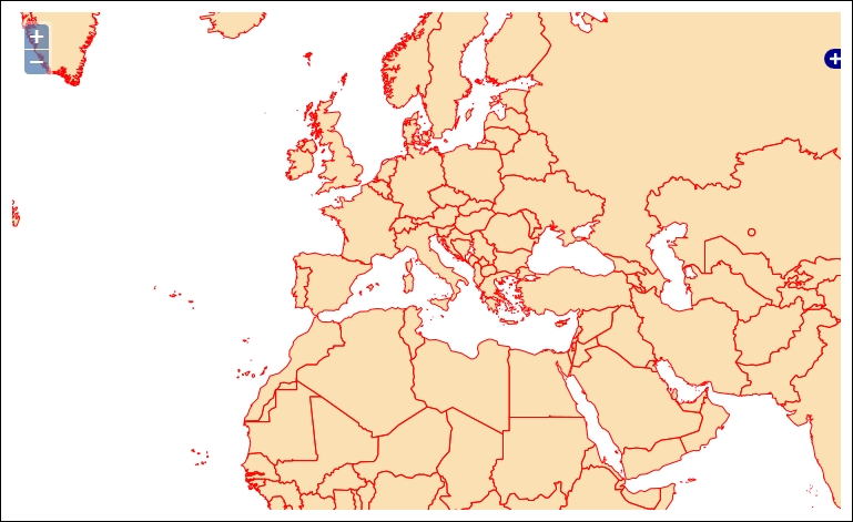
Reprojection of data is a part of WFS 1.1.0 and 2.0.0, and GeoServer has provided support since 1.0.0 so that you can use it with any WFS version. The following screenshot is what we're targeting in this recipe:
- Copy the file used in the first recipe to the
wfsReprojection.htmlfile in the same folder. Insert a new parameter for theMapobject:projection: "EPSG:3857",
- Then, alter the JavaScript part when creating the WFS layer:
new OpenLayers.Layer.Vector("countries", { strategies: [new OpenLayers.Strategy.BBOX()], protocol: new OpenLayers.Protocol.WFS({ url: "http://localhost/geoserver/wfs", featureType: "countries", featureNS: "http://www.naturalearthdata.com/", geometryName: "geom", - Add a parameter to request data reprojection:
srsName: new OpenLayers.Projection("EPSG:3857"), srsNameInQuery: true }), - Save the file and point your browser to it. You should get a map that looks like the one shown in the introduction to this recipe.
Using a vendor parameter is really straightforward; you just add it to your request. In our recipe, we want to use the countries' data that is stored in the EPSG:4326 projection, which is the geographical coordinates, and in EPSG:3857, which is the planar coordinates. First of all, we set the spatial reference system for the map:
  map = new OpenLayers.Map({
    div: "myMap",
    allOverlays: true,
    projection: "EPSG:3857",
Then, we create the WFS request for data by inserting the srsName parameter and assigning it the same projected coordinate system used for the map. The Boolean parameter srsNameInQuery is really important, as it defaults to false. If you don't set it, OpenLayers will not ask for reprojection when using WFS 1.0.0:
            srsName: new OpenLayers.Projection("EPSG:3857"),
            srsNameInQuery: true
Let's see what happens when you load the page in your browser and the OpenLayers framework creates the WFS request. Use Firebug to capture the XML code sent to GeoServer with the GetFeature request. The Query element contains the srsName parameter that forces GeoServer to project data:
<wfs:Query typeName="feature:countries_1" srsName="EPSG:3857" xmlns:feature="http://www.naturalearthdata.com/">
  <ogc:Filter xmlns:ogc="http://www.opengis.net/ogc">
    <ogc:BBOX>
      <ogc:PropertyName>geom</ogc:PropertyName>
      <gml:Box xmlns:gml="http://www.opengis.net/gml" srsName="EPSG:3857">
        <gml:coordinates decimal="." cs="," ts=" ">-13325909.428711,-3545545.6572266 16025909.428711,14065545.657227</gml:coordinates>
      </gml:Box>
    </ogc:BBOX>
  </ogc:Filter>
</wfs:Query>