
CHAPTER 25
Location Awareness
Even though they're sometimes overlooked in relation to spectacular growth rates (50-fold increases in wireless data carriage), successful consumer applications (nearly a billion Facebook users), and technical achievement (at Google, Amazon, Apple, and elsewhere), location-based technologies deserve more attention than they typically receive. The many possible combinations of wired Internet, wireless data, vivid displays, well-tuned algorithms running on powerful hardware, vast quantities of data, and new monetization models, when combined with location awareness, have yet to be well understood.
Digital location-based services arose roughly in chronological parallel with the commercial Internet. In 1996, General Motors introduced the OnStar navigation and assistance service in high-end automobiles. Uses of Global Positioning System (GPS, which, like the Internet, was a U.S. military invention, as Figure 25.1 shows) and related technologies have exploded in the intervening years, in the automotive sector and, more recently, on smartphones. The widespread use of Google Earth in television newscasts is another indicator of the underlying trend.
Sales of handheld GPS units continue to double every year or two in the North American market. As the technology is integrated into mobile phones, the social networking market is expected to drive far wider adoption. Foursquare, Facebook Places, numerous other start-ups, and the telecom carriers are expected to deliver more and more applications linking “who,” “where,” and “when.” Powerful indications of this tendency came when Nokia bought NAVTEQ (the “Intel inside” of many online mapping applications) for $8.1 billion in 2007, when Facebook integrated location services in 2010, and when the rapid adoption of the iPhone and other smartphones amplified the market opportunity dramatically. Location-based services (whether Skyhook geolocation, Google Maps and Earth, GPS, or others) have evolved to become a series of platforms on which specific applications can build, tapping the market's creativity and vast quantities of data.
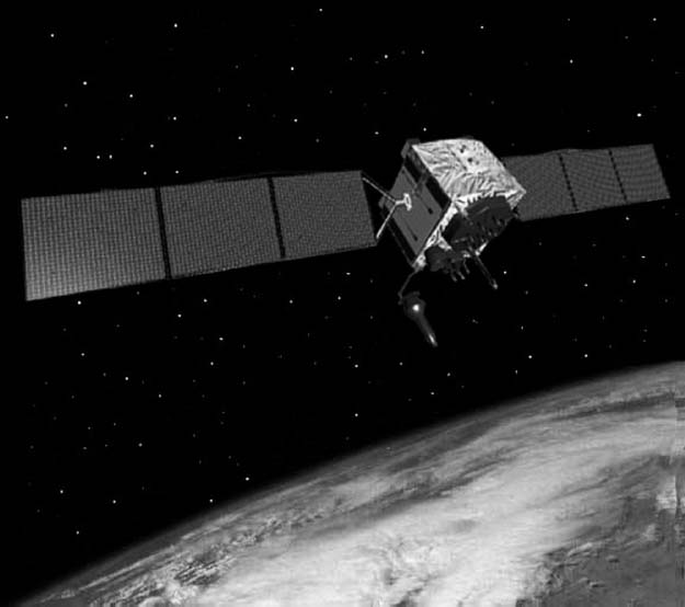
FIGURE 25.1 A New Generation of GPS Satellites Began Deployment in 2010
Source: U.S. Air Force.
In the process, the evolution of location relates to significant questions:
- Who am I in relation to where I am? That is, what are the implications of mapping for identity management?
- Who knows where I am, when I'm there, and where I've been? How much do I control the “information bread crumbs” related to my movements? Who is liable for any harm that may come to me based on the release of my identity and location?
- Who are we relative to where we are? In other words, how do social networks change as they migrate back and forth between virtual space (Facebook) and real space (Mo's Bar)? What happens as the two worlds converge? That is, as a person walks down the street and an everyday smartphone can capture his or her face, the connection of the face to its data can happen pretty much instantaneously. Few people are comforted by this scenario.
Variations on a Theme
While location often seems to be synonymous with GPS, location-based data services actually come in a variety of packages. Some examples follow.
Indoor Positioning Systems
For all of the utility of GPS, there are numerous scenarios where it doesn't work: Mobile X-ray machines or patient gurneys in hospitals, people in burning buildings, work-in-process inventory, and specialized measurement or other tools in a lab or factory all need to be located in sometimes vast and often challenging landscapes, usually within minutes. GPS signals may not penetrate the building, and even if they can, the object of interest must “report back” to those responsible for it. A variety of wired and wireless technologies can be used to create what is in essence a scaled-down version of the GPS environment.
Optical
Such well-known firms as Leica and Nikon have professional products to track minute movements in often massive structures or bodies: dams, glaciers, bridges. Any discussion of location awareness that neglects the powerful role of precision optics, beginning with the essential surveyor's transit, would be incomplete. As they merge with other precision technologies such as lasers, optical instruments become more accurate still.
Wi-Fi Mapping
The worldwide rise of Wi-Fi networking is very much a bottom-up phenomenon. Two consequences of that mode of installation are: often lax network security and considerable coverage overspill. Driving down any suburban or metropolitan street with even a basic wireless device reveals dozens of residential or commercial networks. Such firms as Google have systematically mapped those networks, resulting in yet another overlay onto a growing number of triangulation points. The privacy implications of such mapping have yet to be resolved.
Cellular
Wireless carriers can determine the position of an active (powered-up) device through triangulation with the customer's nearby towers. Such an approach lacks precision when compared to approaches (most notably GPS) that reside on the handset rather than in the network. In either case, the carrier can establish historical location for law enforcement and potentially other purposes.
Skyhook
A start-up based in Boston, Skyhook has built a database of 250 million Wi-Fi physical coordinates then added both GPS and cellular components, making it most precise (inside or near buildings) where GPS is weakest. A software solution combines all available information to create location tracking for any Wi-Fi-enabled device, indoors or out. Skyhook powers location awareness for devices from Apple, Dell, Samsung, and other companies and is now generating secondary data based on those devices.
Landmarks
Noting a few historic transitions and innovations in the history of location-based services reveals the scale, complexity, and wide variety of applications that the core technologies are powering.
OnStar
With roughly 5.5 million subscribers as of mid-2010, OnStar has become the world's largest remote vehicle-assistance service. In addition to receiving navigation and roadside assistance, subscribers can have doors unlocked and gain access to certain diagnostic data related to that particular vehicle. The service delivers important information to emergency response personnel: When extricating occupants from a damaged vehicle, knowing which airbags have deployed can help keep emergency medical technicians, police, and firefighters safe from the explosive force of an undeployed device that might be inadvertently tripped. Knowing the type and severity of the crash before arrival on the scene can also help the teams prepare for the level of damage and injury they are likely to encounter.
The service was launched as a joint venture. General Motors brought the vehicle platform and associated engineering, Hughes Electronics managed the satellite and communications aspects, and Electronic Data Systems, itself being spun out from GM in OnStar's launch year, performed systems integration and information management.
GPS
The history of GPS is even more compelling when considered alongside its nearly contemporary stablemate, the Internet. GPS originated in 1973, the Internet's DoD predecessor ARPANET in 1969. Ronald Reagan allowed GPS to be used for civilian purposes after a 1983 incident involving a Korean Air Lines plane that strayed into Soviet airspace. The Internet was handed off from the National Science Foundation to commercial use in 1995; Bill Clinton ordered fully accurate GPS (20-meter resolution) to be made available May 1, 2000. Previously, the military had access to the most accurate signals while “Selective Availability” (300-meter resolution) was delivered to civilian applications. If an object was big enough (a ship or aircraft), multiple receivers could be networked to generate higher resolution: 1-meter accuracy in 2000. Twenty-four satellites orbit the earth to provide the service.
Since 1990, GPS has spread to a wide variety of uses: recreational hiking and boating, commercial marine navigation, cell phone geolocation, certain aircraft systems, and of course vehicle navigation. Heavy mining and farming equipment can be steered to less than inch tolerances. Vehicles (particularly fleets) and even animals can be “geofenced,” with instant notification if the transmitter leaves a designated area. In addition to latitude and longitude, GPS delivers highly precise time services as well as altitude.
Trimble
Founded by Charles Trimble and two colleagues from HP in 1978 (the first year a GPS satellite was launched), Trimble Navigation has become an essential part of geolocation history. From its base in Silicon Valley, the company has amassed a portfolio of more than 800 patents and offers more than 500 products. Much like Cisco, Trimble has made acquisition of smaller companies a core competency, with many merger-and-acquisition moves in the past 10 years in particular. A measure of Trimble's respect in the industry can be seen in the quality of its joint-venture partners: Both Caterpillar and Nikon have gone to market jointly with Trimble.
The company has a long history of firsts: the first commercial scientific-research and geodectic-survey products based on GPS for oil-drilling teams on offshore platforms, the first GPS unit taken aboard the space shuttle, the first circuit board combining GPS and cellular communications. The reach of GPS can be seen in the variety of Trimble's product offerings: agriculture, engineering and construction, federal government, field and mobile worker (including both public safety and utilities applications), and advanced devices, the latter indicating a significant commitment to research and development.
Location, Mobility, and Identity
Issues of electronic identity and mobility have been playing out in quiet but important ways. Each of several instances is a classic case of social or economic problems being tangled up with a technology challenge. To see only one side of the question is to create the possibility of unintended consequences, allow hidden agendas into play, and generally confuse the allocation of sometimes-scarce resources. At the same time, seeing the issues holistically requires time, perspective, and often resources: For example, Americans take the 911 system for granted but seldom realize how complex and fragile the infrastructure actually is. Each of these examples hints at forthcoming challenges and opportunities.
Social Networking Goes Local
Whether through Dodgeball (a New York start-up that was bought by Google in 2005 then left unexploited), Foursquare, or Facebook Places, the potential for the combination of virtual and real people in virtual or real places is still being explored. Viewed in retrospect, the course of the Dodgeball acquisition raises the revenue questions familiar to watchers of social networks dating from Friendster et al. onward: Who will pay for what, and who collects, by what mechanism? Who owns my location information, and what aspects of it do I control? Much like my medical records, which are not mine but rather the doctor's or hospital's, control appears to be defaulting to the collector rather than the generator of digital bread crumbs, at least in the United States: In Europe, privacy laws and attitudes generally favor the citizen.
The Breakdown of 911
After a series of implementations beginning in 1968, Americans on wireline voice connections could reliably dial the same three-digit emergency number any-where in the country. As the Bell System of the twentieth century fades farther and farther from view, the presumption of 911 reliability declines proportionately with the old business model even as demand increases: The United States generates about 250 million calls a year to 911. The problem comes in two variants.
First, a number of Voice over Internet Protocal (VoIP) customers with life-threatening—and as it turned out, life-ending—emergencies could reach only a recording at Vonage saying to call 911 from another phone. The Texas attorney general raised the question after a 911 call failed during a home invasion in Houston. A baby's death in Florida in 2005 was blamed on a Vonage 911 failure. According to the Wall Street Journal, “In a letter to Florida's Attorney General, [the mother] said the Vonage customer-service representative laughed when she told her that Julia had died. ‘She laughed and stated that they were unable to revive a baby.’”1
For their part, Vonage and the cable operators include bold-print instructions for manual 911 mapping during the sign-up process, but it's been estimated by the U.S. Department of Education that between 14 and 22% of the U.S. population is functionally illiterate.2 In addition, one feature of VoIP is its portability: Plug the phone into an Internet connection any-where and receive calls at a virtual area code of the customer's choice. Children are also a key 911 constituency. Taken collectively, these overlapping populations raise dozens of tricky questions. At the infrastructure level, the Federal Communications Commission and other agencies face the substantial challenge of determining the fairest, safest set of technical interconnection requirements incumbent on the Regional Bells and VoIP carriers.
From the Bell perspective, 911 obviously costs money to implement and maintain, and declining wireline revenues translate to declining 911 funds. Connecting 911 to the Internet in a reliable, secure manner is nontrivial—network attacks have used modems to target the service in the past—and until contractual arrangements are finalized, the Bell companies are reluctant to subsidize the same firms that present themselves as full wireline replacements.
In addition, 911 isn't just a VoIP problem: Cellular users represent nearly 75% of emergency callers, but math and economics conspire to make finding them difficult or impossible. In rural areas, cell towers often follow roads, so attempting to triangulate from three points in a straight line can limit precision. Some states have raided 911 tax revenues for budget relief, limiting funds for further refinement.
Cell Phone Tracking
Wireless carriers offer a variety of services that give a relative (often a parent or an adult child of a potentially confused elder) location information generated by a phone. The service also has been used to help stalkers and abusive spouses find their wives in hiding. Women's shelters routinely strip out the tracking component of cell phones; according to the Wall Street Journal, a Justice Department report in 2009 estimated that 25,000 adults in the United States were victims of GPS stalking every year.3 In addition to the carriers, tracking capability is being developed by sophisticated PC users that spoof the behavior of a cell tower. Keystroke-and location-logging software is also available; one package, called Mobile Spy, costs under $100 per year.
Looking Ahead
As the telephone system migrates from being dominated by fixed lines, where identity resided in the phone, to mobile usage, where identity typically relates to an individual, location is turning out to matter a lot. Mobile number portability was an unexpectedly popular mandate a few years ago, for example. Given the global nature of some of these questions, not to mention numerous issues with global governance over IP addresses and domain naming conventions, the discussions and solutions will only get more complicated. As the examples illustrate, getting social arrangements to keep pace with technology innovation, is if anything, more difficult than the innovation itself.
Notes
1. Shawn Young, “Internet Calling's Downside: Failing to Link Callers to 911,” Wall Street Journal, May 12, 2005, http://online.wsj.com/article/SB111585619278031205.html.
2. National Center for Education Statistics, “National Assessment of Adult Literacy (NAAL),” http://nces.ed.gov/naal/kf_demographics.asp.
3. Justin Scheck, “Stalkers Exploit Cellphone GPS,” Wall Street Journal, August 3, 2010. http://online.wsj.com/article/SB10001424052748703467304575383522318244234.html.