Mention to a geek that a gadget has both GPS and a camera, and there's only one possible reaction: "Does it do geotagging?"
Geotagging means, "embedding your latitude and longitude information into a photo when you take it." After all, every digital picture you've ever taken comes with its time and date invisibly embedded in its file; why not its location?
So the good news is that the iPhone can geotag every photo you take. How you turn on this feature, though, and how you use this information, is a bit trickier.
The iPhone doesn't geotag your photos unless all of the following conditions are true:
The location feature on your phone is turned on. On the Home screen, tap Settings→General, and make sure Location Services is turned On.
The phone knows where it is. If you're indoors, for example, then the GPS chip in the iPhone 3G probably can't get a fix on the satellites overhead. And if you're not near cellular towers or Wi-Fi base stations, then even the pseudo-GPS of the original and 3G iPhones may not be able to triangulate your location.
You've given permission. The first time you use the iPhone's camera (or the first time after you've installed the iPhone 2.0 software), a peculiar message appears: "'Camera' would like to use your current location." What it really means is, "Do you want me to geotag your pictures?"
If you tap OK, then the iPhone's geographical coordinates will be embedded in each photo you take.

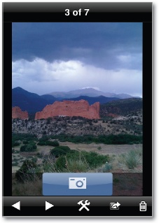
OK, so suppose all of this is true, and the geotagging feature is working. How will you know? Well, there's no way to see the location information on the iPhone itself. It's embedded invisibly in the photo files. You can see it only after the pictures have been transferred to your computer.

At that point, your likelihood of being able to see the geotag information depends on what photo-viewing software you're using. For example:
When you've selected a photo in iPhoto (on the Mac), you can press ⌘-I to view a Photo Info panel. At the very bottom, you'll see the GPS coordinates, expressed as latitude and longitude.
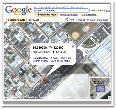
If you export a photo and open it in Preview (on the Mac), you can choose Tools→Inspector to open the Inspector panel. Its center tab offers a world map that pinpoints the photo's location.
If you click Locate (on the Preview panel shown above), you pop into Google Maps online, where you get to see an aerial photo of the spot where you snapped the picture.
Once you've posted your geotagged photos on Flickr.com (the world's largest photo-sharing site), people can use the Explore menu to search for them by location, or even see them clustered on a world map.
If you import your photos into Picasa (for Windows), you can choose Tools→Geotag→View in Google Earth to see a picture's location on the map (if the free Google Earth program is installed on your computer, that is).
Or choose Tools→Geotag→Export to Google Earth File to create a .kmz file, which you can send to a friend. When opened, this file opens Google Earth (if it's on your friend's computer) and displays a miniature of the picture in the right place on the map.

iPhone geotagging is wicked cool, but it's not without its glitches. First, when you email a photo from the iPhone, all EXIF data (invisible time, date, and camera-setting details) are stripped away—including geotagging information. Those coordinates are preserved only when you sync your photos with iTunes.
Furthermore, there are some glitches in the way the iPhone stores geotagging information, which can confuse programs like Flickr.
You can resolve both problems by using programs from the App Store (Chapter 11) instead of the iPhone's built-in Camera program.
SmugShot, for example, correctly geotags your photos and sends that data (along with the photo) directly to SmugMug.com (membership required), which can show you the photo's location using Google Maps online.
Better yet: AirMe correctly tags your photos, preserves the geotags when you email a photo, and auto-uploads your shots to Flickr or AirMe.com. And it's free.
Get it? Get it!