As you know, the Global Positioning System (GPS) helps us determine the global position of a vehicle with the help of GPS satellites. The latitude and longitude of the vehicle can be calculated from the GPS data. The accuracy of GPS can vary with the type of sensor; some sensors have an error in the range of meters, and some have less than 1 meter of error. We can find vehicle state by combining GPS, inertial measurement unit (IMU) and wheel odometry data, and by using sensor fusion algorithms. This can give better estimate of the vehicle. Let's look at the position estimation modules used for the DARPA Challenge 2007.
POS LV modules from Applanix: This is the module used in the Standford autonomous car, Junior. It is a combination of GPS, IMU, and wheel encoders or distance measurement indicator (DMI). You can find it at http://www.applanix.com/products/poslv.html.
Here is what the module looks like:
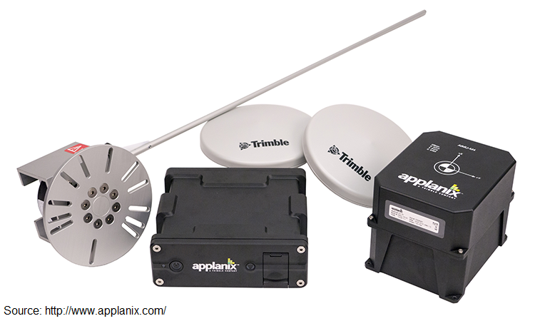
As you can see from the preceding image, there are wheel encoders, an IMU, and a GPS receiver provided with this package.
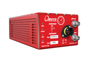
OxTS module: This is another GPS/IMU combo module from Oxford Technical Solution (OxTS) (http://www.oxts.com/). This module was extensively used in the DARPA Challenge in 2007. The module is from the RT 3000 v2 family (http://www.oxts.com/products/rt3000-family/). The entire range of GPS modules from OxTS can be found at http://www.oxts.com/industry/automotive-testing/. Here is the list of the autonomous vehicles that use these modules: http://www.oxts.com/customer-stories/autonomous-vehicles-2/. The following image shows the RT-3000 v2 module: